Cof Cymru: National Historic Assets of Wales · Wales
End Cottage adjoining Mynydd Adda
Llaneilian, Isle of Anglesey, Wales
A Grade II listed building in Nebo, Llaneilian, Isle of Anglesey, designated on 24 January 2001.
The record
- Designation
- Listed building, Grade II
- Broad class
- Domestic
- Date of designation
- 24 January 2001
- Locality
- Nebo
- Community
- Llaneilian
- Unitary authority
- Isle of Anglesey
- Country
- Wales
- Coordinates
- 53.38834, -4.30635
- Cadw reference
- 24559
Slide toward Today to fade the historical sheet and see the modern map underneath.
David Rumsey Map Collection, Stanford LibrariesDavid Rumsey Map Collection, Stanford LibrariesDavid Rumsey Map Collection, Stanford LibrariesDavid Rumsey Map Collection, Stanford LibrariesDavid Rumsey Map Collection, Stanford Libraries
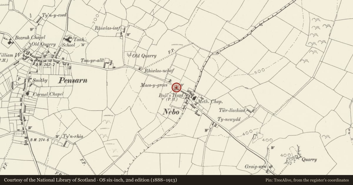
5 historical maps cover this location, the earliest the 1883 map "Watershed map England, Wales 3." (David Rumsey Map Collection, Stanford Libraries).
Historical maps covering this location
- 1883 · Watershed map England, Wales 3. (David Rumsey Map Collection, Stanford Libraries)
- 1896 · Sheet 7. Ordnance Survey of England and Wales. (David Rumsey Map Collection, Stanford Libraries)
- 1899 · 93 Holyhead (Hills) (David Rumsey Map Collection, Stanford Libraries)
- 1901 · Sheet 9 and 10. (David Rumsey Map Collection, Stanford Libraries)
- 1919 · Sheet 41. Anglesey. (David Rumsey Map Collection, Stanford Libraries)
Cadw's description
Location
Located at the NW end of a row of cottages set along the SW side of the country road leading out of the village of Nebo towards Penysarn.
History
Late C18 or early C19 vernacular cottage. The cottage cannot be clearly identified on the Tithe Map, but the 1841 Census Returns record numerous entries for the village of Nebo, many of which were occupied by miners in the local copper mines. It seems likely, therefore, that this was a miner's cottage.
Exterior
Single storey cottage, a 2 window range with doorway between; opening offset to the L (SE). Built of rubble masonry, limewashed. Roof of small, old slates, heavily grouted; stone coping and square gable stack to R (NW), reduced. The door is boarded and the windows are small paned replacements of the original sashes.
Interior
Interior not inspected at the time of the survey.
Reason for designation
Listed as a good late C18 or early C19 cottage which retains its vernacular character. The cottage represents a well-preserved miner's cottage, once a common feature in the local landscape.
Nearby in the register
- Ty Capel BozrahReligious, Ritual and Funeraryunder 1 mi
- Railings to yard at Capel BozrahReligious, Ritual and Funeraryunder 1 mi
- Capel BozrahReligious, Ritual and Funeraryunder 1 mi
- School Room and Store at Capel BozrahReligious, Ritual and Funeraryunder 1 mi
Other entries of the same register within about three miles of this one, by straight line.