Cof Cymru: National Historic Assets of Wales · Wales
Detached Lofted Farm Building at Plas Clocaenog
Clocaenog, Denbighshire, Wales
A Grade II listed building in Clocaenog, Denbighshire, designated on 12 January 2001.
The record
- Designation
- Listed building, Grade II
- Broad class
- Agriculture and Subsistence
- Date of designation
- 12 January 2001
- Locality
- Clocaenog
- Community
- Clocaenog
- Unitary authority
- Denbighshire
- Country
- Wales
- Coordinates
- 53.07750, -3.38111
- Cadw reference
- 24510
Slide toward Today to fade the historical sheet and see the modern map underneath.
David Rumsey Map Collection, Stanford LibrariesDavid Rumsey Map Collection, Stanford LibrariesLlyfrgell Genedlaethol Cymru – The National Library of WalesDavid Rumsey Map Collection, Stanford LibrariesDavid Rumsey Map Collection, Stanford Libraries
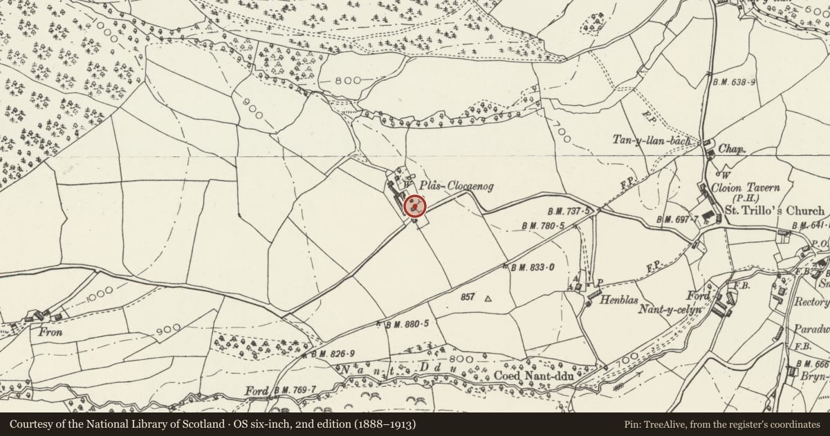
5 historical maps cover this location, the earliest the 1795 map "To Sir Watkin Williams-Wynn Bart ... the map of the six counties of North Wales is most humbly inscribed by his obedient humble servant" (Llyfrgell Genedlaethol Cymru – The National Library of Wales).
Historical maps covering this location
- 1795 · To Sir Watkin Williams-Wynn Bart ... the map of the six counties of North Wales is most… (Llyfrgell Genedlaethol Cymru – The National Library of Wales)
- 1830 · V.3:11-15:XV. Britisches Reich. A. Kon: England. b. Frstenthum Wales: Shire: 37-40 (David Rumsey Map Collection, Stanford Libraries)
- 1883 · Watershed map England, Wales 3. (David Rumsey Map Collection, Stanford Libraries)
- 1898 · 120 Corwen (Hills) (David Rumsey Map Collection, Stanford Libraries)
- 1901 · Sheet 9 and 10. (David Rumsey Map Collection, Stanford Libraries)
Cadw's description
Location
To east side of farmyard opposite the long barn range, south east of the house.
History
The detached building to the south east of Plas Clocaenog and opposite the barn range dates from the period 1875-1899, first appearing on the Ordnance Survey map of 1899.
Exterior
Building with loft in local masonry including brick dressings to the apertures. Square-shuttered openings to the loft, one altered to a door. Facing south west is a stone and brick staircase against the gable end leading to a vertically boarded door under a brick arch.
Reason for designation
Listed for group value with Plas Clocaenog farmhouse.
Nearby in the register
- Triple Stable or Cowhouse at Plas ClocaenogAgriculture and Subsistenceunder 1 mi
- Barn Range at Plas ClocaenogAgriculture and Subsistenceunder 1 mi
- Plas Clocaenog Farmhouse with attached outbuildingsAgriculture and Subsistenceunder 1 mi
- Hen BlasAgriculture and Subsistenceunder 1 mi
Other entries of the same register within about three miles of this one, by straight line.