Cof Cymru: National Historic Assets of Wales · Wales
Plas Clocaenog Farmhouse with attached outbuildings
Clocaenog, Denbighshire, Wales
A Grade II listed building in Clocaenog, Ruthin, Denbighshire, designated on 12 January 2001.
The record
- Designation
- Listed building, Grade II
- Broad class
- Agriculture and Subsistence
- Date of designation
- 12 January 2001
- Locality
- Clocaenog
- Town
- Ruthin
- Community
- Clocaenog
- Unitary authority
- Denbighshire
- Country
- Wales
- Coordinates
- 53.07781, -3.38175
- Cadw reference
- 24505
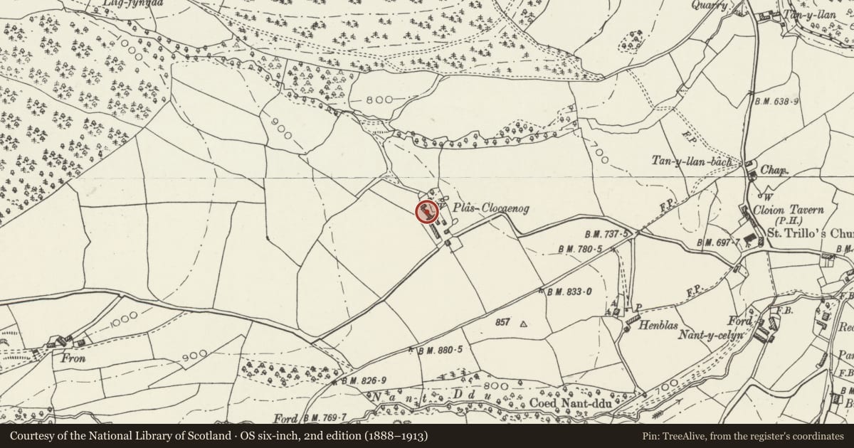
Slide toward Today to fade the historical sheet and see the modern map underneath.
David Rumsey Map Collection, Stanford LibrariesDavid Rumsey Map Collection, Stanford LibrariesLlyfrgell Genedlaethol Cymru – The National Library of WalesDavid Rumsey Map Collection, Stanford LibrariesDavid Rumsey Map Collection, Stanford Libraries
5 historical maps cover this location, the earliest the 1795 map "To Sir Watkin Williams-Wynn Bart ... the map of the six counties of North Wales is most humbly inscribed by his obedient humble servant" (Llyfrgell Genedlaethol Cymru – The National Library of Wales).
Historical maps covering this location
- 1795 · To Sir Watkin Williams-Wynn Bart ... the map of the six counties of North Wales is most… (Llyfrgell Genedlaethol Cymru – The National Library of Wales)
- 1830 · V.3:11-15:XV. Britisches Reich. A. Kon: England. b. Frstenthum Wales: Shire: 37-40 (David Rumsey Map Collection, Stanford Libraries)
- 1883 · Watershed map England, Wales 3. (David Rumsey Map Collection, Stanford Libraries)
- 1898 · 120 Corwen (Hills) (David Rumsey Map Collection, Stanford Libraries)
- 1901 · Sheet 9 and 10. (David Rumsey Map Collection, Stanford Libraries)
Cadw's description
Location
On the road leading west from the village of Clocaenog, at about ½ km from the village.
History
A farmhouse likely to be of the C16 or C17.
The farm of Plas Clocaenog appears on the draft Ordnance Survey plan of c1819. It appears on the Tithe Survey of 1839 as owned by the Rt Hon Lord Bagot and occupied by John Evans, with about 140 acres (55.7ha).
Exterior
A large farmhouse in local materials, facing north east, with a rear lateral chimney and with a small forecourt. Small front outbuilding to north and lofted sheds to south in tandem.
Reason for designation
A vernacular farmhouse of some local status, believed to have escaped recent alteration and to have retained its historic character; accompanied by an extensive set of traditional farmbuildings.
Nearby in the register
- Barn Range at Plas ClocaenogAgriculture and Subsistenceunder 1 mi
- Detached Lofted Farm Building at Plas ClocaenogAgriculture and Subsistenceunder 1 mi
- Triple Stable or Cowhouse at Plas ClocaenogAgriculture and Subsistenceunder 1 mi
- Hen BlasAgriculture and Subsistenceunder 1 mi
Other entries of the same register within about three miles of this one, by straight line.