Cof Cymru: National Historic Assets of Wales · Wales
The War Memorial, Marros
Eglwyscummin, Carmarthenshire, Wales
A Grade II listed building in Marros, Whitland, Eglwyscummin, Carmarthenshire, designated on 12 January 2001.
The record
- Designation
- Listed building, Grade II
- Broad class
- Religious, Ritual and Funerary
- Date of designation
- 12 January 2001
- Locality
- Marros
- Town
- Whitland
- Community
- Eglwyscummin
- Unitary authority
- Carmarthenshire
- Country
- Wales
- Coordinates
- 51.75062, -4.59808
- Cadw reference
- 24497
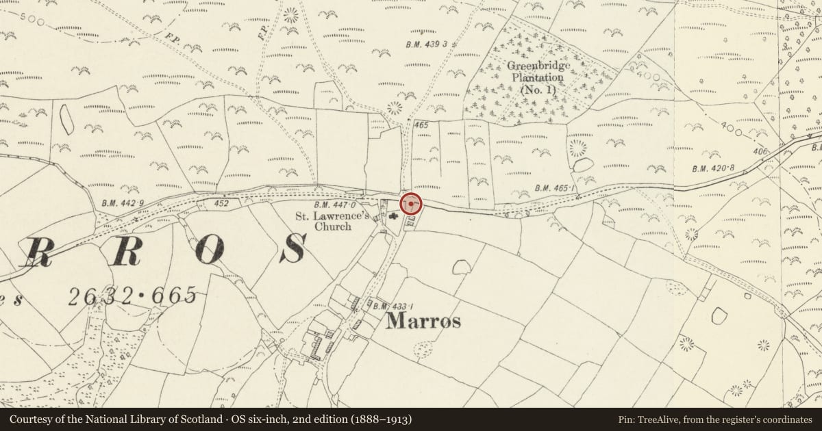
Slide toward Today to fade the historical sheet and see the modern map underneath.
David Rumsey Map Collection, Stanford LibrariesDavid Rumsey Map Collection, Stanford LibrariesDavid Rumsey Map Collection, Stanford LibrariesDavid Rumsey Map Collection, Stanford LibrariesDavid Rumsey Map Collection, Stanford Libraries
5 historical maps cover this location, the earliest the 1608 map "(13) Cambriae Typus." (David Rumsey Map Collection, Stanford Libraries).
Historical maps covering this location
- 1608 · (13) Cambriae Typus. (David Rumsey Map Collection, Stanford Libraries)
- 1636 · Cornubia : Devonia, Somersetus, Dorcestria, Wiltonia, Glocestria ... (David Rumsey Map Collection, Stanford Libraries)
- 1637 · The fourth table of England. Cornub. Devonia, Somerset etc. (David Rumsey Map Collection, Stanford Libraries)
- 1830 · V.3:11-15:XV. Britisches Reich. A. Kon: England. b. Frstenthum Wales: Shire: 37-40 (David Rumsey Map Collection, Stanford Libraries)
- 1891 · Sheet 10. Ordnance Survey of England and Wales. . (David Rumsey Map Collection, Stanford Libraries)
Cadw's description
Location
Situated just E of the Church of Saint Lawrence, S of minor road from Pendine to Amroth, approximately 3km W of Pendine.
History
War Memorial of 1930 in the form of a neolithic dolmen, all of limestone from Marros Mountain.
Exterior
War Memorial, rock-faced limestone, of two big uprights and a lintel on a stone-paved platform approached by 4 curving stone steps from the N. The steps splay out each side and the sides a of the platform are revetted with rough-hewn stone blocks placed one next to the other, those flanking the steps ascending in height, the platform with taller stones at the 4 corners. On the lintel and both uprights are bronze plaques with 'The Great War 1914-1918' and the names of those who served and those who died.
Reason for designation
Included as an unusual war memorial, of group value with the parish church.
Nearby in the register
- Church of Saint LawrenceReligious, Ritual and Funeraryunder 1 mi
- Churchyard Cross in churchyard of Church of Saint LawrenceReligious, Ritual and Funeraryunder 1 mi
- Lime kiln SE of PwllIndustrialunder 1 mi
- Garness Farm, round barrow 400m to SW ofRound Barrowunder 1 mi
Other entries of the same register within about three miles of this one, by straight line.