Cof Cymru: National Historic Assets of Wales · Wales
Pen Bont
Cylch-y-Garn, Isle of Anglesey, Wales
A Grade II listed building in Rhydwyn, Cylch-y-Garn, Isle of Anglesey, designated on 27 November 2000.
The record
- Designation
- Listed building, Grade II
- Broad class
- Domestic
- Date of designation
- 27 November 2000
- Locality
- Rhydwyn
- Community
- Cylch-y-Garn
- Unitary authority
- Isle of Anglesey
- Country
- Wales
- Coordinates
- 53.37041, -4.53354
- Cadw reference
- 24430
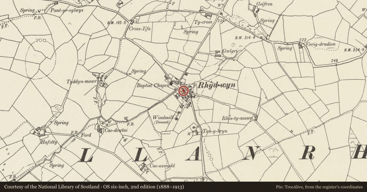
Slide toward Today to fade the historical sheet and see the modern map underneath.
David Rumsey Map Collection, Stanford LibrariesDavid Rumsey Map Collection, Stanford LibrariesDavid Rumsey Map Collection, Stanford LibrariesDavid Rumsey Map Collection, Stanford LibrariesDavid Rumsey Map Collection, Stanford Libraries
5 historical maps cover this location, the earliest the 1799 map "Ireland." (David Rumsey Map Collection, Stanford Libraries).
Historical maps covering this location
- 1799 · Ireland. (David Rumsey Map Collection, Stanford Libraries)
- 1883 · Watershed map England, Wales 3. (David Rumsey Map Collection, Stanford Libraries)
- 1899 · 93 Holyhead (Hills) (David Rumsey Map Collection, Stanford Libraries)
- 1901 · Sheet 9 and 10. (David Rumsey Map Collection, Stanford Libraries)
- 1919 · Sheet 41. Anglesey. (David Rumsey Map Collection, Stanford Libraries)
Cadw's description
Location
Slightly set back from the SW side of the main road in the village of Rhydwyn.
History
Late C18 or early C19 cottage. Pen Bont is not marked on the Tithe Map of the parish of Llanrhuddlad, 1843; however, the map is poorly annotated, not all the buildings are shown and none of the agricultural buildings are recorded. The plot formed part of the adjacent farm of Cae Dowtai, a small holding of over 21 acres(8.5 hectares); it is likely that the cottage was in use as accommodation for farm labourers.
Exterior
Single storey cottage abutting a 2-storey dwelling to the R (NW). Built of stone, front elevation roughcast rendered. Roof of small, old slates with tiled ridge and stone coping to L. Single gable stack to L is rendered, with dripstones and capping. Entrance elevation opens into a small enclosed garden to front, with low rendered rubble wall; central modern boarded flanked by 4-pane horned sash windows.
Interior
Interior not inspected at the time of survey.
Reason for designation
Listed as a well-preserved small vernacular cottage, retaining its character in use of materials and in the arrangement of openings. With the adjacent Menai and Menai Bach, Pen Bont forms a good village group.
Nearby in the register
- MenaiDomesticunder 1 mi
- Menai BachDomesticunder 1 mi
- Cae HenDomesticunder 1 mi
- Melin DrylliauIndustrialunder 1 mi
Other entries of the same register within about three miles of this one, by straight line.