Cof Cymru: National Historic Assets of Wales · Wales
Myrtle House
Ambleston, Pembrokeshire, Wales
A Grade II listed building in Ambleston, Haverfordwest, Pembrokeshire, designated on 21 November 2000.
The record
- Designation
- Listed building, Grade II
- Broad class
- Domestic
- Date of designation
- 21 November 2000
- Locality
- Ambleston
- Town
- Haverfordwest
- Community
- Ambleston
- Unitary authority
- Pembrokeshire
- Country
- Wales
- Coordinates
- 51.89458, -4.90752
- Cadw reference
- 24394
Slide toward Today to fade the historical sheet and see the modern map underneath.
David Rumsey Map Collection, Stanford LibrariesDavid Rumsey Map Collection, Stanford LibrariesDavid Rumsey Map Collection, Stanford LibrariesDavid Rumsey Map Collection, Stanford LibrariesDavid Rumsey Map Collection, Stanford Libraries
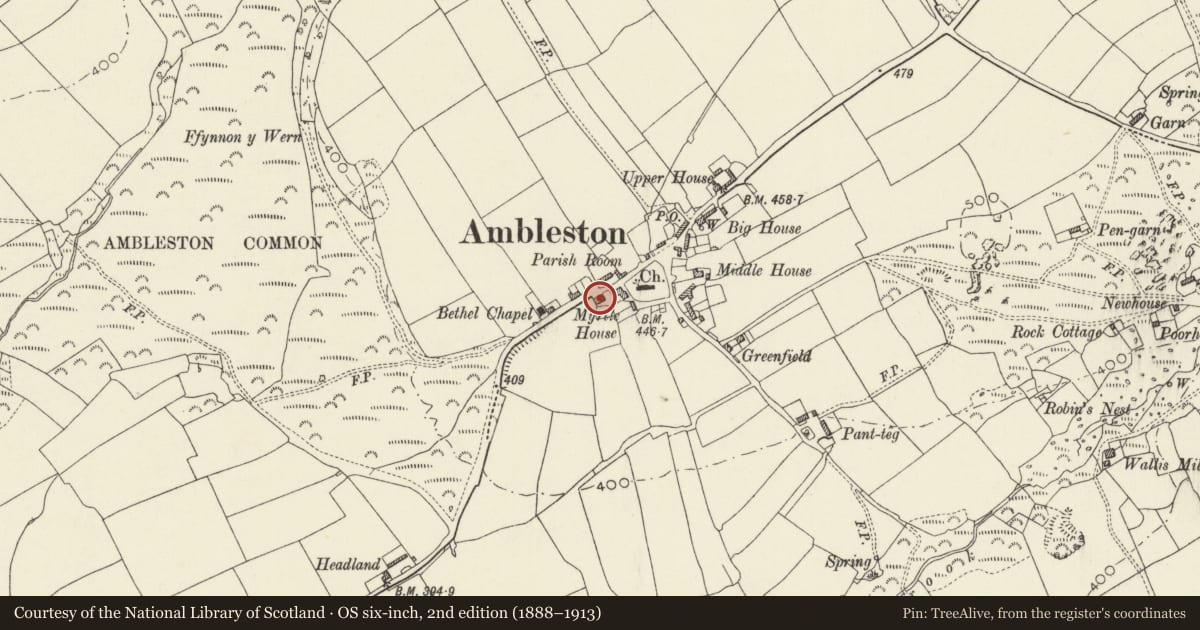
5 historical maps cover this location, the earliest the 1636 map "Cornubia : Devonia, Somersetus, Dorcestria, Wiltonia, Glocestria ..." (David Rumsey Map Collection, Stanford Libraries).
Historical maps covering this location
- 1636 · Cornubia : Devonia, Somersetus, Dorcestria, Wiltonia, Glocestria ... (David Rumsey Map Collection, Stanford Libraries)
- 1891 · Sheet 10. Ordnance Survey of England and Wales. . (David Rumsey Map Collection, Stanford Libraries)
- 1898 · 210 Cardigan (Hills) (David Rumsey Map Collection, Stanford Libraries)
- 1898 · 210 Cardigan (Outline) (David Rumsey Map Collection, Stanford Libraries)
- 1901 · Sheet 13. (David Rumsey Map Collection, Stanford Libraries)
Cadw's description
Location
Situated in Ambleston village on S side of road some 70m W of the churchyard.
History
Earlier C19 village house with service wing.
Exterior
House, rubble stone with close-eaved slate roof and stone end stacks, of squared grey stone. Two-storey, three-window front of 12-pane hornless sashes with rough stone voussoirs and cut stone keystones. Centre door with similar head, 6-panel with overlight of 7 small panes. Windowless left end wall. Lower service range to right, with remnant of whitewash, close-eaved imitation slate roof and big square roughcast right end stack, raised with narrower shaft in C20. Small 6-pane centre casement each floor and half-glazed door to left, the door and lower window with stone voussoirs. Windowless end wall, outshut rear.
Interior
Not seen at time of resurvey.
Reason for designation
Included as a well-preserved village house with service wing of regional character, retaining original windows and door.
Nearby in the register
- Outbuilding to East of Myrtle HouseDomesticunder 1 mi
- Church of St MaryReligious, Ritual and Funeraryunder 1 mi
- Castle FlemishEnclosureunder 1 mi
- Hook HouseDomesticunder 1 mi
Other entries of the same register within about three miles of this one, by straight line.