Cof Cymru: National Historic Assets of Wales · Wales
Milestone SE of Eglwys Oen Duw
Treflys, Powys, Wales
A Grade II listed building in Beulah, Treflys, Powys, designated on 30 October 2000.
The record
- Designation
- Listed building, Grade II
- Broad class
- Communications
- Date of designation
- 30 October 2000
- Locality
- Beulah
- Community
- Treflys
- Unitary authority
- Powys
- Country
- Wales
- Coordinates
- 52.15357, -3.58694
- Cadw reference
- 24364
Slide toward Today to fade the historical sheet and see the modern map underneath.
David Rumsey Map Collection, Stanford LibrariesDavid Rumsey Map Collection, Stanford LibrariesDavid Rumsey Map Collection, Stanford LibrariesDavid Rumsey Map Collection, Stanford LibrariesDavid Rumsey Map Collection, Stanford Libraries
5 historical maps cover this location, the earliest the 1608 map "(13) Cambriae Typus." (David Rumsey Map Collection, Stanford Libraries).
Historical maps covering this location
- 1608 · (13) Cambriae Typus. (David Rumsey Map Collection, Stanford Libraries)
- 1637 · Particular description of Wales. Cambria seu Wallia (David Rumsey Map Collection, Stanford Libraries)
- 1830 · V.3:11-15:XV. Britisches Reich. A. Kon: England. b. Frstenthum Wales: Shire: 37-40 (David Rumsey Map Collection, Stanford Libraries)
- 1899 · 196 Builth (Hills) (David Rumsey Map Collection, Stanford Libraries)
- 1901 · Sheet 14. (David Rumsey Map Collection, Stanford Libraries)
Cadw's description
Location
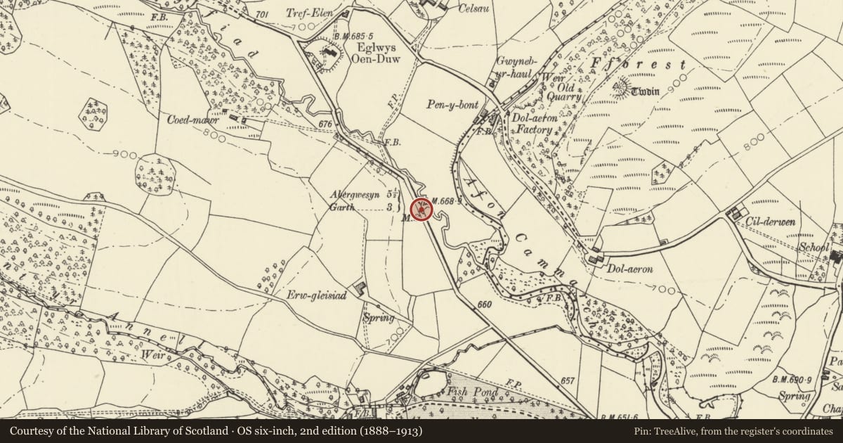
Approximately 400m SE of Eglwys Oen Duw on the E side of a minor road between Beulah and Abergwesyn.
History
The present road between Beulah and Abergwesyn was built in the third quarter of the C19, largely at the instigation of Henry Thomas. The new road was laid out on a more favourable gradient than the earlier road shown on the 1841 Tithe map and was diverted away from Thomas' own house at Llwynmadoc. The milestones all date from the construction of the new road and are shown on the Ordnance Survey of 1888.
Exterior
A dressed milestone with a rounded top. The face is engraved: 'Llanwrtyd 4 3/4, Garth 3, Abergwesyn 5 1/2'.
Reason for designation
Listed for group value as one of a series of 4 mid C19 milestones marking the diversion of the local road by a prominent local landowner.
Nearby in the register
- Footbridge on SW side of Eglwys Oen Duw churchyardReligious, Ritual and Funeraryunder 1 mi
- Eglwys Oen DuwReligious, Ritual and Funeraryunder 1 mi
- The Old VicarageDomesticunder 1 mi
- Fforest Castle MoundMotteunder 1 mi
Other entries of the same register within about three miles of this one, by straight line.