Cof Cymru: National Historic Assets of Wales · Wales
Drinking Trough and Wall opposite Main Entrance Gateway to Tal-y-coed Court
Whitecastle, Monmouthshire, Wales
A Grade II listed building in Tal-y-coed, Monmouth, Whitecastle, Monmouthshire, designated on 27 October 2000.
The record
- Designation
- Listed building, Grade II
- Broad class
- No class recorded
- Date of designation
- 27 October 2000
- Locality
- Tal-y-coed
- Town
- Monmouth
- Community
- Whitecastle
- Unitary authority
- Monmouthshire
- Country
- Wales
- Coordinates
- 51.83030, -2.84366
- Cadw reference
- 24325
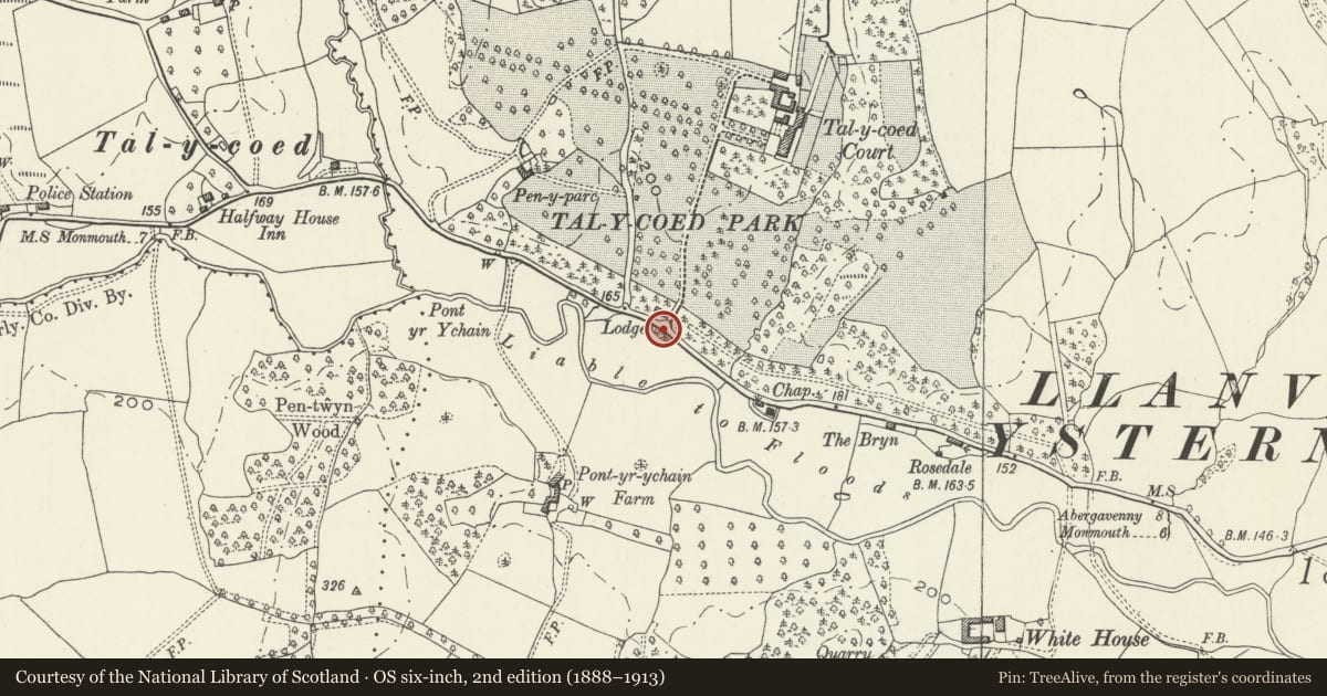
Slide toward Today to fade the historical sheet and see the modern map underneath.
David Rumsey Map Collection, Stanford LibrariesDavid Rumsey Map Collection, Stanford LibrariesDavid Rumsey Map Collection, Stanford LibrariesDavid Rumsey Map Collection, Stanford LibrariesDavid Rumsey Map Collection, Stanford Libraries
5 historical maps cover this location, the earliest the 1636 map "Cornubia : Devonia, Somersetus, Dorcestria, Wiltonia, Glocestria ..." (David Rumsey Map Collection, Stanford Libraries).
Historical maps covering this location
- 1636 · Cornubia : Devonia, Somersetus, Dorcestria, Wiltonia, Glocestria ... (David Rumsey Map Collection, Stanford Libraries)
- 1830 · V.3:11-15:XV.Britisches Reich. A. Kon: England. a. England ab sich: Shire:15-17, 33 (David Rumsey Map Collection, Stanford Libraries)
- 1895 · Sheet 11. Ordnance Survey of England and Wales. (David Rumsey Map Collection, Stanford Libraries)
- 1896 · 233 Monmouth (Hills) (David Rumsey Map Collection, Stanford Libraries)
- 1901 · Sheet 14. (David Rumsey Map Collection, Stanford Libraries)
Cadw's description
Location
Approximately 2km E of Llantilio Crossenny, in small lay-by on S side of the B4233.
History
Designed c1882 by F.R. Kempson architect as part of the estate plan for Tal-y-coed Court.
Exterior
Boundary wall, segmental in plan, built of rubble stone blocks laid in random uneven courses, curves inwards to ornamental trough (centre). Rectangular trough is raised on stone blocks at each end. Each face of trough is enriched with gadrooning. Set into the back wall is a large shaped head-stone with floral spray in head and two encircled rosettes below. Above spout is the Welsh motto on a scroll DWER IN RHYDD BAWP (‘Water is free to everybody').
Reason for designation
Late C19 Drinking Trough having important group value with the neighbouring Gatepiers, Piers and Wall, Entrance Lodge and other listed buildings at Tal-y-coed Court.
Nearby in the register
- Gatepiers, Piers and Walls at Main Entrance to Tal-y-coed CourtNo class recordedunder 1 mi
- Lodge at Main Entrance to Tal-y-coed CourtDomesticunder 1 mi
- Pont-yr-ychain FarmhouseNo class recordedunder 1 mi
- Stable and Cartshed at Pont-yr-ychain FarmNo class recordedunder 1 mi
Other entries of the same register within about three miles of this one, by straight line.