Cof Cymru: National Historic Assets of Wales · Wales
Barn at The Great House
Grosmont, Monmouthshire, Wales
A Grade II listed building in Llangua, Abergavenny, Grosmont, Monmouthshire, designated on 19 October 2000.
The record
- Designation
- Listed building, Grade II
- Broad class
- Agriculture and Subsistence
- Date of designation
- 19 October 2000
- Locality
- Llangua
- Town
- Abergavenny
- Community
- Grosmont
- Unitary authority
- Monmouthshire
- Country
- Wales
- Coordinates
- 51.92837, -2.88491
- Cadw reference
- 24179
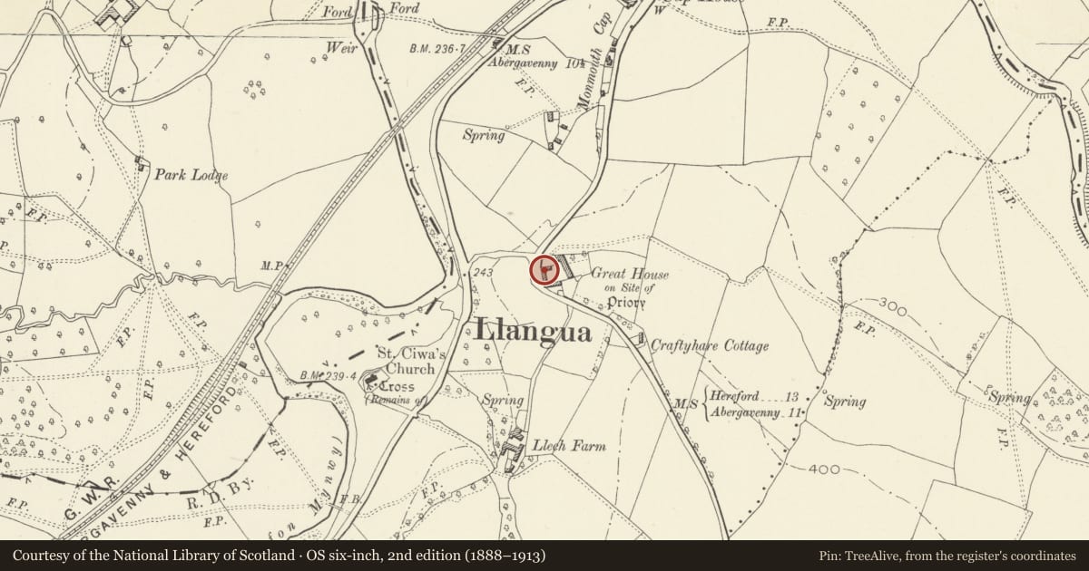
Slide toward Today to fade the historical sheet and see the modern map underneath.
David Rumsey Map Collection, Stanford LibrariesDavid Rumsey Map Collection, Stanford LibrariesDavid Rumsey Map Collection, Stanford LibrariesDavid Rumsey Map Collection, Stanford LibrariesDavid Rumsey Map Collection, Stanford Libraries
5 historical maps cover this location, the earliest the 1636 map "Cornubia : Devonia, Somersetus, Dorcestria, Wiltonia, Glocestria ..." (David Rumsey Map Collection, Stanford Libraries).
Historical maps covering this location
- 1636 · Cornubia : Devonia, Somersetus, Dorcestria, Wiltonia, Glocestria ... (David Rumsey Map Collection, Stanford Libraries)
- 1830 · V.3:11-15:XV.Britisches Reich. A. Kon: England. a. England ab sich: Shire:15-17, 33 (David Rumsey Map Collection, Stanford Libraries)
- 1895 · Sheet 11. Ordnance Survey of England and Wales. (David Rumsey Map Collection, Stanford Libraries)
- 1898 · 215 Ross (Hills) (David Rumsey Map Collection, Stanford Libraries)
- 1901 · Sheet 14. (David Rumsey Map Collection, Stanford Libraries)
Cadw's description
Location
On steeply sloping ground on E side of minor road, some 500m S of the junction to Llangua on the A465. The barn lies opposite the farmhouse and encloses one side of farmyard.
History
A probably C18 corn barn. Many of the roof timbers are reused.
Exterior
Large C18 corn barn. S gable is rubble stone. N gable wall and both long walls are rubble stone to a height of about 2m, and timber framed above with external weatherboarding; corrugated metal roof. E front faces farmyard, off-centre doorways to threshing floor have C20 plywood doors. Each side of the doors the stone base walls have two vent slits; the upper wall is weatherboarded (to right) and faced with corrugated metal sheeting (to left). Far left is big metal sliding door. W elevation faces road: wall to left has stone base with corrugated sheeting to upper wall and C20 plywood barn doors; wall to right is entirely stone and has (l to r) metal door, reused 3+3 pane casement and 2-pane window. S gable has square barred opening to upper loft, and on ground floor a flat headed doorway. N gable has attached lean-to cowshed.
Interior
Seven bay corn barn. Box framed walls in two tiers. Six collar and tie beam trusses with queen posts and two tiers of purlins. S end lofted with transverse C20 blockwork partition to milking parlour.
Reason for designation
Substantial and well-preserved C18 corn barn. Group value with Great House and nearby Cider House.
Nearby in the register
- Cider House and Cowhouse at The Great HouseAgriculture and Subsistenceunder 1 mi
- The Great HouseNo class recordedunder 1 mi
- Barn at Monmouth CapAgriculture and Subsistenceunder 1 mi
- Shelter Shed at Monmouth CapAgriculture and Subsistenceunder 1 mi
Other entries of the same register within about three miles of this one, by straight line.