Cof Cymru: National Historic Assets of Wales · Wales
Cider House and Cowhouse at The Great House
Grosmont, Monmouthshire, Wales
A Grade II listed building in Llangua, Abergavenny, Grosmont, Monmouthshire, designated on 19 October 2000.
The record
- Designation
- Listed building, Grade II
- Broad class
- Agriculture and Subsistence
- Date of designation
- 19 October 2000
- Locality
- Llangua
- Town
- Abergavenny
- Community
- Grosmont
- Unitary authority
- Monmouthshire
- Country
- Wales
- Coordinates
- 51.92850, -2.88442
- Cadw reference
- 24178
Slide toward Today to fade the historical sheet and see the modern map underneath.
David Rumsey Map Collection, Stanford LibrariesDavid Rumsey Map Collection, Stanford LibrariesDavid Rumsey Map Collection, Stanford LibrariesDavid Rumsey Map Collection, Stanford LibrariesDavid Rumsey Map Collection, Stanford Libraries
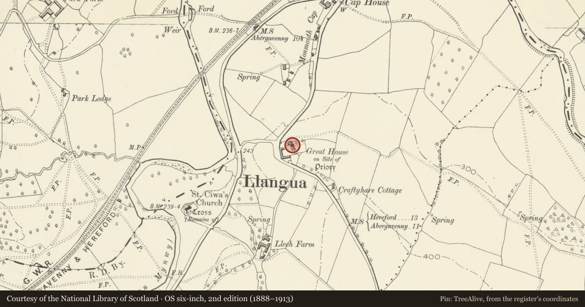
5 historical maps cover this location, the earliest the 1636 map "Cornubia : Devonia, Somersetus, Dorcestria, Wiltonia, Glocestria ..." (David Rumsey Map Collection, Stanford Libraries).
Historical maps covering this location
- 1636 · Cornubia : Devonia, Somersetus, Dorcestria, Wiltonia, Glocestria ... (David Rumsey Map Collection, Stanford Libraries)
- 1830 · V.3:11-15:XV.Britisches Reich. A. Kon: England. a. England ab sich: Shire:15-17, 33 (David Rumsey Map Collection, Stanford Libraries)
- 1895 · Sheet 11. Ordnance Survey of England and Wales. (David Rumsey Map Collection, Stanford Libraries)
- 1898 · 215 Ross (Hills) (David Rumsey Map Collection, Stanford Libraries)
- 1901 · Sheet 14. (David Rumsey Map Collection, Stanford Libraries)
Cadw's description
Location
Attached to N gable of Great House, on steeply sloping ground on E side of minor road, some 500m S of the A465 road junction to Llangua.
History
A probably C18 farm range, converted for use as a Cider House in the C19.
Exterior
Single storey linear range. Rubble stone with corrugated metal roof. W front faces into farmyard with farmhouse attached to right, and has (l to r): a blocked entrance doorway, broad C20 cartshed entry with metal doors, a square window with timber lintel and internal boarded shutters, and a boarded door.
Interior
Five bay interior. Queen post roof trusses with two tiers of purlins. Former cowhouse, at downhill end, is separated from Cider House by a transverse post and panel partition. Well-preserved cider mill retains circular stone trough, drive shaft and stone mill wheel.
Reason for designation
Group value with farmhouse and barn at The Great House.
Nearby in the register
- The Great HouseNo class recordedunder 1 mi
- Barn at The Great HouseAgriculture and Subsistenceunder 1 mi
- Barn at Monmouth CapAgriculture and Subsistenceunder 1 mi
- Shelter Shed at Monmouth CapAgriculture and Subsistenceunder 1 mi
Other entries of the same register within about three miles of this one, by straight line.