Cof Cymru: National Historic Assets of Wales · Wales
Cross in St James's Churchyard
Grosmont, Monmouthshire, Wales
A Grade II listed building in Llangua, Abergavenny, Grosmont, Monmouthshire, designated on 19 October 2000.
The record
- Designation
- Listed building, Grade II
- Broad class
- Religious, Ritual and Funerary
- Date of designation
- 19 October 2000
- Locality
- Llangua
- Town
- Abergavenny
- Community
- Grosmont
- Unitary authority
- Monmouthshire
- Country
- Wales
- Coordinates
- 51.92672, -2.88897
- Cadw reference
- 24173
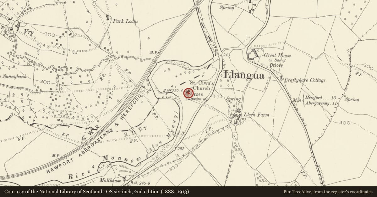
Slide toward Today to fade the historical sheet and see the modern map underneath.
David Rumsey Map Collection, Stanford LibrariesDavid Rumsey Map Collection, Stanford LibrariesDavid Rumsey Map Collection, Stanford LibrariesDavid Rumsey Map Collection, Stanford LibrariesDavid Rumsey Map Collection, Stanford Libraries
5 historical maps cover this location, the earliest the 1636 map "Cornubia : Devonia, Somersetus, Dorcestria, Wiltonia, Glocestria ..." (David Rumsey Map Collection, Stanford Libraries).
Historical maps covering this location
- 1636 · Cornubia : Devonia, Somersetus, Dorcestria, Wiltonia, Glocestria ... (David Rumsey Map Collection, Stanford Libraries)
- 1830 · V.3:11-15:XV.Britisches Reich. A. Kon: England. a. England ab sich: Shire:15-17, 33 (David Rumsey Map Collection, Stanford Libraries)
- 1895 · Sheet 11. Ordnance Survey of England and Wales. (David Rumsey Map Collection, Stanford Libraries)
- 1898 · 215 Ross (Hills) (David Rumsey Map Collection, Stanford Libraries)
- 1901 · Sheet 14. (David Rumsey Map Collection, Stanford Libraries)
Cadw's description
Location
In churchyard, some 5m S of the porch of the Church of St James, Llangua.
History
The remains of a medieval churchyard cross, probably C15.
Exterior
Red sandstone; cement rendered shaft. Base and C20 restored shaft of medieval churchyard cross, standing some 2m high; consisting of square base with two tiers of steps, square socket stone broaches to an octagon, tapering square shaft.
Reason for designation
Included as a medieval churchyard cross having group value with Church of St James.
Nearby in the register
- Church of St JamesReligious, Ritual and Funeraryunder 1 mi
- Sleath Farmhouse (aka Lech Farmhouse)Agriculture and Subsistenceunder 1 mi
- Barn at The Great HouseAgriculture and Subsistenceunder 1 mi
- The Great HouseNo class recordedunder 1 mi
Other entries of the same register within about three miles of this one, by straight line.