Cof Cymru: National Historic Assets of Wales · Wales
Courtyard Wall, Gates and Railings at Hoaldalbert
Grosmont, Monmouthshire, Wales
A Grade II listed building in Hoaldalbert, Abergavenny, Grosmont, Monmouthshire, designated on 19 October 2000.
The record
- Designation
- Listed building, Grade II
- Broad class
- Miscellaneous
- Date of designation
- 19 October 2000
- Locality
- Hoaldalbert
- Town
- Abergavenny
- Community
- Grosmont
- Unitary authority
- Monmouthshire
- Country
- Wales
- Coordinates
- 51.90478, -2.87496
- Cadw reference
- 24160
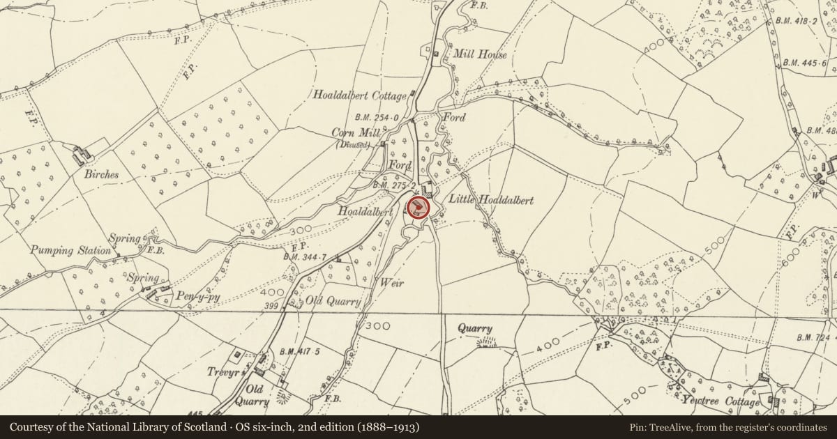
Slide toward Today to fade the historical sheet and see the modern map underneath.
David Rumsey Map Collection, Stanford LibrariesDavid Rumsey Map Collection, Stanford LibrariesDavid Rumsey Map Collection, Stanford LibrariesDavid Rumsey Map Collection, Stanford LibrariesDavid Rumsey Map Collection, Stanford Libraries
5 historical maps cover this location, the earliest the 1636 map "Cornubia : Devonia, Somersetus, Dorcestria, Wiltonia, Glocestria ..." (David Rumsey Map Collection, Stanford Libraries).
Historical maps covering this location
- 1636 · Cornubia : Devonia, Somersetus, Dorcestria, Wiltonia, Glocestria ... (David Rumsey Map Collection, Stanford Libraries)
- 1830 · V.3:11-15:XV.Britisches Reich. A. Kon: England. a. England ab sich: Shire:15-17, 33 (David Rumsey Map Collection, Stanford Libraries)
- 1895 · Sheet 11. Ordnance Survey of England and Wales. (David Rumsey Map Collection, Stanford Libraries)
- 1898 · 215 Ross (Hills) (David Rumsey Map Collection, Stanford Libraries)
- 1901 · Sheet 14. (David Rumsey Map Collection, Stanford Libraries)
Cadw's description
Location
At junction of minor road approximately 1 km SW of Grosmont. The wall, gates and railings form a boundary between Hoaldalbert Farmhouse and the Stable Block.
History
A probably mid-C19 courtyard wall with ornamental gates and railings.
Exterior
Gates and railings bound the E side of the farmyard at Hoaldalbert, running between the farmhouse house and stable block. Wrought-iron gates (to right) have dog-rails and are ramped up towards centre to form a broad segmental arched entrance gateway. On each side are low stone flanking walls surmounted by iron railings with stanchions crowned by urn finials. Towards the farmhouse (left) the wall curves back at right angles to form a U-shaped enclosure that bounds the back yard of the house. On E side of this enclosure is a small iron gate (with dog-rail) which opens directly into this yard.
Reason for designation
Included for group value the Farmhouse and listed farm buildings at Hoaldalbert.
Nearby in the register
- Stable Range at HoaldalbertAgriculture and Subsistenceunder 1 mi
- Hoaldalbert FarmhouseDomesticunder 1 mi
- Granary & Cider House at HoaldalbertAgriculture and Subsistenceunder 1 mi
- Barn and attached Hay Barn at HoaldalbertAgriculture and Subsistenceunder 1 mi
Other entries of the same register within about three miles of this one, by straight line.