Cof Cymru: National Historic Assets of Wales · Wales
Retaining Wall/Dam of Holding Pond at the Old Wire Works
Wye Valley, Monmouthshire, Wales
A Grade II listed building in Chapel Hill, Chepstow, Wye Valley, Monmouthshire, designated on 29 September 2000.
The record
- Designation
- Listed building, Grade II
- Broad class
- Industrial
- Date of designation
- 29 September 2000
- Locality
- Chapel Hill
- Town
- Chepstow
- Community
- Wye Valley
- Unitary authority
- Monmouthshire
- Country
- Wales
- Coordinates
- 51.69745, -2.68766
- Cadw reference
- 24038
Slide toward Today to fade the historical sheet and see the modern map underneath.
David Rumsey Map Collection, Stanford LibrariesDavid Rumsey Map Collection, Stanford LibrariesDavid Rumsey Map Collection, Stanford LibrariesDavid Rumsey Map Collection, Stanford LibrariesDavid Rumsey Map Collection, Stanford Libraries
5 historical maps cover this location, the earliest the 1636 map "Cornubia : Devonia, Somersetus, Dorcestria, Wiltonia, Glocestria ..." (David Rumsey Map Collection, Stanford Libraries).
Historical maps covering this location
- 1636 · Cornubia : Devonia, Somersetus, Dorcestria, Wiltonia, Glocestria ... (David Rumsey Map Collection, Stanford Libraries)
- 1830 · V.3:11-15:XV.Britisches Reich. A. Kon: England. a. England ab sich: Shire:15-17, 33 (David Rumsey Map Collection, Stanford Libraries)
- 1895 · Sheet 11. Ordnance Survey of England and Wales. (David Rumsey Map Collection, Stanford Libraries)
- 1897 · 250 Chepstow (Outline) (David Rumsey Map Collection, Stanford Libraries)
- 1905 · 250 Chepstow (Hills) (David Rumsey Map Collection, Stanford Libraries)
Cadw's description
Location
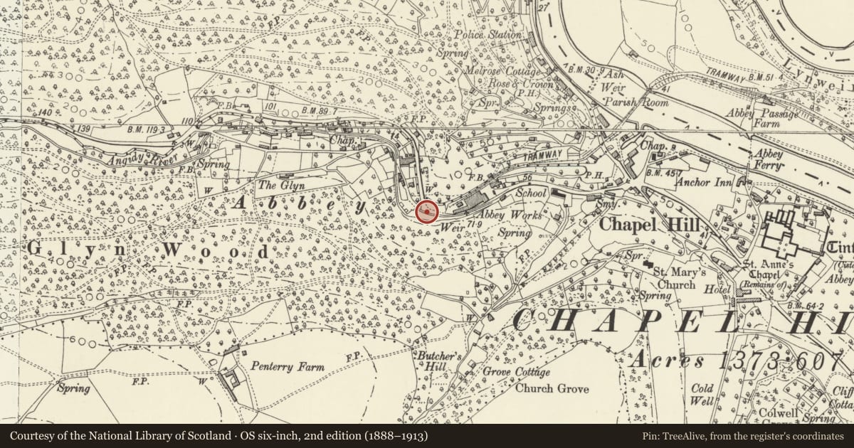
About 500m west of Tintern Cross at the west end of the Old Wireworks site.
History
This dam and retaining wall for the road was constructed to pen a holding pond for the Lower Wireworks in the mid C19, presumably to improve the head of water for a new process at that time. It continued in use as a part of the tinplate works which was opened on the wireworks site in 1880 and which needed water power for the cold rollers.
Exterior
Stone rubble wall about 2m in height and about 40m in length which acted as the dam of a holding pond for the Lower Wireworks. The wall runs along the road and curves round to where the sluice controlled the outflow onto a launder across the road but this is all gone. The wall, however, is little changed.
Reason for designation
Included as a well preserved small mill dam dating probably from the mid C19, and as a part of an important group of surviving relics of the metal industry in the Anghidy valley.
Nearby in the register
- Lower or Abbey Wireworks, TinternIron forgeunder 1 mi
- Crown LodgeDefenceunder 1 mi
- The BayDomesticunder 1 mi
- The Royal George HotelDomesticunder 1 mi
Other entries of the same register within about three miles of this one, by straight line.