Cof Cymru: National Historic Assets of Wales · Wales
Crown Lodge
Wye Valley, Monmouthshire, Wales
A Grade II listed building in Chapel Hill, Chepstow, Wye Valley, Monmouthshire, designated on 29 September 2000.
The record
- Designation
- Listed building, Grade II
- Broad class
- Defence
- Date of designation
- 29 September 2000
- Locality
- Chapel Hill
- Town
- Chepstow
- Community
- Wye Valley
- Unitary authority
- Monmouthshire
- Country
- Wales
- Coordinates
- 51.69773, -2.68277
- Cadw reference
- 24034
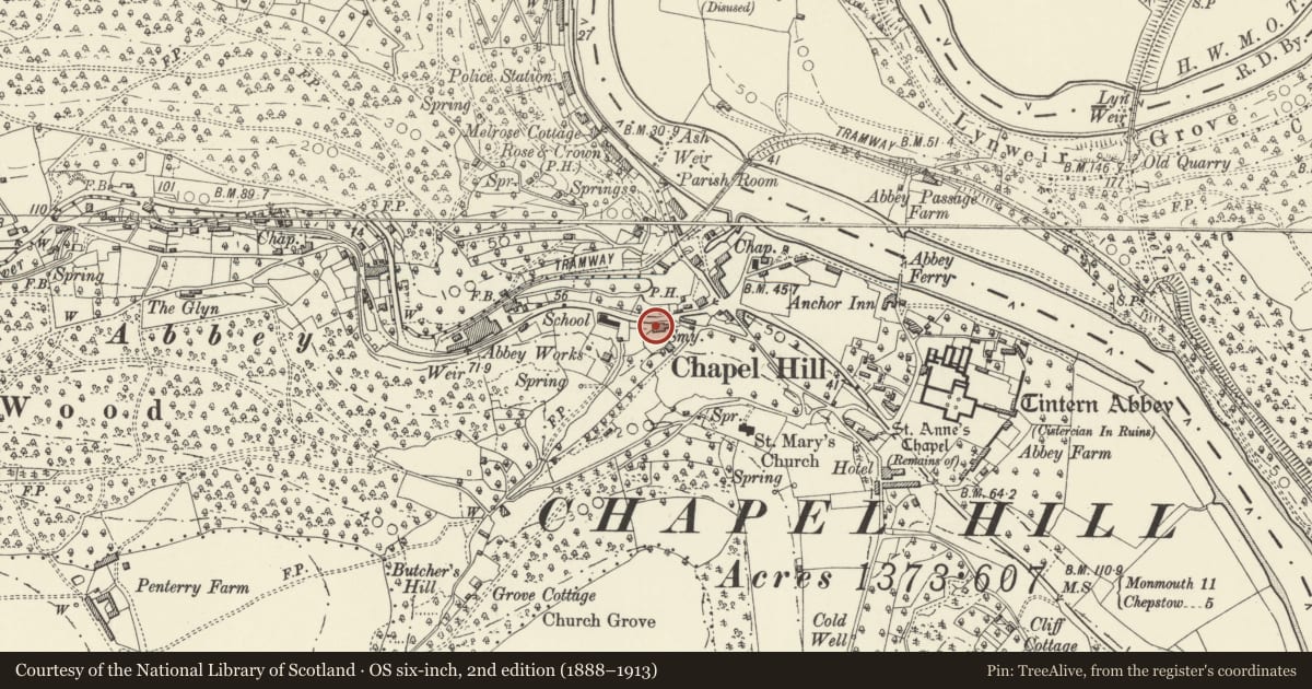
Slide toward Today to fade the historical sheet and see the modern map underneath.
David Rumsey Map Collection, Stanford LibrariesDavid Rumsey Map Collection, Stanford LibrariesDavid Rumsey Map Collection, Stanford LibrariesDavid Rumsey Map Collection, Stanford LibrariesDavid Rumsey Map Collection, Stanford Libraries
5 historical maps cover this location, the earliest the 1636 map "Cornubia : Devonia, Somersetus, Dorcestria, Wiltonia, Glocestria ..." (David Rumsey Map Collection, Stanford Libraries).
Historical maps covering this location
- 1636 · Cornubia : Devonia, Somersetus, Dorcestria, Wiltonia, Glocestria ... (David Rumsey Map Collection, Stanford Libraries)
- 1830 · V.3:11-15:XV.Britisches Reich. A. Kon: England. a. England ab sich: Shire:15-17, 33 (David Rumsey Map Collection, Stanford Libraries)
- 1895 · Sheet 11. Ordnance Survey of England and Wales. (David Rumsey Map Collection, Stanford Libraries)
- 1897 · 250 Chepstow (Outline) (David Rumsey Map Collection, Stanford Libraries)
- 1905 · 250 Chepstow (Hills) (David Rumsey Map Collection, Stanford Libraries)
Cadw's description
Location
About 200m west of Tintern Cross.
History
An c1800 house which has been little changed externally since building.
Exterior
The house is rendered, probably over rubble stone, and has a Welsh slate roof with red brick stacks. A central entrance double depth house with two parallel ranges apparently built at the same time. Three storey three bay front with a 6-panel door with two glazed panels and a flat hood on brackets. The windows are 6 over 6 sashes with 3 over 6 on the second floor. Plain roof with gable stacks. The east gable has one 6 over 6 sash on the second floor, the west gable is blind. The rear range has 6 over 6 sashes in the gables. Rear elevation not seen.
Interior
Interior not seen at resurvey.
Reason for designation
Included as an externally unaltered house dating from about 1800.
Nearby in the register
- The Royal George HotelDomesticunder 1 mi
- The BayDomesticunder 1 mi
- Revetment Wall of Churchyard at Church of St Mary and adjoining Paved Road of Chapel HillTransportunder 1 mi
- St Mary's Church, Chapel HillChurchunder 1 mi
Other entries of the same register within about three miles of this one, by straight line.