Cof Cymru: National Historic Assets of Wales · Wales
Milestone N of Bwlchnewydd
Cynwyl Elfed, Carmarthenshire, Wales
A Grade II listed building in Bwlchnewydd, Carmarthen, Cynwyl Elfed, Carmarthenshire, designated on 19 September 2000.
The record
- Designation
- Listed building, Grade II
- Broad class
- Transport
- Date of designation
- 19 September 2000
- Locality
- Bwlchnewydd
- Town
- Carmarthen
- Community
- Cynwyl Elfed
- Unitary authority
- Carmarthenshire
- Country
- Wales
- Coordinates
- 51.90466, -4.37914
- Cadw reference
- 23987
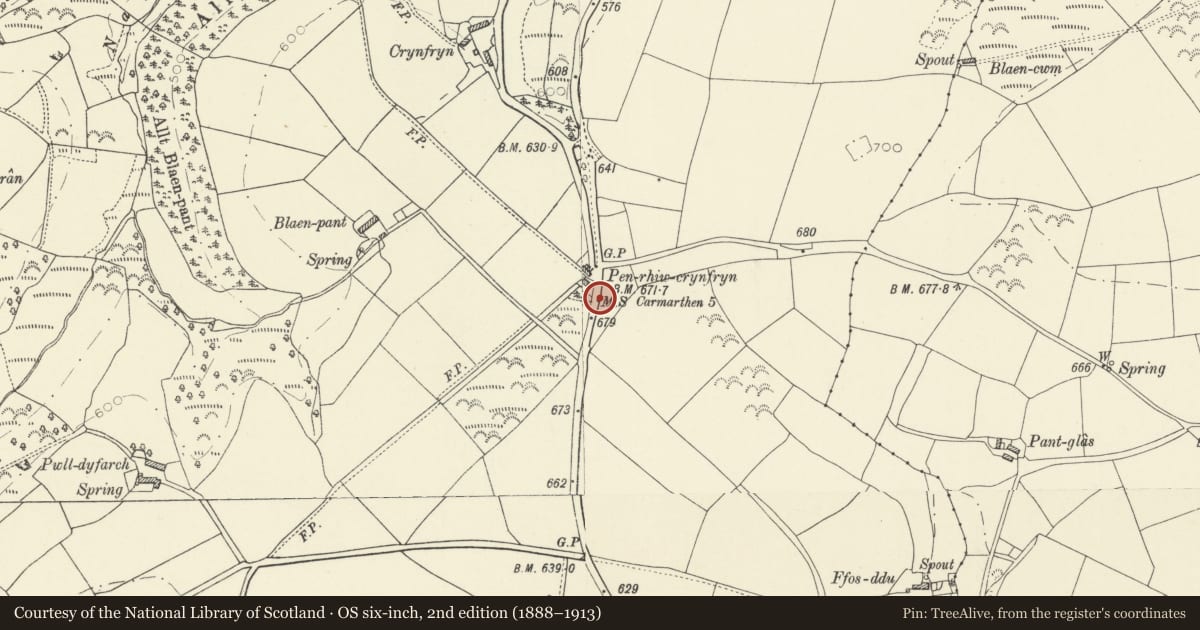
Slide toward Today to fade the historical sheet and see the modern map underneath.
David Rumsey Map Collection, Stanford LibrariesDavid Rumsey Map Collection, Stanford LibrariesDavid Rumsey Map Collection, Stanford LibrariesDavid Rumsey Map Collection, Stanford LibrariesDavid Rumsey Map Collection, Stanford Libraries
5 historical maps cover this location, the earliest the 1636 map "Cornubia : Devonia, Somersetus, Dorcestria, Wiltonia, Glocestria ..." (David Rumsey Map Collection, Stanford Libraries).
Historical maps covering this location
- 1636 · Cornubia : Devonia, Somersetus, Dorcestria, Wiltonia, Glocestria ... (David Rumsey Map Collection, Stanford Libraries)
- 1860 · 41. Caermathen. (David Rumsey Map Collection, Stanford Libraries)
- 1891 · Sheet 10. Ordnance Survey of England and Wales. . (David Rumsey Map Collection, Stanford Libraries)
- 1898 · 211 Newcastle Emlyn (Hills) (David Rumsey Map Collection, Stanford Libraries)
- 1901 · Sheet 14. (David Rumsey Map Collection, Stanford Libraries)
Cadw's description
Location
Situated some 1km N of Bwlchnewyddon, on the E side of the road to Cynwyl Elfed near a junction of minor roads
History
Early C19 milestone on the Bwlchnewydd to Cynwyl Elfed road.
Exterior
Milestone, grey limestone with incised letters 'From CARMARTHEN 5 Miles'.
Reason for designation
Included as a well-lettered milestone on a former turnpike road.
Nearby in the register
- Bwlchnewydd Independent ChapelReligious, Ritual and Funeraryunder 1 mi
- Crug Pant y Bugail round barrowRound Barrowunder 1 mi
- Cwm FlowrogDomestic1 mi
- Cynwyl Elfed Anti-invasion DefencesAnti Invasion Defence Site1 mi
Other entries of the same register within about three miles of this one, by straight line.