Cof Cymru: National Historic Assets of Wales · Wales
Cemaes
Llanegryn, Gwynedd, Wales
A Grade II listed building in Llanegryn, Tywyn, Gwynedd, designated on 26 July 2000.
The record
- Designation
- Listed building, Grade II
- Broad class
- Domestic
- Date of designation
- 26 July 2000
- Locality
- Llanegryn
- Town
- Tywyn
- Community
- Llanegryn
- Unitary authority
- Gwynedd
- Country
- Wales
- Coordinates
- 52.63397, -4.04355
- Cadw reference
- 23795
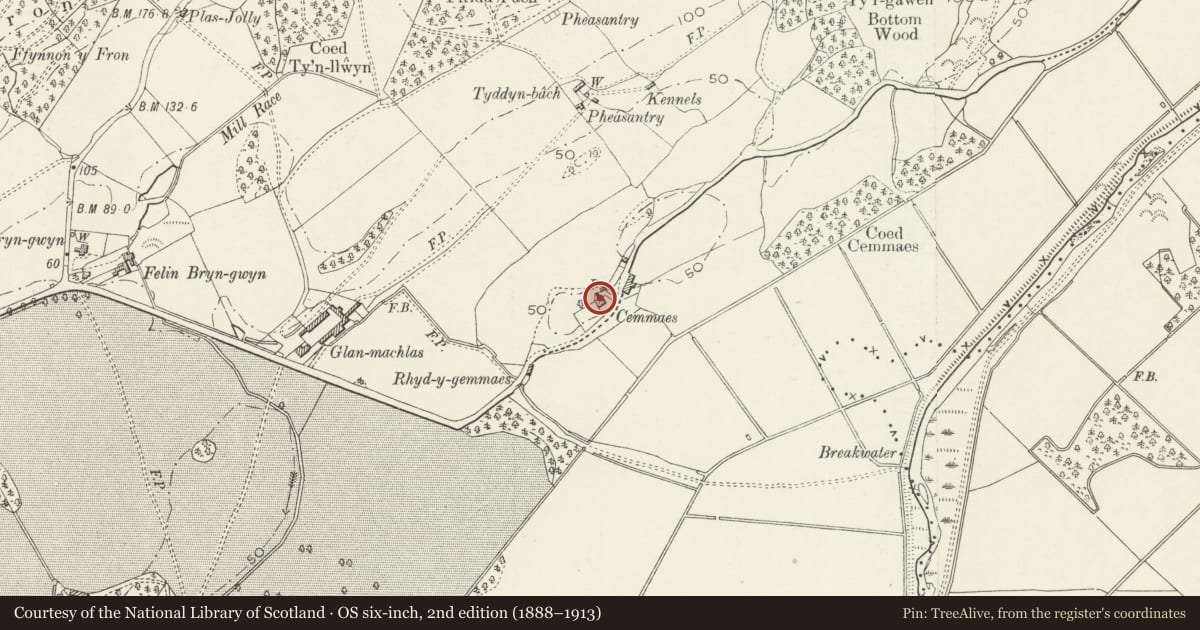
Slide toward Today to fade the historical sheet and see the modern map underneath.
David Rumsey Map Collection, Stanford LibrariesDavid Rumsey Map Collection, Stanford LibrariesDavid Rumsey Map Collection, Stanford LibrariesLlyfrgell Genedlaethol Cymru – The National Library of WalesDavid Rumsey Map Collection, Stanford Libraries
5 historical maps cover this location, the earliest the 1795 map "To Sir Watkin Williams-Wynn Bart ... the map of the six counties of North Wales is most humbly inscribed by his obedient humble servant" (Llyfrgell Genedlaethol Cymru – The National Library of Wales).
Historical maps covering this location
- 1795 · To Sir Watkin Williams-Wynn Bart ... the map of the six counties of North Wales is most… (Llyfrgell Genedlaethol Cymru – The National Library of Wales)
- 1883 · Watershed map England, Wales 3. (David Rumsey Map Collection, Stanford Libraries)
- 1896 · Sheet 7. Ordnance Survey of England and Wales. (David Rumsey Map Collection, Stanford Libraries)
- 1899 · 149 Barmouth (Hills) (David Rumsey Map Collection, Stanford Libraries)
- 1901 · Sheet 9 and 10. (David Rumsey Map Collection, Stanford Libraries)
Cadw's description
Location
The house stands above the road from the village to Abergynolwyn, E of Glanmachlas.
History
The farm is probably of C17 or earlier origins, the name appearing in a list of estates in the parish in 1717. It is said to have been built by the owner or manager of a slate quarry, and incorporated into the Peniarth estate in the mid C19, when it appears to have been largely rebuilt.
Exterior
Built of rubble stonework, with a slate roof, the verges slabbed, and gable stacks. Two storeys, three window bays. Central entrance, a modern door set within a slate slab open-fronted porch. Large 6-pane horned sash windows equally spaced either side, each with sawn slate lintel outlined by a slate projecting drip with out-turned dropped ends. Short rear wing with lateral rear door and window.
Reason for designation
Included as a well proportioned farmhouse retaining original C19 detail characteristic of estate work, including an interesting slate porch and other details.
Nearby in the register
- Barn in the farmyard at GlanmachlasAgriculture and Subsistenceunder 1 mi
- SE range of farm buildings around the large farmyard at GlanmachlasAgriculture and Subsistenceunder 1 mi
- Farm range on the NE side of the farmyard at GlanmachlasAgriculture and Subsistenceunder 1 mi
- GlanmachlasDomesticunder 1 mi
Other entries of the same register within about three miles of this one, by straight line.