Cof Cymru: National Historic Assets of Wales · Wales
3 Wonastow Road
Monmouth, Monmouthshire, Wales
A Grade II listed building in Overmonnow, Monmouth, Monmouthshire, designated on 15 August 1974.
The record
- Designation
- Listed building, Grade II
- Broad class
- Domestic
- Date of designation
- 15 August 1974
- Locality
- Overmonnow
- Town
- Monmouth
- Community
- Monmouth
- Unitary authority
- Monmouthshire
- Country
- Wales
- Coordinates
- 51.80865, -2.72367
- Cadw reference
- 2366
Slide toward Today to fade the historical sheet and see the modern map underneath.
David Rumsey Map Collection, Stanford LibrariesDavid Rumsey Map Collection, Stanford LibrariesDavid Rumsey Map Collection, Stanford LibrariesDavid Rumsey Map Collection, Stanford LibrariesDavid Rumsey Map Collection, Stanford Libraries
5 historical maps cover this location, the earliest the 1636 map "Cornubia : Devonia, Somersetus, Dorcestria, Wiltonia, Glocestria ..." (David Rumsey Map Collection, Stanford Libraries).
Historical maps covering this location
- 1636 · Cornubia : Devonia, Somersetus, Dorcestria, Wiltonia, Glocestria ... (David Rumsey Map Collection, Stanford Libraries)
- 1830 · V.3:11-15:XV.Britisches Reich. A. Kon: England. a. England ab sich: Shire:15-17, 33 (David Rumsey Map Collection, Stanford Libraries)
- 1895 · Sheet 11. Ordnance Survey of England and Wales. (David Rumsey Map Collection, Stanford Libraries)
- 1896 · 233 Monmouth (Hills) (David Rumsey Map Collection, Stanford Libraries)
- 1901 · Sheet 14. (David Rumsey Map Collection, Stanford Libraries)
Cadw's description
Location
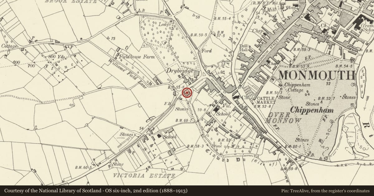
About 100m west of the roundabout at the junction between Drybridge Street and Rockfield Road.
History
Early/mid C19, externally unaltered since. It is not shown on the Tithe Map of 1843.
Exterior
Faced with roughcast render, painted, Welsh slate roof. Two storeys, three windows, double fronted central entrance plan with rear wing. Unequal elevation with wider bay to main living room and bedroom on the right. Six panel door with slender pilasters, transom light and small hood flanked by 8 over 8 pane sashes. Upper floor has 4 over 8 panes sashes flanking a central 3 over 6 pane sash. Low pitch roof with rendered stack on either gable. House connects on the left with the rear wing of No. 1 (qv). Rear kitchen wing not visible from street, additional stack. Rear elevation not seen.
Interior
Interior not seen at resurvey.
Reason for designation
Included for its special architectural interest as a mid C19 house of definite character which is part of the important group of historic buildings in Overmonnow.
Nearby in the register
- Brook CottageDomesticunder 1 mi
- 10 Drybridge TerraceNo class recordedunder 1 mi
- 9 Drybridge TerraceNo class recordedunder 1 mi
- 8 Drybridge TerraceDomesticunder 1 mi
Other entries of the same register within about three miles of this one, by straight line.