Cof Cymru: National Historic Assets of Wales · Wales
8 Drybridge Terrace
Monmouth, Monmouthshire, Wales
A Grade II listed building in Overmonnow, Monmouth, Monmouthshire, designated on 15 August 1974.
The record
- Designation
- Listed building, Grade II
- Broad class
- Domestic
- Date of designation
- 15 August 1974
- Locality
- Overmonnow
- Town
- Monmouth
- Community
- Monmouth
- Unitary authority
- Monmouthshire
- Country
- Wales
- Coordinates
- 51.80883, -2.72271
- Cadw reference
- 85166
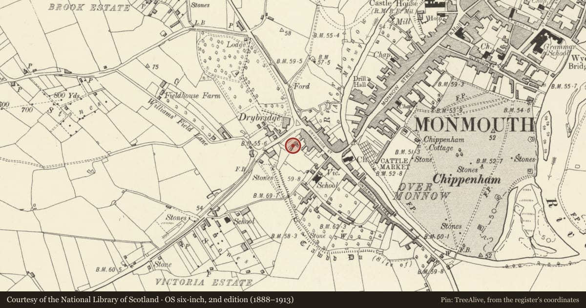
Slide toward Today to fade the historical sheet and see the modern map underneath.
David Rumsey Map Collection, Stanford LibrariesDavid Rumsey Map Collection, Stanford LibrariesDavid Rumsey Map Collection, Stanford LibrariesDavid Rumsey Map Collection, Stanford LibrariesDavid Rumsey Map Collection, Stanford Libraries
5 historical maps cover this location, the earliest the 1636 map "Cornubia : Devonia, Somersetus, Dorcestria, Wiltonia, Glocestria ..." (David Rumsey Map Collection, Stanford Libraries).
Historical maps covering this location
- 1636 · Cornubia : Devonia, Somersetus, Dorcestria, Wiltonia, Glocestria ... (David Rumsey Map Collection, Stanford Libraries)
- 1830 · V.3:11-15:XV.Britisches Reich. A. Kon: England. a. England ab sich: Shire:15-17, 33 (David Rumsey Map Collection, Stanford Libraries)
- 1895 · Sheet 11. Ordnance Survey of England and Wales. (David Rumsey Map Collection, Stanford Libraries)
- 1896 · 233 Monmouth (Hills) (David Rumsey Map Collection, Stanford Libraries)
- 1901 · Sheet 14. (David Rumsey Map Collection, Stanford Libraries)
Cadw's description
Location
Approached along an alleyway between Nos. 26 & 28 Drybridge Street.
History
Early to mid C19. Notable as part of one of the few surviving rear terraces in Monmouth.
Exterior
Rendered and painted front with Welsh slate roof. Double depth, double fronted house with central entrance originally, now changed to left (since listing in 1974). Two storeys, with band between. Central recessed 6-panel door with pointed head. Second similar in small slated porch to left, this is now the entrance. Two-light small paned casement with pointed heads to right, and single light on to left where the new porch obtrudes. Two more 2-light ones in floor above. Low pitch roof with brick stacks. Two storey rear extension, the only one in the row.
Interior
Interior not seen at resurvey.
Reason for designation
Included for its special interest as a part of the important group of historic buildings in the suburb of Overmonnow and as one of the few off-street terraces surviving in Monmouth.
Nearby in the register
- 7 Drybridge TerraceNo class recordedunder 1 mi
- 9 Drybridge TerraceNo class recordedunder 1 mi
- 10 Drybridge TerraceNo class recordedunder 1 mi
- 6 Drybridge TerraceNo class recordedunder 1 mi
Other entries of the same register within about three miles of this one, by straight line.