Cof Cymru: National Historic Assets of Wales · Wales
Minffordd
Denbigh, Denbighshire, Wales
A Grade II listed building in Denbigh - Town, Denbigh, Denbighshire, designated on 20 July 2000.
The record
- Designation
- Listed building, Grade II
- Broad class
- Domestic
- Date of designation
- 20 July 2000
- Locality
- Denbigh - Town
- Community
- Denbigh
- Unitary authority
- Denbighshire
- Country
- Wales
- Coordinates
- 53.18556, -3.41426
- Cadw reference
- 23632
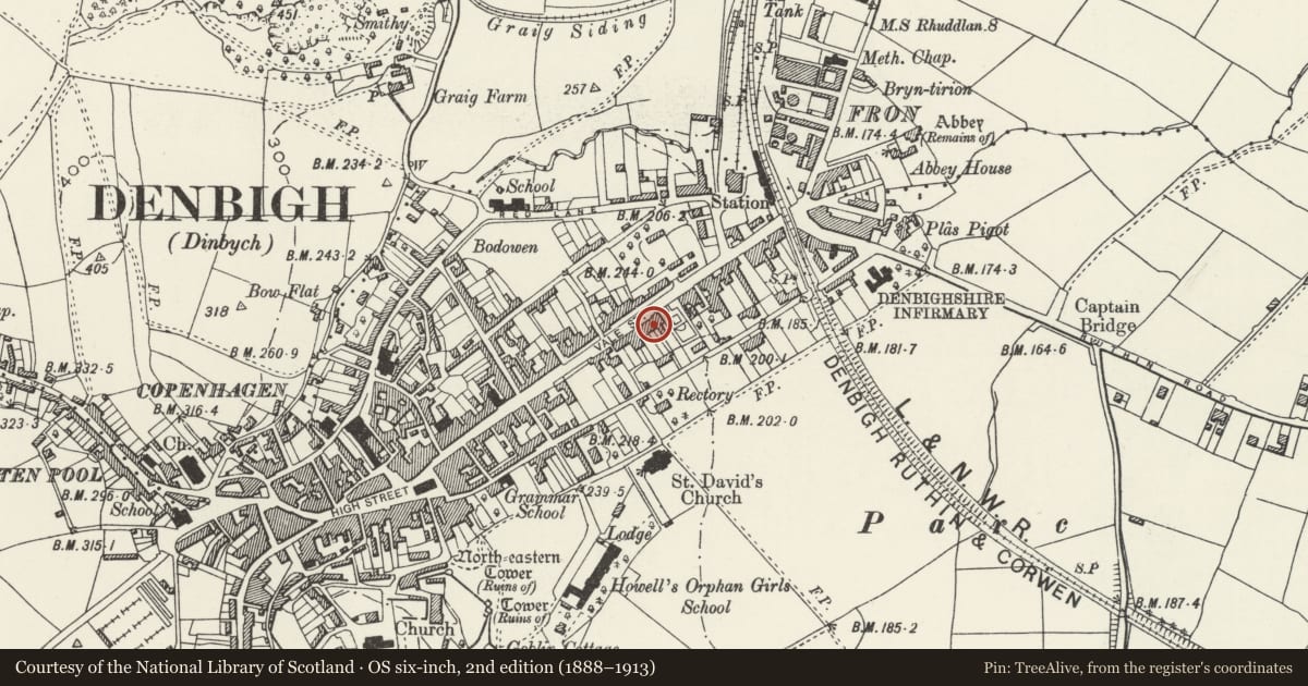
Slide toward Today to fade the historical sheet and see the modern map underneath.
David Rumsey Map Collection, Stanford LibrariesLlyfrgell Genedlaethol Cymru – The National Library of WalesDavid Rumsey Map Collection, Stanford LibrariesDavid Rumsey Map Collection, Stanford LibrariesDavid Rumsey Map Collection, Stanford Libraries
5 historical maps cover this location, the earliest the 1608 map "(13) Cambriae Typus." (David Rumsey Map Collection, Stanford Libraries).
Historical maps covering this location
- 1608 · (13) Cambriae Typus. (David Rumsey Map Collection, Stanford Libraries)
- 1795 · To Sir Watkin Williams-Wynn Bart ... the map of the six counties of North Wales is most… (Llyfrgell Genedlaethol Cymru – The National Library of Wales)
- 1830 · V.3:11-15:XV. Britisches Reich. A. Kon: England. b. Frstenthum Wales: Shire: 37-40 (David Rumsey Map Collection, Stanford Libraries)
- 1883 · Watershed map England, Wales 3. (David Rumsey Map Collection, Stanford Libraries)
- 1901 · Sheet 9 and 10. (David Rumsey Map Collection, Stanford Libraries)
Cadw's description
Location
Set back from the road behind a low hedged forecourt wall.
History
Mid-Victorian town house of some scale; erected in a quarter of the town where the gentry, lawyers and professional men traditionally had their houses from the C16 to the C19.
Exterior
Substantial gabled house of 3 storeys. Of squared, coursed limestone blocks (Graig stone) with yellow stock brick dressings to the openings; slate roof and red brick chimney with oversailing upper courses. The facade is of 5 bays, with each bay defined by a gable over the second floor window, of equal size; these with plain renewed bargeboards. Three-bay symmetrical main section and a 2-bay flush section to the R incorporating a carriage arch to the far R which gives access, via a through-passage, to the rear; this with depressed arch, projecting stone key and boarded double doors.
Central entrance to the main section (ie in bay 2) with part-glazed Victorian panelled door beneath a slated porch canopy with decorative scissor-bracing and finial to the front. Single-storey flanking bays, canted and with hipped slate roofs; plain sash glazing. To the R of the right-hand bay is a plain sash window with cambered head. Similar windows to the first floor with arched sashes to the second; projecting sills throughout.
Interior
The interior was not inspected at the time of survey.
Reason for designation
Listed for its special interest as a large Victorian town house retaining good original external character.
Group value with other listed items in Vale Street.
Nearby in the register
- 84 Vale StreetDomesticunder 1 mi
- ArosfaDomesticunder 1 mi
- GarthDomesticunder 1 mi
- 76 Vale Street, inc forecourt wallsDomesticunder 1 mi
Other entries of the same register within about three miles of this one, by straight line.