Cof Cymru: National Historic Assets of Wales · Wales
Lime Kiln
Ilston, Swansea, Wales
A Grade II listed building in Penmaen, Swansea, Ilston, designated on 19 July 2000.
The record
- Designation
- Listed building, Grade II
- Broad class
- Industrial
- Date of designation
- 19 July 2000
- Locality
- Penmaen
- Town
- Swansea
- Community
- Ilston
- Unitary authority
- Swansea
- Country
- Wales
- Coordinates
- 51.57145, -4.12401
- Cadw reference
- 23544
Slide toward Today to fade the historical sheet and see the modern map underneath.
David Rumsey Map Collection, Stanford LibrariesDavid Rumsey Map Collection, Stanford LibrariesDavid Rumsey Map Collection, Stanford LibrariesDavid Rumsey Map Collection, Stanford LibrariesDavid Rumsey Map Collection, Stanford Libraries
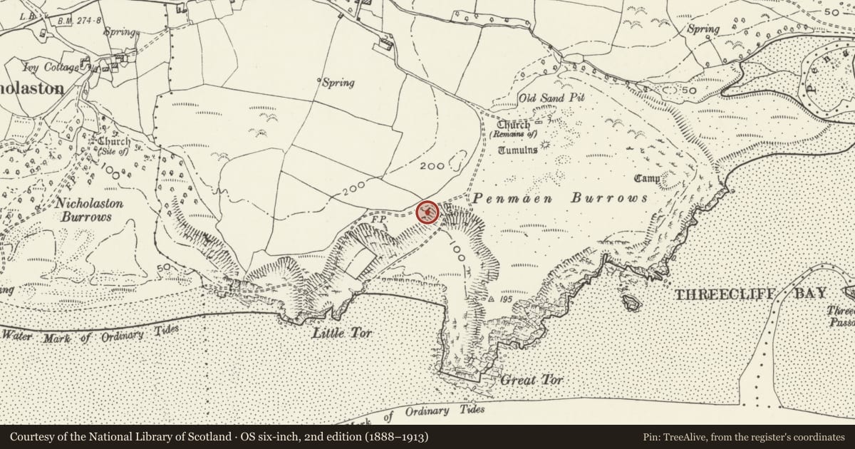
5 historical maps cover this location, the earliest the 1636 map "Cornubia : Devonia, Somersetus, Dorcestria, Wiltonia, Glocestria ..." (David Rumsey Map Collection, Stanford Libraries).
Historical maps covering this location
- 1636 · Cornubia : Devonia, Somersetus, Dorcestria, Wiltonia, Glocestria ... (David Rumsey Map Collection, Stanford Libraries)
- 1865 · England and Wales. England No. 6. (David Rumsey Map Collection, Stanford Libraries)
- 1891 · Sheet 10. Ordnance Survey of England and Wales. . (David Rumsey Map Collection, Stanford Libraries)
- 1897 · 247 Swansea (Hills) (David Rumsey Map Collection, Stanford Libraries)
- 1920 · Sheet 100. Llanelly. (David Rumsey Map Collection, Stanford Libraries)
Cadw's description
Location
On Penmaen Burrows, 1km south of Penmaen House.
History
This limekiln appears as active on the c1830 1" Ordnance Survey map and on the 25" map of 1879. It appears as disused on the 25" map of 1913.
Exterior
A bow-shaped limekiln built out from the hillside in axe-dressed local limestone, roughly coursed; two working recesses slightly angled, facing east and north. The east-facing recess is about 2½m. deep and has a segmental arch of about 2½m span; the north-facing recess is about 3½ m deep and its segmental arch is about 3m span. Both recesses are straight sided but corbelled over the working hole. Only the drawhole of the east-facing recess is visible, with an iron bar.
Interior
The kiln is lined in fire-brickwork one brick thick, of which the top 2 m is visible. It is about 2½m diameter at the top.
Reason for designation
A very well-preserved limekiln of the early C19.
Nearby in the register
- Penmaen Burrows Burial ChamberChambered Tombunder 1 mi
- Penmaen Burrows ChurchChurchunder 1 mi
- Penmaen Burrows RingworkRingworkunder 1 mi
- Penmaen Farmhouse and adjacent cottageAgriculture and Subsistenceunder 1 mi
Other entries of the same register within about three miles of this one, by straight line.