Cof Cymru: National Historic Assets of Wales · Wales
Cottage E of the Church of St Michael
Llanfihangel-y-Pennant, Gwynedd, Wales
A Grade II listed building in Llanfihangel-y-Pennant, Tywyn, Gwynedd, designated on 10 April 2000.
The record
- Designation
- Listed building, Grade II
- Broad class
- Domestic
- Date of designation
- 10 April 2000
- Locality
- Llanfihangel-y-Pennant
- Town
- Tywyn
- Community
- Llanfihangel-y-Pennant
- Unitary authority
- Gwynedd
- Country
- Wales
- Coordinates
- 52.66140, -3.96529
- Cadw reference
- 23210
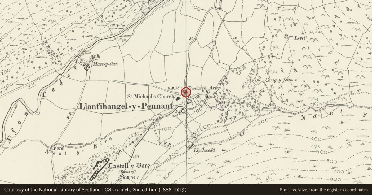
Slide toward Today to fade the historical sheet and see the modern map underneath.
David Rumsey Map Collection, Stanford LibrariesDavid Rumsey Map Collection, Stanford LibrariesDavid Rumsey Map Collection, Stanford LibrariesLlyfrgell Genedlaethol Cymru – The National Library of WalesDavid Rumsey Map Collection, Stanford Libraries
5 historical maps cover this location, the earliest the 1795 map "To Sir Watkin Williams-Wynn Bart ... the map of the six counties of North Wales is most humbly inscribed by his obedient humble servant" (Llyfrgell Genedlaethol Cymru – The National Library of Wales).
Historical maps covering this location
- 1795 · To Sir Watkin Williams-Wynn Bart ... the map of the six counties of North Wales is most… (Llyfrgell Genedlaethol Cymru – The National Library of Wales)
- 1883 · Watershed map England, Wales 3. (David Rumsey Map Collection, Stanford Libraries)
- 1896 · Sheet 7. Ordnance Survey of England and Wales. (David Rumsey Map Collection, Stanford Libraries)
- 1899 · 149 Barmouth (Hills) (David Rumsey Map Collection, Stanford Libraries)
- 1901 · Sheet 9 and 10. (David Rumsey Map Collection, Stanford Libraries)
Cadw's description
Location
The cottage stands beside the road, facing the E end of the chancel.
History
Built probably in the early C19. The tithe map for the parish of 1838 is not clear as to whether this actual building existed at that period.
Exterior
The building is constructed with local rubble stone, with flushed joints, and a slate roof. Two storeys, 3 window bays. The W front is approximately symmetrical, with a central door set in an open gabled timber porch. Small 4-paned horned sash windows to the ground floor, and similar 4-paned windows to the first floor under the eaves. Gable stacks with weather courses. Integral outshut under an extension of the roof at the rear.
Interior
Not accessible at the time of survey.
Reason for designation
Included as a good example of a typical small rural dwelling of W Meirionnydd, of group value with the Church of St Michael.
Nearby in the register
- Lychgate to the Church of St MichaelReligious, Ritual and Funeraryunder 1 mi
- Graveyard monument at the Church of St MichaelReligious, Ritual and Funeraryunder 1 mi
- Church of St MichaelReligious, Ritual and Funeraryunder 1 mi
- Churchyard wall at the Church of St MichaelReligious, Ritual and Funeraryunder 1 mi
Other entries of the same register within about three miles of this one, by straight line.