Cof Cymru: National Historic Assets of Wales · Wales
Graveyard monument at the Church of St Michael
Llanfihangel-y-Pennant, Gwynedd, Wales
A Grade II listed building in Llanfihangel-y-Pennant, Gwynedd, designated on 10 April 2000.
The record
- Designation
- Listed building, Grade II
- Broad class
- Religious, Ritual and Funerary
- Date of designation
- 10 April 2000
- Locality
- Llanfihangel-y-Pennant
- Community
- Llanfihangel-y-Pennant
- Unitary authority
- Gwynedd
- Country
- Wales
- Coordinates
- 52.66119, -3.96565
- Cadw reference
- 23165
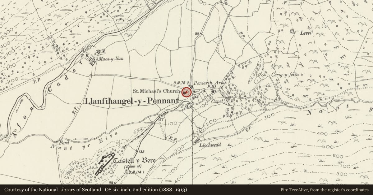
Slide toward Today to fade the historical sheet and see the modern map underneath.
David Rumsey Map Collection, Stanford LibrariesDavid Rumsey Map Collection, Stanford LibrariesDavid Rumsey Map Collection, Stanford LibrariesLlyfrgell Genedlaethol Cymru – The National Library of WalesDavid Rumsey Map Collection, Stanford Libraries
5 historical maps cover this location, the earliest the 1795 map "To Sir Watkin Williams-Wynn Bart ... the map of the six counties of North Wales is most humbly inscribed by his obedient humble servant" (Llyfrgell Genedlaethol Cymru – The National Library of Wales).
Historical maps covering this location
- 1795 · To Sir Watkin Williams-Wynn Bart ... the map of the six counties of North Wales is most… (Llyfrgell Genedlaethol Cymru – The National Library of Wales)
- 1883 · Watershed map England, Wales 3. (David Rumsey Map Collection, Stanford Libraries)
- 1896 · Sheet 7. Ordnance Survey of England and Wales. (David Rumsey Map Collection, Stanford Libraries)
- 1899 · 149 Barmouth (Hills) (David Rumsey Map Collection, Stanford Libraries)
- 1901 · Sheet 9 and 10. (David Rumsey Map Collection, Stanford Libraries)
Cadw's description
Location
The monument stands within the graveyard, at the SE corner of the chancel of the Church of St Michael.
History
Erected c1704 as a memorial for members of the Pughe family.
Exterior
A much-weathered slab of the local grey slate, supported on two composite drums of stone, and relating directly to the recessed moulded panel in the chancel E wall above. This reads [.. .... ] THISTO/MB:WERE:BURIED / GRACE PUGHE / ALIAS GRUIFFHS / VIGRLILL SEPTE/MBER21 AD 1679(?) / IGMS FB 23 1691 / AND MARY PUGH / JUNE 19 1704 REDE / MPTOR NOSTER PVMFT(?).
Reason for designation
Included as a graveyard monument of unusual form, with its associated inscription retaining part of a traditional Roman formula, rare for the period.
Nearby in the register
- Church of St MichaelReligious, Ritual and Funeraryunder 1 mi
- Lychgate to the Church of St MichaelReligious, Ritual and Funeraryunder 1 mi
- Churchyard wall at the Church of St MichaelReligious, Ritual and Funeraryunder 1 mi
- Cottage E of the Church of St MichaelDomesticunder 1 mi
Other entries of the same register within about three miles of this one, by straight line.