Cof Cymru: National Historic Assets of Wales · Wales
The Old Shop
Llanfihangel-y-Pennant, Gwynedd, Wales
A Grade II listed building in Abergynolwyn, Tywyn, Llanfihangel-y-Pennant, Gwynedd, designated on 10 April 2000.
The record
- Designation
- Listed building, Grade II
- Broad class
- Domestic
- Date of designation
- 10 April 2000
- Locality
- Abergynolwyn
- Town
- Tywyn
- Community
- Llanfihangel-y-Pennant
- Unitary authority
- Gwynedd
- Country
- Wales
- Coordinates
- 52.64384, -3.95666
- Cadw reference
- 23206
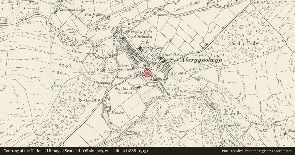
Slide toward Today to fade the historical sheet and see the modern map underneath.
David Rumsey Map Collection, Stanford LibrariesDavid Rumsey Map Collection, Stanford LibrariesDavid Rumsey Map Collection, Stanford LibrariesLlyfrgell Genedlaethol Cymru – The National Library of WalesDavid Rumsey Map Collection, Stanford Libraries
5 historical maps cover this location, the earliest the 1795 map "To Sir Watkin Williams-Wynn Bart ... the map of the six counties of North Wales is most humbly inscribed by his obedient humble servant" (Llyfrgell Genedlaethol Cymru – The National Library of Wales).
Historical maps covering this location
- 1795 · To Sir Watkin Williams-Wynn Bart ... the map of the six counties of North Wales is most… (Llyfrgell Genedlaethol Cymru – The National Library of Wales)
- 1883 · Watershed map England, Wales 3. (David Rumsey Map Collection, Stanford Libraries)
- 1896 · Sheet 7. Ordnance Survey of England and Wales. (David Rumsey Map Collection, Stanford Libraries)
- 1899 · 149 Barmouth (Hills) (David Rumsey Map Collection, Stanford Libraries)
- 1901 · Sheet 9 and 10. (David Rumsey Map Collection, Stanford Libraries)
Cadw's description
Location
The building is in the centre of the village, at the W end of a row of 3, facing across the B4405 towards the Railway Inn.
History
Built probably in the late C18 or early C19 as one house within a row of 3 dwellings related to the early expansion of the slate industry at Bryneglwys.
Exterior
Built of rubble stonework and whitewashed, with an old slate roof. Two storeys, a 3-window bay facade offset to the left, with an additional window at the right end of the ground floor. Boarded door with a 2-pane overlight, and deep stone lintel. Narrow 12-pane sash windows to the ground floor, the one right of the door replacing a former shopfront, the lintel of which remains. Nine-pane single sash window to the left. On the first floor, three 6-pane single hornless sash windows within deep reveals, one replaced with horns. Large gable end stack with weather courses. To the rear, a large lean-to under an extension of the roof, and with a boarded door and 3-pane modern window.
Interior
Not inspected at the time of the re-survey.
Reason for designation
Included as a well preserved village vernacular dwelling in the context of a small but expanding village, largely retaining its original external features.
Nearby in the register
- DolawelDomesticunder 1 mi
- 2 Heol Tan-y-brynDomesticunder 1 mi
- 3 Heol Tan-y-brynDomesticunder 1 mi
- 4 Heol Tan-y-brynDomesticunder 1 mi
Other entries of the same register within about three miles of this one, by straight line.