Cof Cymru: National Historic Assets of Wales · Wales
Ruins of Old Kinmel, in the grounds of Kinmel Park
Abergele, Conwy, Wales
A Grade II listed building in Kinmel, Abergele, Conwy, designated on 6 October 1970.
The record
- Designation
- Listed building, Grade II
- Broad class
- Domestic
- Date of designation
- 6 October 1970
- Locality
- Kinmel
- Town
- Abergele
- Community
- Abergele
- Unitary authority
- Conwy
- Country
- Wales
- Coordinates
- 53.25879, -3.52370
- Cadw reference
- 230
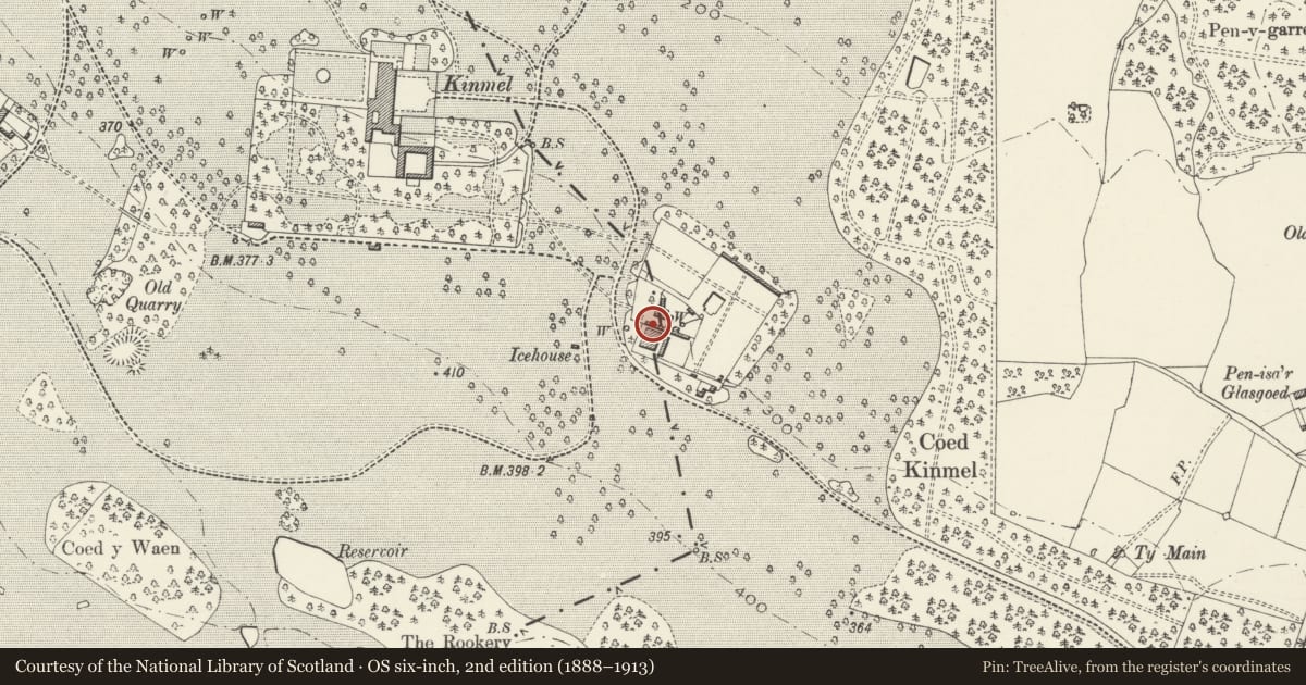
Slide toward Today to fade the historical sheet and see the modern map underneath.
David Rumsey Map Collection, Stanford LibrariesNational Library of ScotlandDavid Rumsey Map Collection, Stanford LibrariesLlyfrgell Genedlaethol Cymru – The National Library of WalesDavid Rumsey Map Collection, Stanford Libraries
5 historical maps cover this location, the earliest the 1795 map "To Sir Watkin Williams-Wynn Bart ... the map of the six counties of North Wales is most humbly inscribed by his obedient humble servant" (Llyfrgell Genedlaethol Cymru – The National Library of Wales).
Historical maps covering this location
- 1795 · To Sir Watkin Williams-Wynn Bart ... the map of the six counties of North Wales is most… (Llyfrgell Genedlaethol Cymru – The National Library of Wales)
- 1830 · V.3:11-15:XV. Britisches Reich. A. Kon: England. b. Frstenthum Wales: Shire: 37-40 (David Rumsey Map Collection, Stanford Libraries)
- 1883 · Watershed map England, Wales 3. (David Rumsey Map Collection, Stanford Libraries)
- 1901 · Sheet 9 and 10. (David Rumsey Map Collection, Stanford Libraries)
- 1963 · Map No. 35 - Local Government Commission for Wales : [Definitive maps showing proposed… (National Library of Scotland)
Cadw's description
Location
The ruins stand forlornly in the former garden enclosure attached to the SW side of the kitchen gardens of Kinmel.
History
Probably built by the Holland family as the initials DH and L are recorded, together with the date 1615 on an outer doorcase. It probably commemorated the marriage of David Holland II and Dorothy Lloyd, by which union the property came to the Hollands.
Exterior
The ruins are those of a mid-C17 Jacobean style house, which was used for staff accommodation after the family was accommodated in a new house further W by Samuel Wyatt from c1791. In 1970 it was described as originally 2 storeys and attics, 3 windows and 3 dormers, and a two-storeyed gabled porch. Stone mullioned and transomed windows. Now the ruins are covered with vegetation.
Reason for designation
Included for its C17 origin and for its important historic associations with the present Grade 1 Kinmel.
Nearby in the register
- Kitchen Garden Walls SE of KinmelGardens, Parks and Urban Spacesunder 1 mi
- Garden HouseDomesticunder 1 mi
- Icehouse to the NW of the Kitchen Garden at KinmelDomesticunder 1 mi
- Gates and Gate Piers at the E end of the Broad WalkGardens, Parks and Urban Spacesunder 1 mi
Other entries of the same register within about three miles of this one, by straight line.