Cof Cymru: National Historic Assets of Wales · Wales
Kitchen Garden Walls SE of Kinmel
Abergele, Conwy, Wales
A Grade II listed building in Kinmel, Abergele, Conwy, designated on 5 August 1997.
The record
- Designation
- Listed building, Grade II
- Broad class
- Gardens, Parks and Urban Spaces
- Date of designation
- 5 August 1997
- Locality
- Kinmel
- Town
- Abergele
- Community
- Abergele
- Unitary authority
- Conwy
- Country
- Wales
- Coordinates
- 53.25925, -3.52364
- Cadw reference
- 18682
Slide toward Today to fade the historical sheet and see the modern map underneath.
David Rumsey Map Collection, Stanford LibrariesNational Library of ScotlandDavid Rumsey Map Collection, Stanford LibrariesLlyfrgell Genedlaethol Cymru – The National Library of WalesDavid Rumsey Map Collection, Stanford Libraries
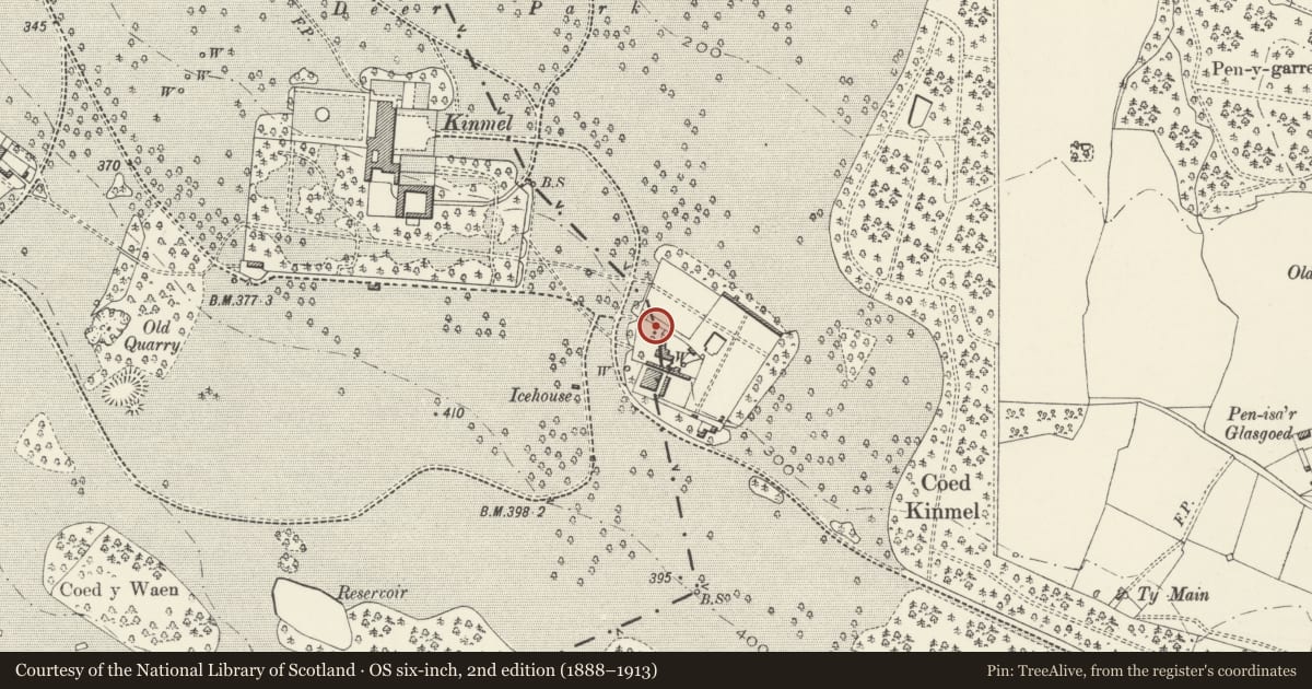
5 historical maps cover this location, the earliest the 1795 map "To Sir Watkin Williams-Wynn Bart ... the map of the six counties of North Wales is most humbly inscribed by his obedient humble servant" (Llyfrgell Genedlaethol Cymru – The National Library of Wales).
Historical maps covering this location
- 1795 · To Sir Watkin Williams-Wynn Bart ... the map of the six counties of North Wales is most… (Llyfrgell Genedlaethol Cymru – The National Library of Wales)
- 1830 · V.3:11-15:XV. Britisches Reich. A. Kon: England. b. Frstenthum Wales: Shire: 37-40 (David Rumsey Map Collection, Stanford Libraries)
- 1883 · Watershed map England, Wales 3. (David Rumsey Map Collection, Stanford Libraries)
- 1901 · Sheet 9 and 10. (David Rumsey Map Collection, Stanford Libraries)
- 1963 · Map No. 35 - Local Government Commission for Wales : [Definitive maps showing proposed… (National Library of Scotland)
Cadw's description
Location
The kitchen garden stands aproximately 300m SE of the service end of Kinmel, and beyond the driveway to Garden House.
History
The kitchen garden was laid out originally in relationship to Old Kinmel, forming part of its working gardens. It was apparently remodelled c1870 in relationship to the house in the present position, thus is likely to date from the late C19.
Exterior
Brick walls approximately 5m high with a flush weathered stone coping on the N, E and S sides, the S side, facing Old Kinmel being of stone. They form a rectangular enclosure approximately 80 x 70m, the NE side rather longer, and have modest gates at the centre of each side.
Reason for designation
Included as a surviving part of the important landscaped park at Kinmel.
Nearby in the register
- Ruins of Old Kinmel, in the grounds of Kinmel ParkDomesticunder 1 mi
- Icehouse to the NW of the Kitchen Garden at KinmelDomesticunder 1 mi
- Garden HouseDomesticunder 1 mi
- Gates and Gate Piers at the E end of the Broad WalkGardens, Parks and Urban Spacesunder 1 mi
Other entries of the same register within about three miles of this one, by straight line.