Cof Cymru: National Historic Assets of Wales · Wales
Former Post Office
Llanarth, Monmouthshire, Wales
A Grade II listed building in Llanarth, Raglan, Monmouthshire, designated on 15 March 2000.
The record
- Designation
- Listed building, Grade II
- Broad class
- Commercial
- Date of designation
- 15 March 2000
- Locality
- Llanarth
- Town
- Raglan
- Community
- Llanarth
- Unitary authority
- Monmouthshire
- Country
- Wales
- Coordinates
- 51.79467, -2.90606
- Cadw reference
- 22992
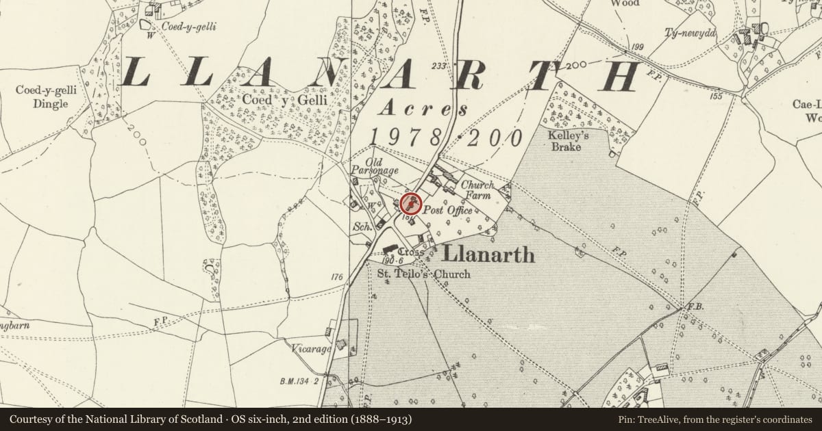
Slide toward Today to fade the historical sheet and see the modern map underneath.
David Rumsey Map Collection, Stanford LibrariesDavid Rumsey Map Collection, Stanford LibrariesDavid Rumsey Map Collection, Stanford LibrariesDavid Rumsey Map Collection, Stanford LibrariesDavid Rumsey Map Collection, Stanford Libraries
5 historical maps cover this location, the earliest the 1608 map "(13) Cambriae Typus." (David Rumsey Map Collection, Stanford Libraries).
Historical maps covering this location
- 1608 · (13) Cambriae Typus. (David Rumsey Map Collection, Stanford Libraries)
- 1636 · Cornubia : Devonia, Somersetus, Dorcestria, Wiltonia, Glocestria ... (David Rumsey Map Collection, Stanford Libraries)
- 1830 · V.3:11-15:XV.Britisches Reich. A. Kon: England. a. England ab sich: Shire:15-17, 33 (David Rumsey Map Collection, Stanford Libraries)
- 1895 · Sheet 11. Ordnance Survey of England and Wales. (David Rumsey Map Collection, Stanford Libraries)
- 1901 · Sheet 14. (David Rumsey Map Collection, Stanford Libraries)
Cadw's description
Location
Situated in centre of Llanarth village on E side of road.
History
Former village post office and shop, closed 1990s. Probably early to mid C19.
Exterior
Former post office, colourwashed stucco lined as ashlar with plain tile roof and brick end stacks. Two storeys and attic, 3-window range. Two gabled dormers with small-paned windows, 3 first floor small-paned casement pairs with cambered heads and ground floor small 12-pane sash left, door centre and C19 canted bay right. Windows are small with cambered heads, bay is not quite aligned with window above, has 1-3-1 lights with top lights and hipped slate roof. Door is boarded in gabled porch on 2 big scrolled brackets, 2 iron columns added for support. Inset GR post-box to left of door. S end wall is painted brick. Rear wing with slate roof and tall brick E stack.
Outbuilding to S, painted rubble stone with plain tile roof. Timber lintel of blocked opening to left, then straight joint, then window and door with brick heads. Small catslide eaves-breaking loft light over door.
Reason for designation
Listed as a well-preserved early-mid C19 house in village centre.
Nearby in the register
- Telephone Call-box (01873 840412)Communicationsunder 1 mi
- Bryn TegDomesticunder 1 mi
- Church of Saint TeiloReligious, Ritual and Funeraryunder 1 mi
- Churchyard Cross in Llanarth churchyardReligious, Ritual and Funeraryunder 1 mi
Other entries of the same register within about three miles of this one, by straight line.