Cof Cymru: National Historic Assets of Wales · Wales
Lock and overbridge at Neath Canal Depot
Tonna, Neath Port Talbot, Wales
A Grade II listed building in Neath Canal Depot, Tonna, Neath Port Talbot, designated on 25 February 2000.
The record
- Designation
- Listed building, Grade II
- Broad class
- Transport
- Date of designation
- 25 February 2000
- Locality
- Neath Canal Depot
- Community
- Tonna
- Unitary authority
- Neath Port Talbot
- Country
- Wales
- Coordinates
- 51.67431, -3.78123
- Cadw reference
- 22872
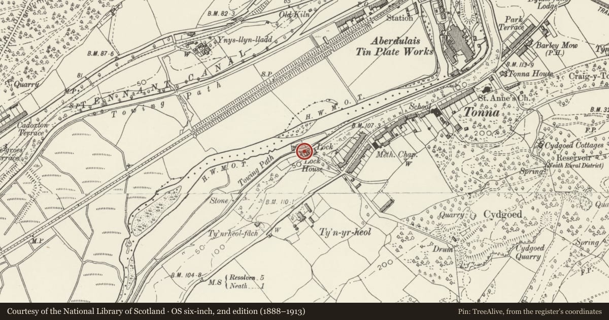
Slide toward Today to fade the historical sheet and see the modern map underneath.
David Rumsey Map Collection, Stanford LibrariesDavid Rumsey Map Collection, Stanford LibrariesDavid Rumsey Map Collection, Stanford LibrariesDavid Rumsey Map Collection, Stanford LibrariesDavid Rumsey Map Collection, Stanford Libraries
5 historical maps cover this location, the earliest the 1636 map "Cornubia : Devonia, Somersetus, Dorcestria, Wiltonia, Glocestria ..." (David Rumsey Map Collection, Stanford Libraries).
Historical maps covering this location
- 1636 · Cornubia : Devonia, Somersetus, Dorcestria, Wiltonia, Glocestria ... (David Rumsey Map Collection, Stanford Libraries)
- 1637 · The fourth table of England. Cornub. Devonia, Somerset etc. (David Rumsey Map Collection, Stanford Libraries)
- 1865 · England and Wales. England No. 6. (David Rumsey Map Collection, Stanford Libraries)
- 1891 · Sheet 10. Ordnance Survey of England and Wales. . (David Rumsey Map Collection, Stanford Libraries)
- 1897 · 247 Swansea (Hills) (David Rumsey Map Collection, Stanford Libraries)
Cadw's description
Location
On the N side of Lock House at the foot of Lock Hill.
History
The Neath Canal was begun in 1791 and opened in 1794. Traffic ceased in 1921. The lock is an original feature of the canal.
Exterior
The lock chamber is built with coursed stone walls and flat stone copings. At the E end is a concave brick wall with integral sluice, heightened in order to dam the water further E. At the W end are the partial remains of 2 lock gates. Over the W end of the lock is a renewed bridge with stone parapet and concrete decking.
Reason for designation
Listed for its industrial archaeological interest as an integral component of the most complete depot of any of the South Wales canals.
Nearby in the register
- Stable at Neath Canal DepotTransportunder 1 mi
- Wood seasoning shed & saw pit at Neath Canal DepotTransportunder 1 mi
- Workshop, store and smithy at Neath Canal DepotTransportunder 1 mi
- Lock HouseDomesticunder 1 mi
Other entries of the same register within about three miles of this one, by straight line.