Cof Cymru: National Historic Assets of Wales · Wales
Workshop, store and smithy at Neath Canal Depot
Tonna, Neath Port Talbot, Wales
A Grade II listed building in Neath Canal Depot, Tonna, Neath Port Talbot, designated on 25 February 2000.
The record
- Designation
- Listed building, Grade II
- Broad class
- Transport
- Date of designation
- 25 February 2000
- Locality
- Neath Canal Depot
- Community
- Tonna
- Unitary authority
- Neath Port Talbot
- Country
- Wales
- Coordinates
- 51.67440, -3.78156
- Cadw reference
- 22866
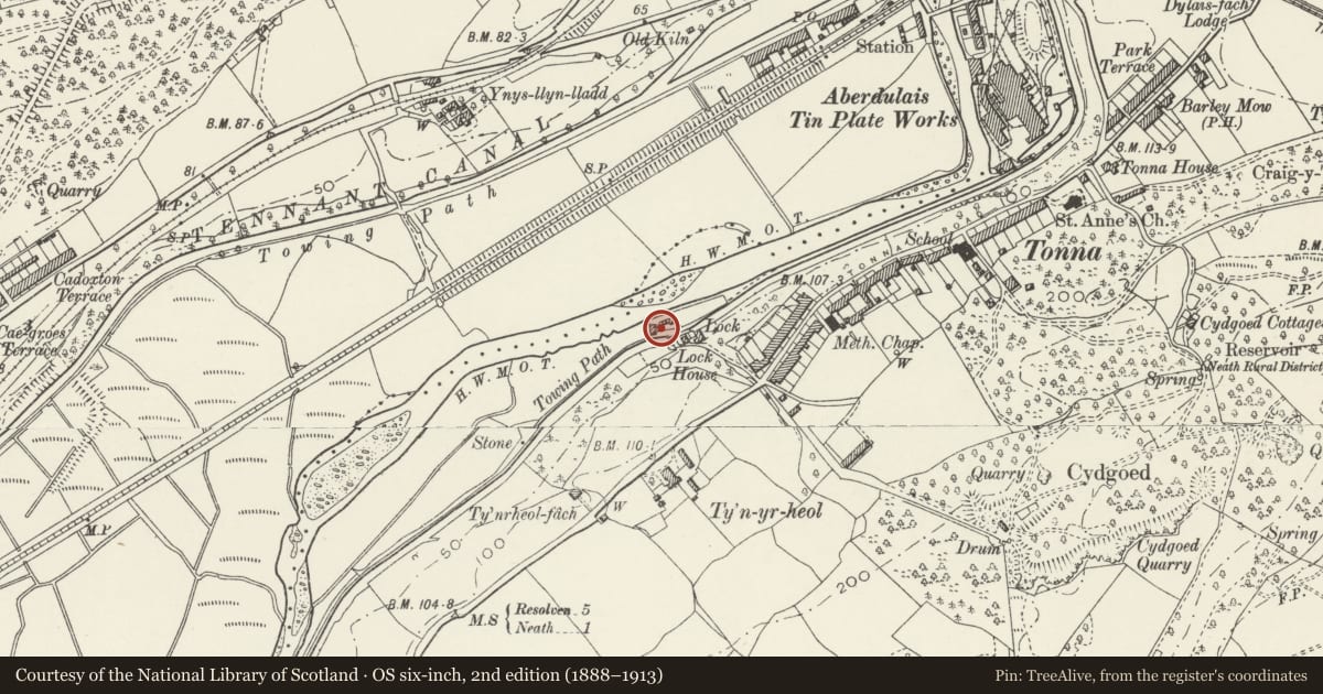
Slide toward Today to fade the historical sheet and see the modern map underneath.
David Rumsey Map Collection, Stanford LibrariesDavid Rumsey Map Collection, Stanford LibrariesDavid Rumsey Map Collection, Stanford LibrariesDavid Rumsey Map Collection, Stanford LibrariesDavid Rumsey Map Collection, Stanford Libraries
5 historical maps cover this location, the earliest the 1636 map "Cornubia : Devonia, Somersetus, Dorcestria, Wiltonia, Glocestria ..." (David Rumsey Map Collection, Stanford Libraries).
Historical maps covering this location
- 1636 · Cornubia : Devonia, Somersetus, Dorcestria, Wiltonia, Glocestria ... (David Rumsey Map Collection, Stanford Libraries)
- 1637 · The fourth table of England. Cornub. Devonia, Somerset etc. (David Rumsey Map Collection, Stanford Libraries)
- 1865 · England and Wales. England No. 6. (David Rumsey Map Collection, Stanford Libraries)
- 1891 · Sheet 10. Ordnance Survey of England and Wales. . (David Rumsey Map Collection, Stanford Libraries)
- 1897 · 247 Swansea (Hills) (David Rumsey Map Collection, Stanford Libraries)
Cadw's description
Location
On the N side of the Neath Canal almost opposite Lock House and facing a small yard on the E side.
History
The Neath Canal was begun in 1791 and opened in 1794. Traffic ceased in 1921. The workshop is probably late C18 or early C19 and is shown on the Llantwit-Juxta-Neath Tithe map. The smithy was added in the third quarter of the C19 and is first shown on the 1870s Ordnance Survey, on which a projecting storage are is shown in front of the workshop.
Exterior
A 2-unit single-storey structure comprising a workshop on the S side of snecked stone and smithy on the N side of rubble stone, placed end to end. A butt joint between the two is clearly visible in the W elevation, but the E elevation is a late C20 rebuild in random rubble. Both units have renewed slate roofs, with skylights to the W slope. Projecting in front of the workshop on the E side facing the yard is a square open-sided canopy with rubble piers and pyramidal slate roof which is mostly late C20 rebuild. It was probably used for storing timber. Facing the yard the workshop has 2 doorways, the smithy a single segmental-headed doorway, all rebuilt and with boarded doors. A blocked segmental-headed window is in the N gable end of the smithy. The S gable end has a single loft opening under a lintel now boarded up. The rear wall has a blocked window to the R of the workshop, its original head now missing and rebuilt with random rubble. The smithy has 2 short square stone stacks rising from the eaves.
Interior
The roofs are carried on softwood trusses. A dividing wall separates the 2 units. The smithy at the N end is at a lower level.
Reason for designation
Listed, notwisthstanding reconstruction, for its industrial archaeological interest as an integral component of the most complete depot of any of the South Wales canals.
Nearby in the register
- Lock and overbridge at Neath Canal DepotTransportunder 1 mi
- Wood seasoning shed & saw pit at Neath Canal DepotTransportunder 1 mi
- Stable at Neath Canal DepotTransportunder 1 mi
- Lock HouseDomesticunder 1 mi
Other entries of the same register within about three miles of this one, by straight line.