Cof Cymru: National Historic Assets of Wales · Wales
Penlan-fach bridge
Tonna, Neath Port Talbot, Wales
A Grade II listed building in Wenallt, Tonna, Neath Port Talbot, designated on 25 February 2000.
The record
- Designation
- Listed building, Grade II
- Broad class
- Transport
- Date of designation
- 25 February 2000
- Locality
- Wenallt
- Community
- Tonna
- Unitary authority
- Neath Port Talbot
- Country
- Wales
- Coordinates
- 51.67513, -3.76555
- Cadw reference
- 22859
Slide toward Today to fade the historical sheet and see the modern map underneath.
David Rumsey Map Collection, Stanford LibrariesDavid Rumsey Map Collection, Stanford LibrariesDavid Rumsey Map Collection, Stanford LibrariesDavid Rumsey Map Collection, Stanford LibrariesDavid Rumsey Map Collection, Stanford Libraries
5 historical maps cover this location, the earliest the 1636 map "Cornubia : Devonia, Somersetus, Dorcestria, Wiltonia, Glocestria ..." (David Rumsey Map Collection, Stanford Libraries).
Historical maps covering this location
- 1636 · Cornubia : Devonia, Somersetus, Dorcestria, Wiltonia, Glocestria ... (David Rumsey Map Collection, Stanford Libraries)
- 1637 · The fourth table of England. Cornub. Devonia, Somerset etc. (David Rumsey Map Collection, Stanford Libraries)
- 1830 · V.3:11-15:XV. Britisches Reich. A. Kon: England. b. Frstenthum Wales: Shire: 37-40 (David Rumsey Map Collection, Stanford Libraries)
- 1865 · England and Wales. England No. 6. (David Rumsey Map Collection, Stanford Libraries)
- 1891 · Sheet 10. Ordnance Survey of England and Wales. . (David Rumsey Map Collection, Stanford Libraries)
Cadw's description
Location
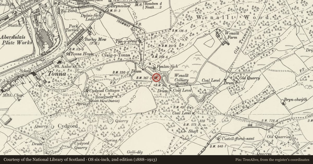
On an unclassified road to Wenallt Farm approximately 1km ESE of Tonna church spanning a stream and the former Glyncorrwg Mineral Railway.
History
A bridge built 1839-42 over an inclined section of the Glyncorrwg Mineral Railway, engineered by William Kirkhouse, who may therefore also have built the overbridge.
Exterior
A single-carriageway coursed rubble-stone bridge with a single round arch with dressed arch ring. The imposts have fragments of former pilasters on the N side. The abutments are stepped, and are flanked by later abutments discernible by straight joints. There is no parapet.
Reason for designation
Listed for its industrial archaeological interest as a well-detailed early bridge associated with the Glyncorrwg Mineral Railway.
Nearby in the register
- Church of St AnneReligious, Ritual and Funeraryunder 1 mi
- 12 Dulais Fach RoadDomesticunder 1 mi
- Dulais FachDomesticunder 1 mi
- Dulais Isaf HouseDomesticunder 1 mi
Other entries of the same register within about three miles of this one, by straight line.