Cof Cymru: National Historic Assets of Wales · Wales
Lychgate at church of St Catwg
Pentyrch, Cardiff, Wales
A Grade II listed building in Pentyrch, Cardiff, designated on 31 January 2000.
The record
- Designation
- Listed building, Grade II
- Broad class
- Religious, Ritual and Funerary
- Date of designation
- 31 January 2000
- Locality
- Pentyrch
- Community
- Pentyrch
- Unitary authority
- Cardiff
- Country
- Wales
- Coordinates
- 51.52738, -3.29362
- Cadw reference
- 22815
Slide toward Today to fade the historical sheet and see the modern map underneath.
David Rumsey Map Collection, Stanford LibrariesDavid Rumsey Map Collection, Stanford LibrariesDavid Rumsey Map Collection, Stanford LibrariesDavid Rumsey Map Collection, Stanford LibrariesDavid Rumsey Map Collection, Stanford Libraries
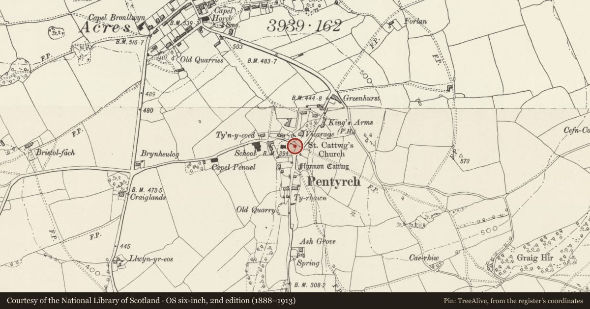
5 historical maps cover this location, the earliest the 1636 map "Cornubia : Devonia, Somersetus, Dorcestria, Wiltonia, Glocestria ..." (David Rumsey Map Collection, Stanford Libraries).
Historical maps covering this location
- 1636 · Cornubia : Devonia, Somersetus, Dorcestria, Wiltonia, Glocestria ... (David Rumsey Map Collection, Stanford Libraries)
- 1637 · The fourth table of England. Cornub. Devonia, Somerset etc. (David Rumsey Map Collection, Stanford Libraries)
- 1865 · England and Wales. England No. 6. (David Rumsey Map Collection, Stanford Libraries)
- 1898 · 263 Cardiff (Hills) (David Rumsey Map Collection, Stanford Libraries)
- 1913 · Sheet 110. Cardiff & Mouth of the Severn. (David Rumsey Map Collection, Stanford Libraries)
Cadw's description
Location
Forming the E entrance to the churchyard on Church Road.
History
Plaque records 'Gift of Thomas Henry Sparks JP 1928-1955' who was reputedly also the designer; he contributed to the local fashion for Tudor-style black and white buildings.
Exterior
Lychgate with exceptionally steep-pitched roof and prominent swept-out eaves with almost dog-leg profile. Of timber construction on a coursed ashlar plinth with Welsh slate roof surmounted by a large cross. 4 bays deep with timber arcade. The internal arch is wide and minimally pointed with struts rising to apex, the overhang of the gable supported by brackets; double timber gates with braces.
Reason for designation
Included for group value with the church, also The King's Arms.
Nearby in the register
- Church of St CatwgReligious, Ritual and Funeraryunder 1 mi
- The King's Arms Public HouseRecreationalunder 1 mi
- Former Penuel ChapelReligious, Ritual and Funeraryunder 1 mi
- Horeb Presbyterian Church including attached hall to rightReligious, Ritual and Funeraryunder 1 mi
Other entries of the same register within about three miles of this one, by straight line.