Cof Cymru: National Historic Assets of Wales · Wales
4 Glendower Street
Monmouth, Monmouthshire, Wales
A Grade II listed building in Monmouth, Monmouthshire, designated on 15 August 1974.
The record
- Designation
- Listed building, Grade II
- Broad class
- Domestic
- Date of designation
- 15 August 1974
- Locality
- Monmouth
- Town
- Monmouth
- Community
- Monmouth
- Unitary authority
- Monmouthshire
- Country
- Wales
- Coordinates
- 51.81133, -2.71463
- Cadw reference
- 2270
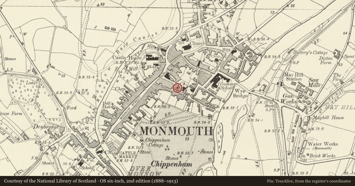
Slide toward Today to fade the historical sheet and see the modern map underneath.
David Rumsey Map Collection, Stanford LibrariesDavid Rumsey Map Collection, Stanford LibrariesDavid Rumsey Map Collection, Stanford LibrariesDavid Rumsey Map Collection, Stanford LibrariesDavid Rumsey Map Collection, Stanford Libraries
5 historical maps cover this location, the earliest the 1636 map "Cornubia : Devonia, Somersetus, Dorcestria, Wiltonia, Glocestria ..." (David Rumsey Map Collection, Stanford Libraries).
Historical maps covering this location
- 1636 · Cornubia : Devonia, Somersetus, Dorcestria, Wiltonia, Glocestria ... (David Rumsey Map Collection, Stanford Libraries)
- 1830 · V.3:11-15:XV.Britisches Reich. A. Kon: England. a. England ab sich: Shire:15-17, 33 (David Rumsey Map Collection, Stanford Libraries)
- 1895 · Sheet 11. Ordnance Survey of England and Wales. (David Rumsey Map Collection, Stanford Libraries)
- 1896 · 233 Monmouth (Hills) (David Rumsey Map Collection, Stanford Libraries)
- 1901 · Sheet 14. (David Rumsey Map Collection, Stanford Libraries)
Cadw's description
Location
An important residential street to the south of the town centre of Monmouth.
History
Probably early C19, but very close to 1800.
Interior
Interior not seen at resurvey. Contemporary joinery and staircase with stick balusters and turned newel posts.
Reason for designation
Included for its special architectural interest as one of a pair of well preserved c1800 houses with strong group value in Glendower Street.
Nearby in the register
- 6 Glendower StreetNo class recordedunder 1 mi
- 8 Glendower StreetDomesticunder 1 mi
- Nelson RoomsHealth and Welfareunder 1 mi
- 10 Glendower StreetNo class recordedunder 1 mi
Other entries of the same register within about three miles of this one, by straight line.