Cof Cymru: National Historic Assets of Wales · Wales
Sheds to the rear of the Almshouses, including associated Gates and Gatepiers
Llanrhaeadr-Yng-Nghinmeirch, Denbighshire, Wales
A Grade II listed building in Llanrhaeadr, Llanrhaeadr-Yng-Nghinmeirch, Denbighshire, designated on 29 November 1999.
The record
- Designation
- Listed building, Grade II
- Broad class
- Agriculture and Subsistence
- Date of designation
- 29 November 1999
- Locality
- Llanrhaeadr
- Community
- Llanrhaeadr-Yng-Nghinmeirch
- Unitary authority
- Denbighshire
- Country
- Wales
- Coordinates
- 53.15960, -3.37596
- Cadw reference
- 22681
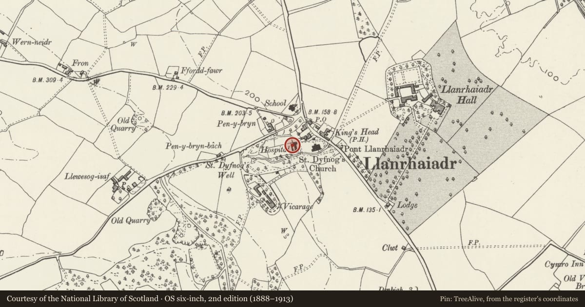
Slide toward Today to fade the historical sheet and see the modern map underneath.
David Rumsey Map Collection, Stanford LibrariesLlyfrgell Genedlaethol Cymru – The National Library of WalesDavid Rumsey Map Collection, Stanford LibrariesDavid Rumsey Map Collection, Stanford LibrariesDavid Rumsey Map Collection, Stanford Libraries
5 historical maps cover this location, the earliest the 1608 map "(13) Cambriae Typus." (David Rumsey Map Collection, Stanford Libraries).
Historical maps covering this location
- 1608 · (13) Cambriae Typus. (David Rumsey Map Collection, Stanford Libraries)
- 1795 · To Sir Watkin Williams-Wynn Bart ... the map of the six counties of North Wales is most… (Llyfrgell Genedlaethol Cymru – The National Library of Wales)
- 1830 · V.3:11-15:XV. Britisches Reich. A. Kon: England. b. Frstenthum Wales: Shire: 37-40 (David Rumsey Map Collection, Stanford Libraries)
- 1883 · Watershed map England, Wales 3. (David Rumsey Map Collection, Stanford Libraries)
- 1901 · Sheet 9 and 10. (David Rumsey Map Collection, Stanford Libraries)
Cadw's description
Location
Located immediately to the rear of the almshouses.
History
Early C19 sheds with incorporated Ty Bach, erected to serve the almshouse complex of 1729, probably during repairs and alterations carried out by Lord Bagot of Blifthfield in 1820.
Exterior
Two single storey shed blocks joined centrally by a pair of contemporary gates and gatepiers. The shed blocks are of whitened rubble construction with mono-pitch slate roofs. Each has 4 plain boarded entrances to the front and a segmentally-arched stone Ty Bach entrance to the L and R ends of the L and R blocks respectively. Between the two are a pair of plain stone gatepiers with contemporary wrought iron half-gates; these have scrolled ends, serpentine top rail and plain railings. The gates lead to the rear gardens belonging to the almshouses.
Reason for designation
Listed for its special interest as an early C19 shed range associated with the Llanrhaeadr almshouses.
Group value with other listed items at the almshouses and St Dyfnog's Church.
Nearby in the register
- No.2 The AlmshousesHealth and Welfareunder 1 mi
- No.1 The AlmshousesDomesticunder 1 mi
- No.3 The AlmshousesHealth and Welfareunder 1 mi
- No.4 The AlmshousesHealth and Welfareunder 1 mi
Other entries of the same register within about three miles of this one, by straight line.