Cof Cymru: National Historic Assets of Wales · Wales
No.3 The Almshouses
Llanrhaeadr-Yng-Nghinmeirch, Denbighshire, Wales
A Grade II listed building in Llanrhaeadr, Denbigh, Llanrhaeadr-Yng-Nghinmeirch, Denbighshire, designated on 19 July 1966.
The record
- Designation
- Listed building, Grade II
- Broad class
- Health and Welfare
- Date of designation
- 19 July 1966
- Locality
- Llanrhaeadr
- Town
- Denbigh
- Community
- Llanrhaeadr-Yng-Nghinmeirch
- Unitary authority
- Denbighshire
- Country
- Wales
- Coordinates
- 53.15952, -3.37580
- Cadw reference
- 22679
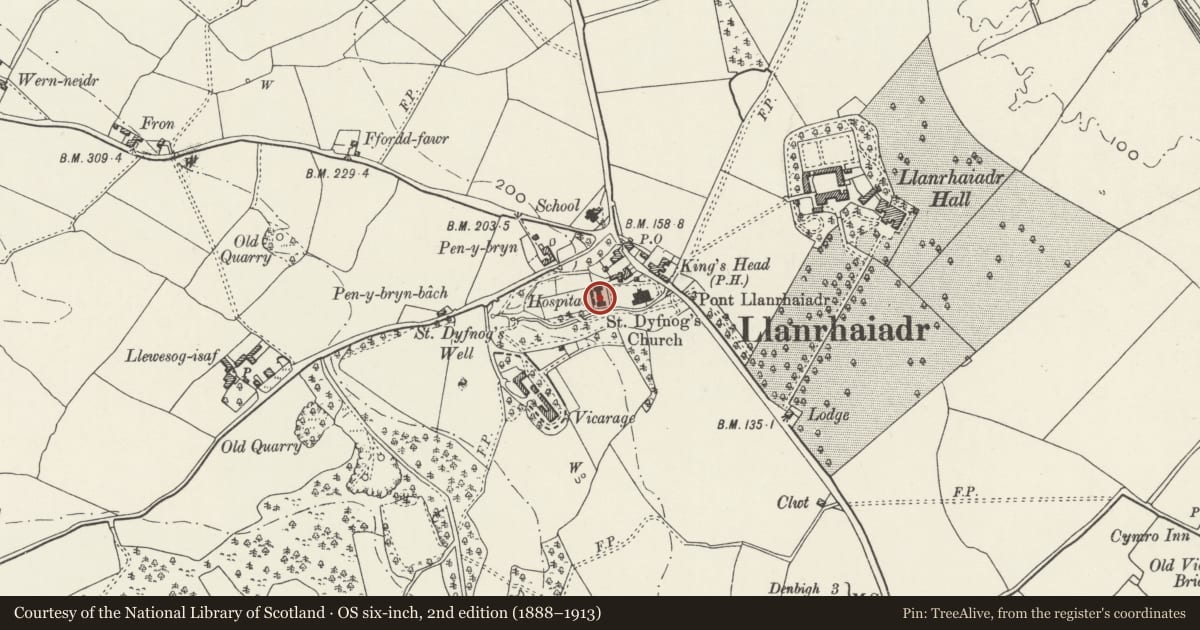
Slide toward Today to fade the historical sheet and see the modern map underneath.
David Rumsey Map Collection, Stanford LibrariesLlyfrgell Genedlaethol Cymru – The National Library of WalesDavid Rumsey Map Collection, Stanford LibrariesDavid Rumsey Map Collection, Stanford LibrariesDavid Rumsey Map Collection, Stanford Libraries
5 historical maps cover this location, the earliest the 1608 map "(13) Cambriae Typus." (David Rumsey Map Collection, Stanford Libraries).
Historical maps covering this location
- 1608 · (13) Cambriae Typus. (David Rumsey Map Collection, Stanford Libraries)
- 1795 · To Sir Watkin Williams-Wynn Bart ... the map of the six counties of North Wales is most… (Llyfrgell Genedlaethol Cymru – The National Library of Wales)
- 1830 · V.3:11-15:XV. Britisches Reich. A. Kon: England. b. Frstenthum Wales: Shire: 37-40 (David Rumsey Map Collection, Stanford Libraries)
- 1883 · Watershed map England, Wales 3. (David Rumsey Map Collection, Stanford Libraries)
- 1901 · Sheet 9 and 10. (David Rumsey Map Collection, Stanford Libraries)
Cadw's description
Location
Adjoining the churchyard at the W end.
History
The Llanrhaeadr almshouses were erected by Jane, widow of Maurice Jones of Ddol and Llanrhaeadr hall in 1729. The foundation provided for eight houses and gardens for poor elderly folk of the parish. The complex was conceived as an H-shaped block with a central gabled porch giving access via a covered passage to a large walled garden at the rear. The eight units were originally of one room each and had shared chimneys; their entrances were from the passage, rear and sides, thereby ensuring that the facade appeared as a unified whole. In 1820 the great great nephew of the foundress, William, second Baron Bagot of Blifthfield in Staffordshire, and Pool Park and Bachymbyd in Denbighshire, repaired the almshouses and made minor alterations, notably to the chimneys and openings. The complex was further restored in 1963 and is currently divided into four units.
Reason for designation
Listed for its special interest as a second-quarter C18 almshouse complex with sensitive C19 alterations retaining particularly good external character.
Group value with other listed items at the Almshouses and St Dyfnog's Church.
Nearby in the register
- No.4 The AlmshousesHealth and Welfareunder 1 mi
- No.2 The AlmshousesHealth and Welfareunder 1 mi
- Sheds to the rear of the Almshouses, including associated Gates and GatepiersAgriculture and Subsistenceunder 1 mi
- Gates, Gatepiers and Forecourt Walls, including associated Arch and Bridge to S, at the AlmshousesGardens, Parks and Urban Spacesunder 1 mi
Other entries of the same register within about three miles of this one, by straight line.