Cof Cymru: National Historic Assets of Wales · Wales
Monmouth Police Station
Monmouth, Monmouthshire, Wales
A Grade II listed building in Monmouth, Monmouthshire, designated on 15 August 1974.
The record
- Designation
- Listed building, Grade II
- Broad class
- Domestic
- Date of designation
- 15 August 1974
- Locality
- Monmouth
- Town
- Monmouth
- Community
- Monmouth
- Unitary authority
- Monmouthshire
- Country
- Wales
- Coordinates
- 51.81090, -2.71391
- Cadw reference
- 2268
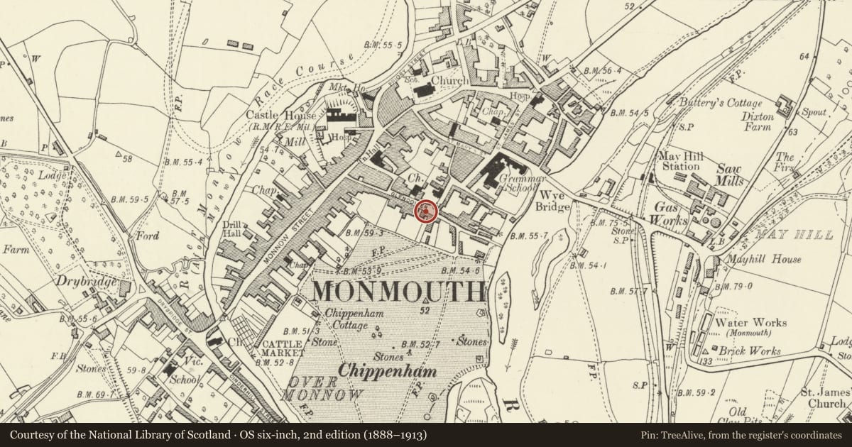
Slide toward Today to fade the historical sheet and see the modern map underneath.
David Rumsey Map Collection, Stanford LibrariesDavid Rumsey Map Collection, Stanford LibrariesDavid Rumsey Map Collection, Stanford LibrariesDavid Rumsey Map Collection, Stanford LibrariesDavid Rumsey Map Collection, Stanford Libraries
5 historical maps cover this location, the earliest the 1636 map "Cornubia : Devonia, Somersetus, Dorcestria, Wiltonia, Glocestria ..." (David Rumsey Map Collection, Stanford Libraries).
Historical maps covering this location
- 1636 · Cornubia : Devonia, Somersetus, Dorcestria, Wiltonia, Glocestria ... (David Rumsey Map Collection, Stanford Libraries)
- 1830 · V.3:11-15:XV.Britisches Reich. A. Kon: England. a. England ab sich: Shire:15-17, 33 (David Rumsey Map Collection, Stanford Libraries)
- 1895 · Sheet 11. Ordnance Survey of England and Wales. (David Rumsey Map Collection, Stanford Libraries)
- 1896 · 233 Monmouth (Hills) (David Rumsey Map Collection, Stanford Libraries)
- 1901 · Sheet 14. (David Rumsey Map Collection, Stanford Libraries)
Cadw's description
Location
An important residential street to the south of the town centre of Monmouth.
History
Built as a house in the early to mid C19 but became a police station in the late C19, probably at the formation of Monmouthshire County Council in 1888 and this was probably when the lower range was added to the main house. The 1881 O.S. map shows the police station as being in Agincourt Street.
Exterior
Rendered and painted throughout, with Welsh slate roofs. Double depth plan with entry to the left for the Superintendent's house and right for the station. Three storeys, four windows to the house, 1 + 3. Ground floor windows and doorway on left side in semi-circular headed recesses, panel door and fanlight, 6 over 6 pane ashes with radiating heads. Impost band, band between floors. First floor windows tall 6 over 6 pane sashes, 3 over 6 above. Hipped roof with rendered stack on ridge to left. Two storey extension on right with bands running through (reported as single storey in 1974). Three semi-circular headed W + W + D on ground floor as before and 6 over 6 pane sashes above. Roof hipped to right.
Return walls are blind and rear elevation very altered and modernised in late C20.
Interior
Only the office was seen at resurvey. This is in the extension and has been completely modernised. It is reported that the main building has no historic features visible.
Reason for designation
Included for its special architectural interest as a handsome early C19 house with additional historic interest as a long term police station with strong group value.
Nearby in the register
- Monmouth Rugby Football ClubRecreationalunder 1 mi
- 14 Glendower StreetNo class recordedunder 1 mi
- Henry Burton CourtNo class recordedunder 1 mi
- 15 Glendower StreetDomesticunder 1 mi
Other entries of the same register within about three miles of this one, by straight line.