Cof Cymru: National Historic Assets of Wales · Wales
1 & 2 Sportsman's Row
Clynnog, Gwynedd, Wales
A Grade II listed building in Gyrn Goch, Caernarfon, Clynnog, Gwynedd, designated on 15 September 1999.
The record
- Designation
- Listed building, Grade II
- Broad class
- Domestic
- Date of designation
- 15 September 1999
- Locality
- Gyrn Goch
- Town
- Caernarfon
- Community
- Clynnog
- Unitary authority
- Gwynedd
- Country
- Wales
- Coordinates
- 53.01071, -4.38051
- Cadw reference
- 22346
Slide toward Today to fade the historical sheet and see the modern map underneath.
David Rumsey Map Collection, Stanford LibrariesDavid Rumsey Map Collection, Stanford LibrariesDavid Rumsey Map Collection, Stanford LibrariesDavid Rumsey Map Collection, Stanford LibrariesLlyfrgell Genedlaethol Cymru – The National Library of Wales
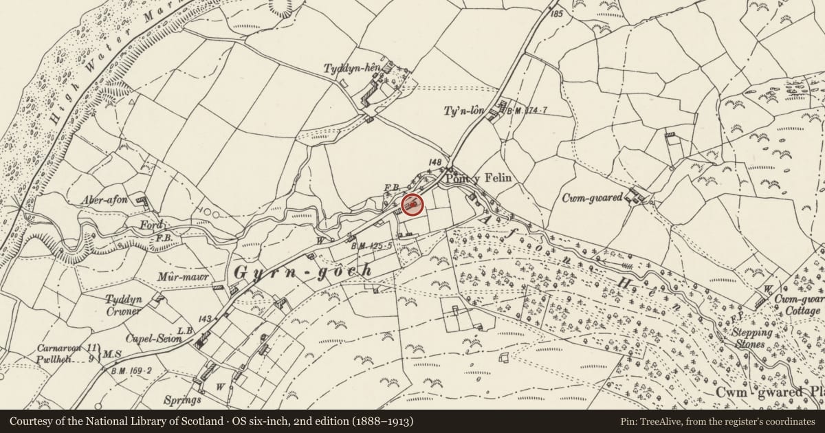
5 historical maps cover this location, the earliest the 1795 map "To Sir Watkin Williams-Wynn Bart ... the map of the six counties of North Wales is most humbly inscribed by his obedient humble servant" (Llyfrgell Genedlaethol Cymru – The National Library of Wales).
Historical maps covering this location
- 1795 · To Sir Watkin Williams-Wynn Bart ... the map of the six counties of North Wales is most… (Llyfrgell Genedlaethol Cymru – The National Library of Wales)
- 1883 · Watershed map England, Wales 3. (David Rumsey Map Collection, Stanford Libraries)
- 1896 · Sheet 7. Ordnance Survey of England and Wales. (David Rumsey Map Collection, Stanford Libraries)
- 1899 · 118 Nevin (Hills) (David Rumsey Map Collection, Stanford Libraries)
- 1901 · Sheet 9 and 10. (David Rumsey Map Collection, Stanford Libraries)
Cadw's description
Location
The house is at the NE end of a row of cottages fronting the A499 Pwllheli to Caernarfon road, approximately 1800m SW of Clynnog-fawr.
History
Built probably in the early C19 as an inn called The Sportsman, later subdivided to become a row of small cottages.
Exterior
House, now divided into 2 cottages at the end of the row, built of rubble with gable end stacks, part external on the right. Slate roofs, tarred at the rear. Two storeys. No 1 has a glazed door and small 16-pane sash windows to both ground and first floors. No 2 is of 2 bays, and has a glazed door within a modern porch. Similar 16-pane sashes to the ground floor each side of the door, and 2 small 16-pane sashes to the first floor. Each house has 1 window to the rear.
Reason for designation
Included as a pair of cottages retaining much of the appearance of the former inn, including the original small-paned sash windows, characteristic of the early C19.
Nearby in the register
- Hut Circle Settlement South-West of Pen-yr-allt UchafHut Circle Settlementunder 1 mi
- Bachwen Burial ChamberChambered Long Cairnunder 1 mi
- Pen yr allt uchafAgriculture and Subsistenceunder 1 mi
- Ffynnon BeunoWater Supply and Drainageunder 1 mi
Other entries of the same register within about three miles of this one, by straight line.