Cof Cymru: National Historic Assets of Wales · Wales
Former Coach House to rear of Nos 34 & 36
Cowbridge with Llanblethian, Vale of Glamorgan, Wales
A Grade II listed building in Cowbridge, Cowbridge with Llanblethian, Vale of Glamorgan, designated on 16 September 1999.
The record
- Designation
- Listed building, Grade II
- Broad class
- Domestic
- Date of designation
- 16 September 1999
- Locality
- Cowbridge
- Community
- Cowbridge with Llanblethian
- Unitary authority
- Vale of Glamorgan
- Country
- Wales
- Coordinates
- 51.46166, -3.44852
- Cadw reference
- 22311
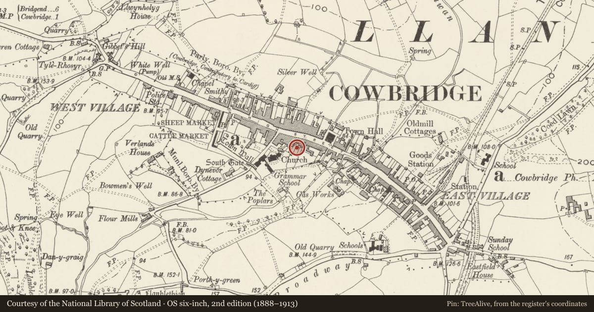
Slide toward Today to fade the historical sheet and see the modern map underneath.
David Rumsey Map Collection, Stanford LibrariesDavid Rumsey Map Collection, Stanford LibrariesDavid Rumsey Map Collection, Stanford LibrariesDavid Rumsey Map Collection, Stanford LibrariesDavid Rumsey Map Collection, Stanford Libraries
5 historical maps cover this location, the earliest the 1636 map "Cornubia : Devonia, Somersetus, Dorcestria, Wiltonia, Glocestria ..." (David Rumsey Map Collection, Stanford Libraries).
Historical maps covering this location
- 1636 · Cornubia : Devonia, Somersetus, Dorcestria, Wiltonia, Glocestria ... (David Rumsey Map Collection, Stanford Libraries)
- 1637 · The fourth table of England. Cornub. Devonia, Somerset etc. (David Rumsey Map Collection, Stanford Libraries)
- 1865 · England and Wales. England No. 6. (David Rumsey Map Collection, Stanford Libraries)
- 1897 · 262 Pontypridd (Hills) (David Rumsey Map Collection, Stanford Libraries)
- 1897 · 262 Pontypridd (Outline) (David Rumsey Map Collection, Stanford Libraries)
Cadw's description
Location
To rear of Nos 34 & 36 High Street.
History
Probably early C19.
Exterior
Two storeys, with loft over broad carriage entrance. Painted rubble walls, slate gabled roof. Facing N, boarded window opening to loft, above wide vehicular opening.
Reason for designation
Included for group value with adjacent listed buildings.
Nearby in the register
- Woodcocks and W G DaviesCommercialunder 1 mi
- The Great HouseCommercialunder 1 mi
- Etcetera and ThreshersCommercialunder 1 mi
- Ogmore Vale BakeryCommercialunder 1 mi
Other entries of the same register within about three miles of this one, by straight line.