Cof Cymru: National Historic Assets of Wales · Wales
Pen Rallt
Llanrug, Gwynedd, Wales
A Grade II listed building in Bwlch, Llanrug, Gwynedd, designated on 27 August 1999.
The record
- Designation
- Listed building, Grade II
- Broad class
- Domestic
- Date of designation
- 27 August 1999
- Locality
- Bwlch
- Community
- Llanrug
- Unitary authority
- Gwynedd
- Country
- Wales
- Coordinates
- 53.14058, -4.17070
- Cadw reference
- 22250
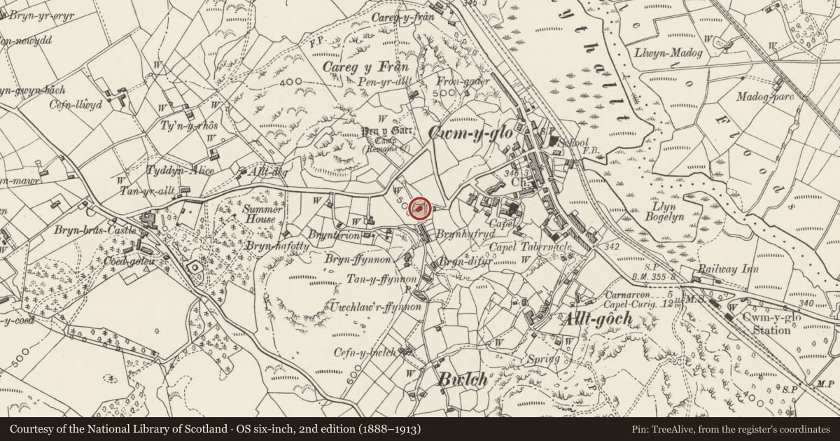
Slide toward Today to fade the historical sheet and see the modern map underneath.
David Rumsey Map Collection, Stanford LibrariesDavid Rumsey Map Collection, Stanford LibrariesDavid Rumsey Map Collection, Stanford LibrariesDavid Rumsey Map Collection, Stanford LibrariesDavid Rumsey Map Collection, Stanford Libraries
5 historical maps cover this location, the earliest the 1896 map "Sheet 7. Ordnance Survey of England and Wales." (David Rumsey Map Collection, Stanford Libraries).
Historical maps covering this location
- 1896 · Sheet 7. Ordnance Survey of England and Wales. (David Rumsey Map Collection, Stanford Libraries)
- 1899 · 106 Bangor (Outline) (David Rumsey Map Collection, Stanford Libraries)
- 1899 · 106 Bangor (Hills) (David Rumsey Map Collection, Stanford Libraries)
- 1901 · Sheet 9 and 10. (David Rumsey Map Collection, Stanford Libraries)
- 1919 · Sheet 41. Anglesey. (David Rumsey Map Collection, Stanford Libraries)
Cadw's description
Location
Located at the end of a track running downslope from the minor road between Cwm-y-glo and Bryn Bras Castle.
History
Not shown on the 1839 Tithe Map, the house is likely to have been built c.1860, apparently as a farmhouse, although much of its land is now gone.
Exterior
House. 2-storey, slightly asymmetrical 3-bay front. Roughly coursed rubblestone with buttered pointing; slate roof and rendered integral end stacks. Windows all original 4-pane sashes with slate cills, directly below eaves on first floor and with slate lintels to ground floor; entrance slightly offset to left has late C20 door. Single-storey addition on left has large C20 window to front. Fenestration pattern of main house repeated to first floor of rendered rear wall.
Interior
Interior not inspected at time of Survey.
Reason for designation
Included as a well-preserved example of a later C19 small farmhouse, still exhibiting the plan-form and many of the features of farmhouses built in the decades around 1800, a distinctive local building type important in this region.
Nearby in the register
- Caer Carreg y FranHillfortunder 1 mi
- Pant-y-CelynDomesticunder 1 mi
- Observatory at Bryn Bras CastleGardens, Parks and Urban Spacesunder 1 mi
- Pan figure and pool in walled 'knot' garden at Bryn Bras CastleGardens, Parks and Urban Spacesunder 1 mi
Other entries of the same register within about three miles of this one, by straight line.