Cof Cymru: National Historic Assets of Wales · Wales
Derwydd Walled Garden and Gazebo
Llandybie, Carmarthenshire, Wales
A Grade II listed building in Derwydd, Burry Port, Llandybie, Carmarthenshire, designated on 27 August 1999.
The record
- Designation
- Listed building, Grade II
- Broad class
- Domestic
- Date of designation
- 27 August 1999
- Locality
- Derwydd
- Town
- Burry Port
- Community
- Llandybie
- Unitary authority
- Carmarthenshire
- Country
- Wales
- Coordinates
- 51.84254, -4.01516
- Cadw reference
- 22214
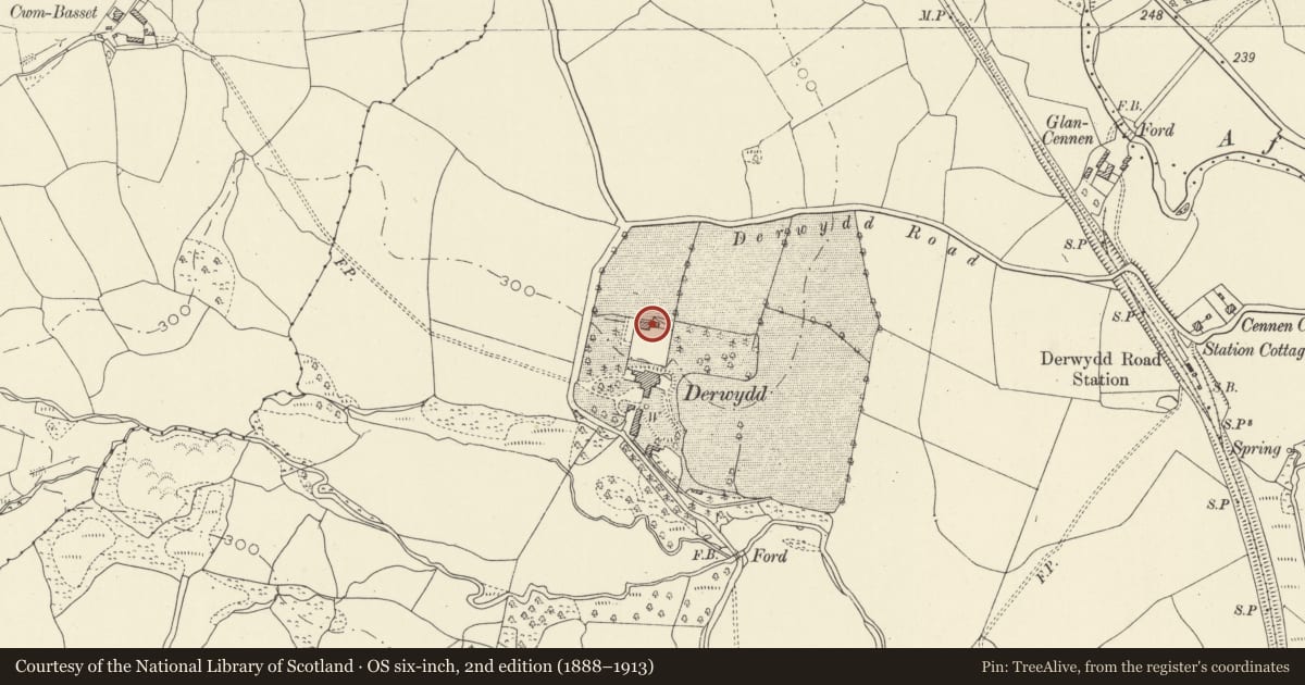
Slide toward Today to fade the historical sheet and see the modern map underneath.
David Rumsey Map Collection, Stanford LibrariesDavid Rumsey Map Collection, Stanford LibrariesDavid Rumsey Map Collection, Stanford LibrariesDavid Rumsey Map Collection, Stanford LibrariesDavid Rumsey Map Collection, Stanford Libraries
5 historical maps cover this location, the earliest the 1860 map "41. Caermathen." (David Rumsey Map Collection, Stanford Libraries).
Historical maps covering this location
- 1860 · 41. Caermathen. (David Rumsey Map Collection, Stanford Libraries)
- 1891 · Sheet 10. Ordnance Survey of England and Wales. . (David Rumsey Map Collection, Stanford Libraries)
- 1898 · 230 Ammanford (Hills) (David Rumsey Map Collection, Stanford Libraries)
- 1898 · 230 Ammanford (Outline) (David Rumsey Map Collection, Stanford Libraries)
- 1901 · Sheet 14. (David Rumsey Map Collection, Stanford Libraries)
Cadw's description
Location
Immediately to the north of Derwydd Mansion. The gazebo stands outside the garden at north, the walls of the latter ramped up to its front wall. Gates to the garden at east, west and south.
History
The outline of the garden is shown on the Tithe map, but not the gazebo. The latter appears on the map of 1876.
Exterior
Gazebo in rubble masonry, part rendered at the front, with local stone roofing tiles, partly lost at rear. The building is of two storeys, approximately cubic in form, with a pyramid roof. The front elevation has a single window above, with a string course just below sill level; two windows and a central doorway below, the windows segmentally headed and the doorway round-headed. Chimney at right. Window to the upper storey at rear.
Rubble masonry garden walls about 2.5m in height. At the south is a flight of steps down to the house.
Reason for designation
Good example of a formal walled garden with a C19 gazebo on the axis, listed also for group value with Derwydd mansion.
Nearby in the register
- Derwydd MansionDomesticunder 1 mi
- Derwydd Outer Wall and GatesDomesticunder 1 mi
- Derwydd Stable Cottage and Related WallsDomesticunder 1 mi
- Two Burnt Mounds 600m ESE of Rhyd-y-Ffynnon FarmBurnt Moundunder 1 mi
Other entries of the same register within about three miles of this one, by straight line.