Cof Cymru: National Historic Assets of Wales · Wales
Pont-y-wern
Llanfihangel Aberbythych, Carmarthenshire, Wales
A Grade II listed building in Golden Grove Park, Carmarthen, Llanfihangel Aberbythych, Carmarthenshire, designated on 27 August 1999.
The record
- Designation
- Listed building, Grade II
- Broad class
- Transport
- Date of designation
- 27 August 1999
- Locality
- Golden Grove Park
- Town
- Carmarthen
- Community
- Llanfihangel Aberbythych
- Unitary authority
- Carmarthenshire
- Country
- Wales
- Coordinates
- 51.86008, -4.03011
- Cadw reference
- 22178
Slide toward Today to fade the historical sheet and see the modern map underneath.
David Rumsey Map Collection, Stanford LibrariesDavid Rumsey Map Collection, Stanford LibrariesDavid Rumsey Map Collection, Stanford LibrariesDavid Rumsey Map Collection, Stanford LibrariesDavid Rumsey Map Collection, Stanford Libraries
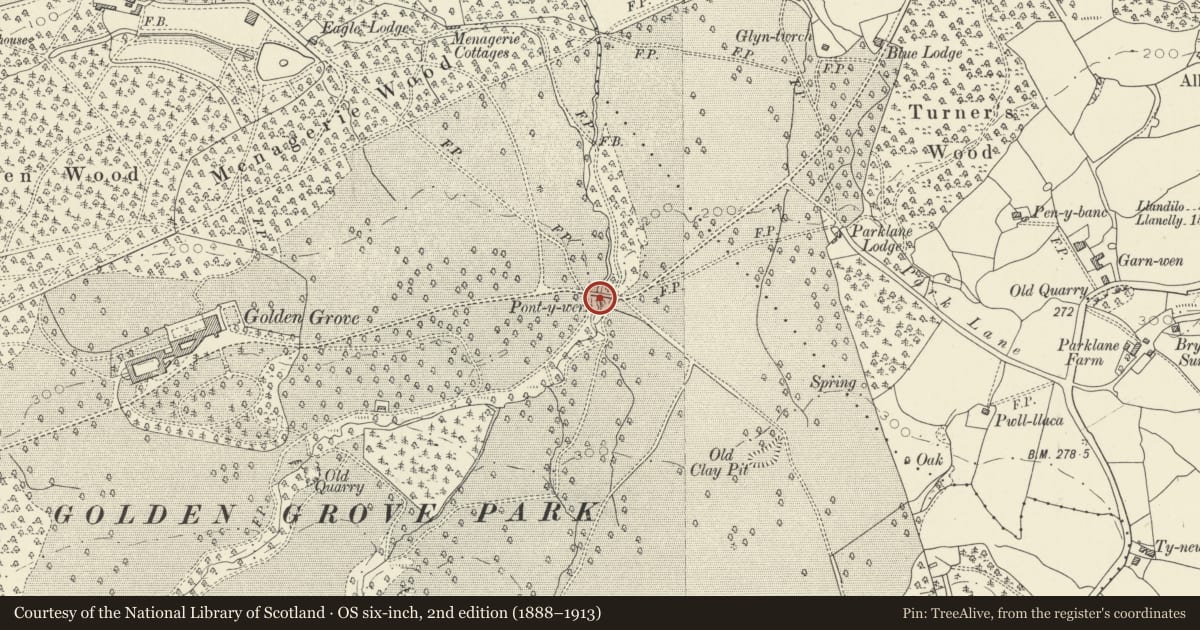
5 historical maps cover this location, the earliest the 1860 map "41. Caermathen." (David Rumsey Map Collection, Stanford Libraries).
Historical maps covering this location
- 1860 · 41. Caermathen. (David Rumsey Map Collection, Stanford Libraries)
- 1891 · Sheet 10. Ordnance Survey of England and Wales. . (David Rumsey Map Collection, Stanford Libraries)
- 1898 · 230 Ammanford (Hills) (David Rumsey Map Collection, Stanford Libraries)
- 1898 · 230 Ammanford (Outline) (David Rumsey Map Collection, Stanford Libraries)
- 1901 · Sheet 14. (David Rumsey Map Collection, Stanford Libraries)
Cadw's description
Location
In park landscape about 500m to the east of Golden Grove, carrying the private drive from the East (Llandeilo) Lodge to the Mansion. It crosses a small stream in a deep narrow valley.
History
Ornamental bridge on the former principal approach drive through Golden Grove Park.
The architect's drawing for this bridge (received from London, and so very probably from the office of Wyatville) is in the Cawdor Papers, in a bundle of c1831 date. It was perhaps built during the construction of the house to facilitate bringing materials from the direction of Llandeilo. The bridge appears on the 1839 Tithe Plan.
The architect's instructions left it to the mason to decide whether the outer lengths of the parapets were to be plain or formed with balustrades.
Exterior
A fine single-arch estate bridge in limestone. 12m span, carrying a road about 5m in width. Deep segmental arch. Thin voussoirs nearly ½m in depth; thin keystone. Two shallow buttresses each side carried up to form piers in the parapets.
The parapets are in ashlar masonry, each in three lengths articulated by little piers; the central length each side incorporates three sets of balusters. The parapet has a weathering at foot and the top course is chamfered with a slight weathering to the exterior.
Reason for designation
A fine estate bridge contemporary with Golden Grove mansion.
Nearby in the register
- Golden Grove Inner East GateDomesticunder 1 mi
- Golden Grove Garden Seat and StairsDomesticunder 1 mi
- Eagle LodgeDomesticunder 1 mi
- Golden Grove MansionDomesticunder 1 mi
Other entries of the same register within about three miles of this one, by straight line.