Cof Cymru: National Historic Assets of Wales · Wales
Golden Grove Inner East Gate
Llanfihangel Aberbythych, Carmarthenshire, Wales
A Grade II listed building in Golden Grove Park, Carmarthen, Llanfihangel Aberbythych, Carmarthenshire, designated on 27 August 1999.
The record
- Designation
- Listed building, Grade II
- Broad class
- Domestic
- Date of designation
- 27 August 1999
- Locality
- Golden Grove Park
- Town
- Carmarthen
- Community
- Llanfihangel Aberbythych
- Unitary authority
- Carmarthenshire
- Country
- Wales
- Coordinates
- 51.85945, -4.03656
- Cadw reference
- 22171
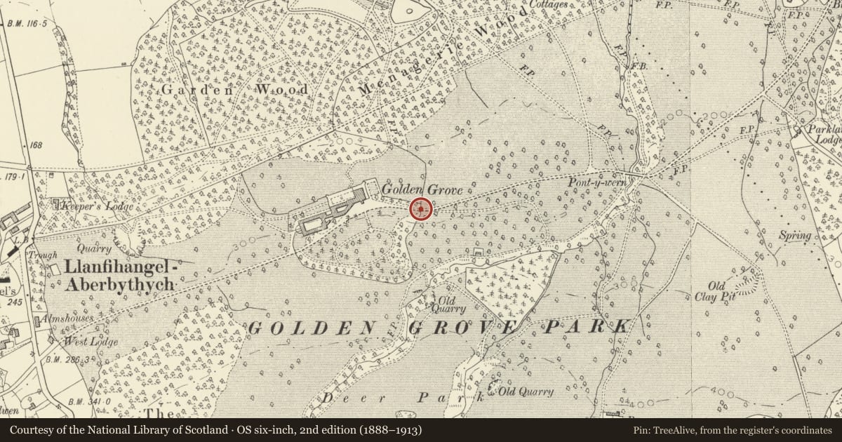
Slide toward Today to fade the historical sheet and see the modern map underneath.
David Rumsey Map Collection, Stanford LibrariesDavid Rumsey Map Collection, Stanford LibrariesDavid Rumsey Map Collection, Stanford LibrariesDavid Rumsey Map Collection, Stanford LibrariesDavid Rumsey Map Collection, Stanford Libraries
5 historical maps cover this location, the earliest the 1860 map "41. Caermathen." (David Rumsey Map Collection, Stanford Libraries).
Historical maps covering this location
- 1860 · 41. Caermathen. (David Rumsey Map Collection, Stanford Libraries)
- 1891 · Sheet 10. Ordnance Survey of England and Wales. . (David Rumsey Map Collection, Stanford Libraries)
- 1898 · 230 Ammanford (Hills) (David Rumsey Map Collection, Stanford Libraries)
- 1898 · 230 Ammanford (Outline) (David Rumsey Map Collection, Stanford Libraries)
- 1901 · Sheet 14. (David Rumsey Map Collection, Stanford Libraries)
Cadw's description
Location
At the east entrance to the domestic grounds within Golden Grove park, near the south-west corner of the house.
History
Probably contemporary with the completion of the Mansion and offices, c1835.
Exterior
Pair of monolith gatepiers each on a small chamfered plinth and with a moulded and enriched cap. On the gate face of each pier is a rib of stone against which the gate closes. Gate replaced. Modern stile to the south side.
A low wall topped by iron spearhead railings continues to the north and south, the north wall turning west and continuing to the house as a rubble retaining wall.
Wing walls in brick at east side flanking a cattle grid.
Reason for designation
A feature of the landscaping of the immediate environs of Golden Grove, contemporary with the house.
Nearby in the register
- Golden Grove Garden Seat and StairsDomesticunder 1 mi
- Golden Grove MansionDomesticunder 1 mi
- Golden Grove TerraceDomesticunder 1 mi
- Golden Grove Stable BlockDomesticunder 1 mi
Other entries of the same register within about three miles of this one, by straight line.