Cof Cymru: National Historic Assets of Wales · Wales
Fountain House
Llansadwrn, Carmarthenshire, Wales
A Grade II listed building in Llansadwrn, Llanwrda, Carmarthenshire, designated on 29 July 1999.
The record
- Designation
- Listed building, Grade II
- Broad class
- Domestic
- Date of designation
- 29 July 1999
- Locality
- Llansadwrn
- Town
- Llanwrda
- Community
- Llansadwrn
- Unitary authority
- Carmarthenshire
- Country
- Wales
- Coordinates
- 51.96579, -3.89856
- Cadw reference
- 22114
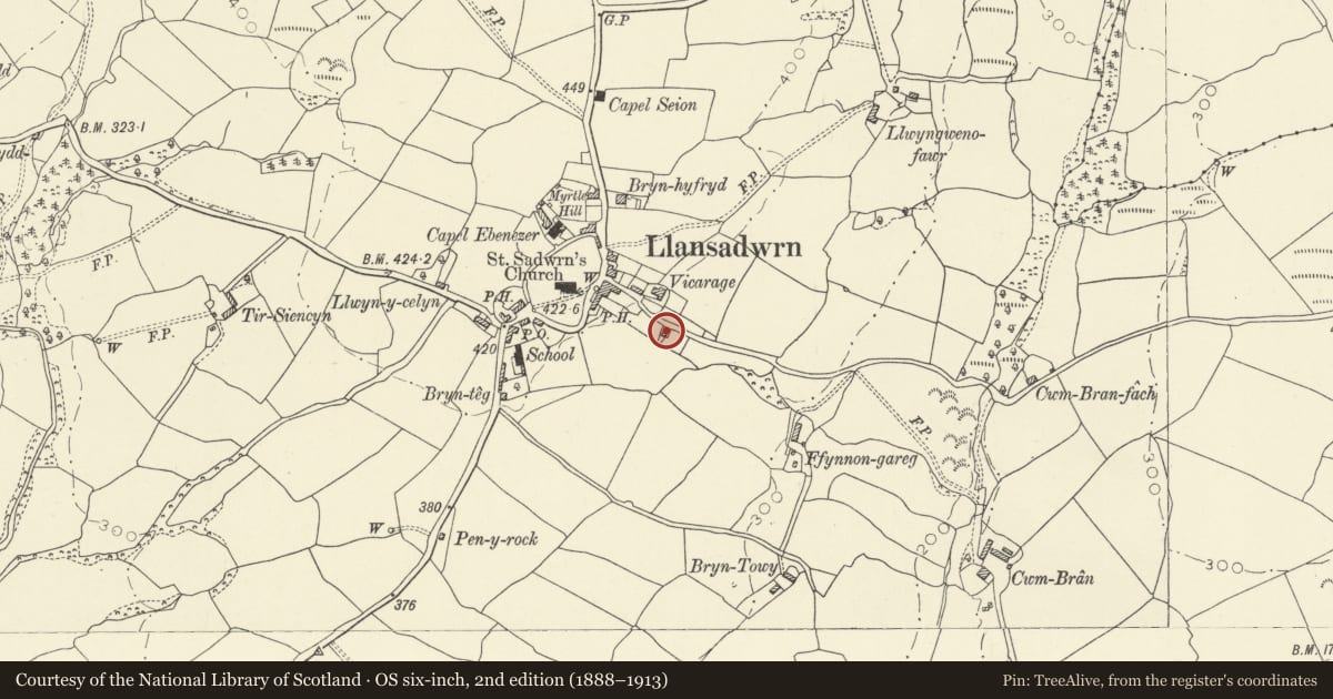
Slide toward Today to fade the historical sheet and see the modern map underneath.
David Rumsey Map Collection, Stanford LibrariesDavid Rumsey Map Collection, Stanford LibrariesDavid Rumsey Map Collection, Stanford LibrariesDavid Rumsey Map Collection, Stanford LibrariesDavid Rumsey Map Collection, Stanford Libraries
5 historical maps cover this location, the earliest the 1860 map "41. Caermathen." (David Rumsey Map Collection, Stanford Libraries).
Historical maps covering this location
- 1860 · 41. Caermathen. (David Rumsey Map Collection, Stanford Libraries)
- 1891 · Sheet 10. Ordnance Survey of England and Wales. . (David Rumsey Map Collection, Stanford Libraries)
- 1898 · 212 Llandovery (Outline) (David Rumsey Map Collection, Stanford Libraries)
- 1898 · 212 Llandovery (Hills) (David Rumsey Map Collection, Stanford Libraries)
- 1901 · Sheet 14. (David Rumsey Map Collection, Stanford Libraries)
Cadw's description
Location
Situated some 100m E of churchyard, on S side of narrow lane.
History
Earlier C19 village house in late Georgian style. Marked on 1839 Tithe Map as owned by David Thomas, occupied by Benjamin Williams. It had an added outshut to rear, removed in late C20 as derelict.
Exterior
House, whitewashed rubble stone with slate roof and rendered end stacks, larger stack to right. Two-storey, 3-window range, offset to left. Original 12-pane small sashes above, late C19 4-pane sashes below, centre boarded door. Stone voussoirs, stone sills. Rendering to N end in gable and to W rear wall, both windowless. Outshut removed. Small single storey outbuilding to left.
Reason for designation
Included as a good example of a village house in late Georgian style, little altered.
Nearby in the register
- The Old VicarageDomesticunder 1 mi
- Church of Saint SadwrnReligious, Ritual and Funeraryunder 1 mi
- The PoundAgriculture and Subsistenceunder 1 mi
- The War MemorialCommemorativeunder 1 mi
Other entries of the same register within about three miles of this one, by straight line.