Cof Cymru: National Historic Assets of Wales · Wales
The War Memorial
Llansadwrn, Carmarthenshire, Wales
A Grade II listed building in Llansadwrn, Llanwrda, Carmarthenshire, designated on 29 July 1999.
The record
- Designation
- Listed building, Grade II
- Broad class
- Commemorative
- Date of designation
- 29 July 1999
- Locality
- Llansadwrn
- Town
- Llanwrda
- Community
- Llansadwrn
- Unitary authority
- Carmarthenshire
- Country
- Wales
- Coordinates
- 51.96601, -3.90116
- Cadw reference
- 22110
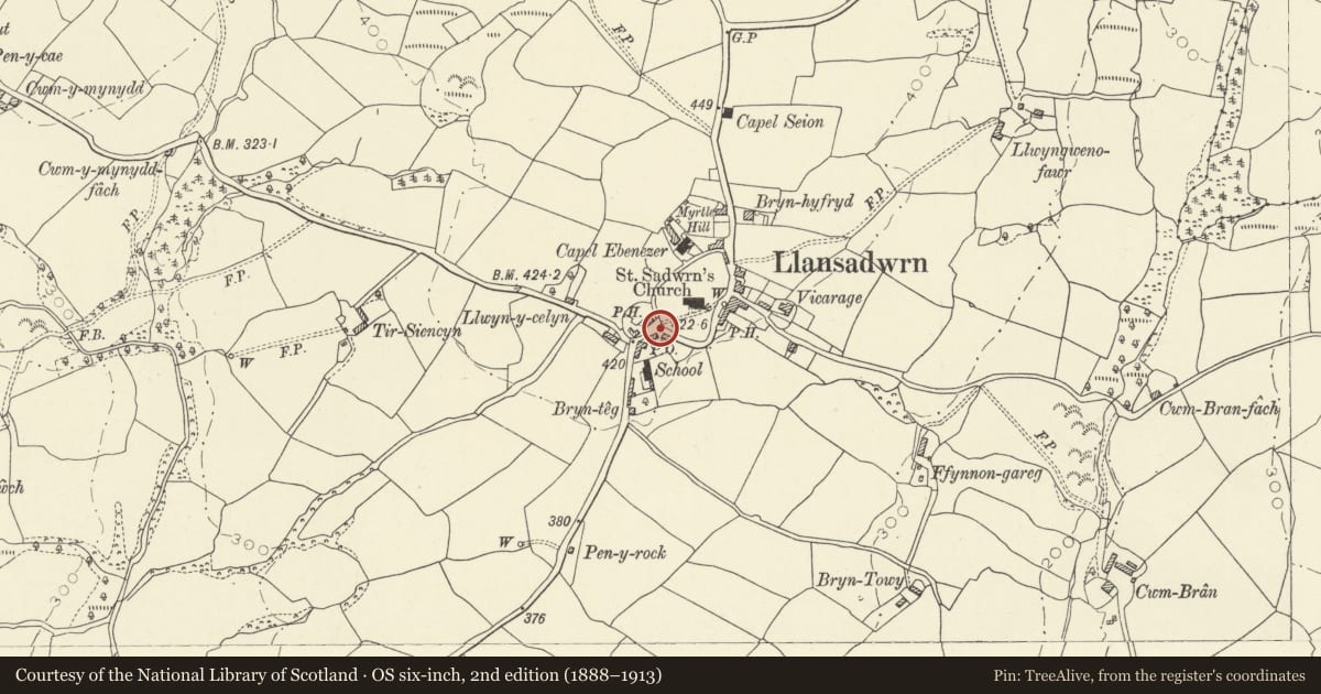
Slide toward Today to fade the historical sheet and see the modern map underneath.
David Rumsey Map Collection, Stanford LibrariesDavid Rumsey Map Collection, Stanford LibrariesDavid Rumsey Map Collection, Stanford LibrariesDavid Rumsey Map Collection, Stanford LibrariesDavid Rumsey Map Collection, Stanford Libraries
5 historical maps cover this location, the earliest the 1860 map "41. Caermathen." (David Rumsey Map Collection, Stanford Libraries).
Historical maps covering this location
- 1860 · 41. Caermathen. (David Rumsey Map Collection, Stanford Libraries)
- 1891 · Sheet 10. Ordnance Survey of England and Wales. . (David Rumsey Map Collection, Stanford Libraries)
- 1898 · 212 Llandovery (Outline) (David Rumsey Map Collection, Stanford Libraries)
- 1898 · 212 Llandovery (Hills) (David Rumsey Map Collection, Stanford Libraries)
- 1901 · Sheet 14. (David Rumsey Map Collection, Stanford Libraries)
Cadw's description
Location
Situated at SW entry to churchyard of Church of St Sadwrn.
History
War memorial of c1920 made by J Thomas of Llanelli.
Exterior
War memorial, grey granite, classically-derived with square base, moulded plinth, polished square shaft with battered sides, two square polished blocks above and bulbous pyramidal cap. Matt tooled finish to cap, plinth, base, and rebated rounded edges of polished blocks. Square base has coved upper moulding, plinth has square thin base with upper cove then ogee profiled main part. Battered shaft with names of dead, then two polished square blocks above, one with inscriptions, upper one with etched military and funereal motifs. Heavy bulbous pyramid capstone with acanthus leaves wrapped around angles. Stone coping surround with iron railings to interlinked oval pattern.
Reason for designation
Included for historical interest and for group value with the Pound and the Church of St Sadwrn.
Nearby in the register
- The PoundAgriculture and Subsistenceunder 1 mi
- Church of Saint SadwrnReligious, Ritual and Funeraryunder 1 mi
- Capel EbenezerReligious, Ritual and Funeraryunder 1 mi
- The Old VicarageDomesticunder 1 mi
Other entries of the same register within about three miles of this one, by straight line.