Cof Cymru: National Historic Assets of Wales · Wales
The Midland Bank, and attached iron railings
Usk, Monmouthshire, Wales
A Grade II listed building in Usk, Monmouthshire, designated on 1 April 1974.
The record
- Designation
- Listed building, Grade II
- Broad class
- Commercial
- Date of designation
- 1 April 1974
- Locality
- Usk
- Town
- Usk
- Community
- Usk
- Unitary authority
- Monmouthshire
- Country
- Wales
- Coordinates
- 51.70369, -2.90252
- Cadw reference
- 2207
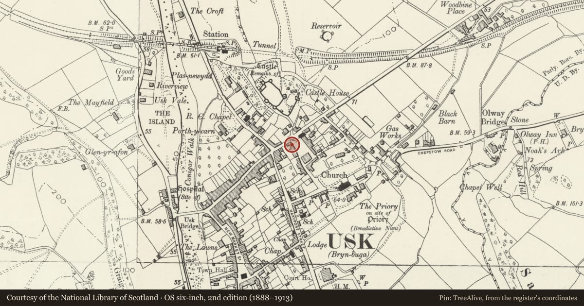
Slide toward Today to fade the historical sheet and see the modern map underneath.
David Rumsey Map Collection, Stanford LibrariesDavid Rumsey Map Collection, Stanford LibrariesDavid Rumsey Map Collection, Stanford LibrariesDavid Rumsey Map Collection, Stanford LibrariesDavid Rumsey Map Collection, Stanford Libraries
5 historical maps cover this location, the earliest the 1636 map "Cornubia : Devonia, Somersetus, Dorcestria, Wiltonia, Glocestria ..." (David Rumsey Map Collection, Stanford Libraries).
Historical maps covering this location
- 1636 · Cornubia : Devonia, Somersetus, Dorcestria, Wiltonia, Glocestria ... (David Rumsey Map Collection, Stanford Libraries)
- 1637 · The fourth table of England. Cornub. Devonia, Somerset etc. (David Rumsey Map Collection, Stanford Libraries)
- 1830 · V.3:11-15:XV.Britisches Reich. A. Kon: England. a. England ab sich: Shire:15-17, 33 (David Rumsey Map Collection, Stanford Libraries)
- 1895 · Sheet 11. Ordnance Survey of England and Wales. (David Rumsey Map Collection, Stanford Libraries)
- 1913 · Sheet 102. Newport. (David Rumsey Map Collection, Stanford Libraries)
Cadw's description
Location
Forming the upper W corner of Twyn Square with side elevation to Castle Parade.
History
c1800.
Exterior
Grand former later Georgian townhouse, now bank and flats. Roughcast rendered with stucco dressings; hipped slate roof with tall brick lateral stacks. Three storeys and cellar. A symmetrical frontage. Five-window range: 9-pane sashes in reveals to top floor and 12-pane below; platband and quoin-strip, deep plinth. Central doorway with square-headed doorcase with entablature and round-arched entrance with fanlight with radiating glazing bars, C20 glazed door. Side elevation facing Castle Parade has a 4-window range of 12-pane sashes. Small front enclosure formed by tall railings with thistle finials on a rendered plinth: the gates have been re-used to form returns to the main entrance; railings joined to swept side-wall at left.
Interior
Ground floor completely refurbished as bank. Two upper floors convereted to flats. No known survival of historic features.
Reason for designation
Listed as a fine former townhouse retaining historic fabric and character. Group value with other listed buildings in Twyn Square and Castle Parade.
Nearby in the register
- The Nag's Head PHCommercialunder 1 mi
- Tail EndDomesticunder 1 mi
- Telephone Call-box adjoining forecourt wall at United Reformed ChurchCommunicationsunder 1 mi
- 10 Twyn SquareAgriculture and Subsistenceunder 1 mi
Other entries of the same register within about three miles of this one, by straight line.