Cof Cymru: National Historic Assets of Wales · Wales
Ivy House, and attached irailings
Usk, Monmouthshire, Wales
A Grade II listed building in Usk, Monmouthshire, designated on 16 February 1953.
The record
- Designation
- Listed building, Grade II
- Broad class
- Domestic
- Date of designation
- 16 February 1953
- Locality
- Usk
- Town
- Usk
- Community
- Usk
- Unitary authority
- Monmouthshire
- Country
- Wales
- Coordinates
- 51.70024, -2.90497
- Cadw reference
- 2174
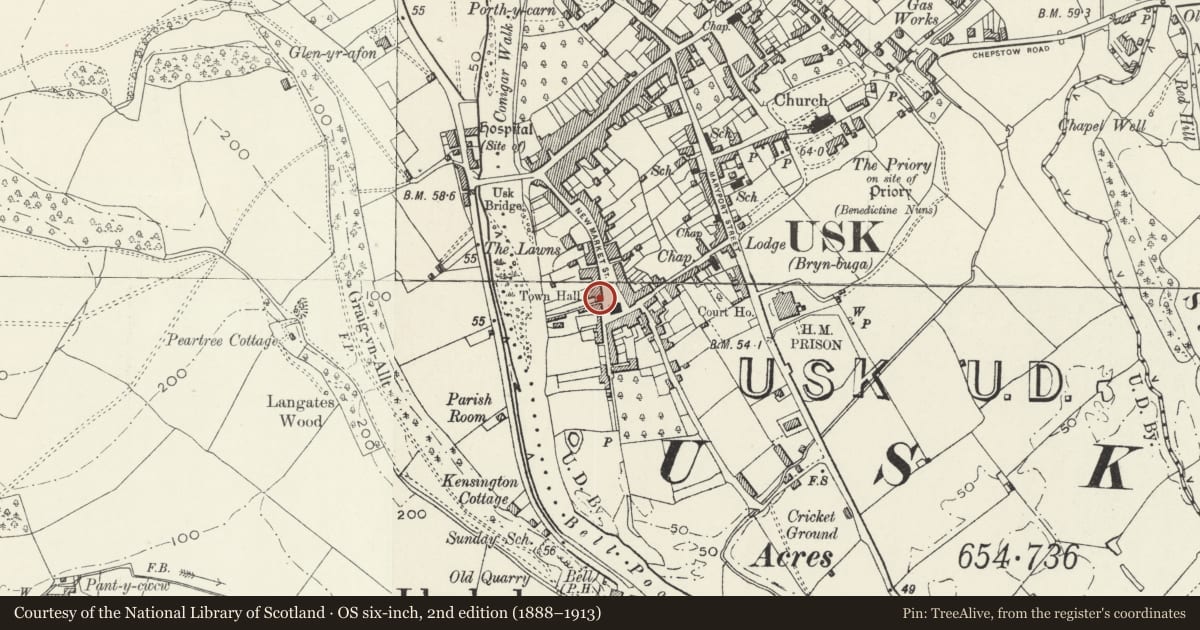
Slide toward Today to fade the historical sheet and see the modern map underneath.
David Rumsey Map Collection, Stanford LibrariesDavid Rumsey Map Collection, Stanford LibrariesDavid Rumsey Map Collection, Stanford LibrariesDavid Rumsey Map Collection, Stanford LibrariesDavid Rumsey Map Collection, Stanford Libraries
5 historical maps cover this location, the earliest the 1636 map "Cornubia : Devonia, Somersetus, Dorcestria, Wiltonia, Glocestria ..." (David Rumsey Map Collection, Stanford Libraries).
Historical maps covering this location
- 1636 · Cornubia : Devonia, Somersetus, Dorcestria, Wiltonia, Glocestria ... (David Rumsey Map Collection, Stanford Libraries)
- 1637 · The fourth table of England. Cornub. Devonia, Somerset etc. (David Rumsey Map Collection, Stanford Libraries)
- 1830 · V.3:11-15:XV.Britisches Reich. A. Kon: England. a. England ab sich: Shire:15-17, 33 (David Rumsey Map Collection, Stanford Libraries)
- 1895 · Sheet 11. Ordnance Survey of England and Wales. (David Rumsey Map Collection, Stanford Libraries)
- 1913 · Sheet 102. Newport. (David Rumsey Map Collection, Stanford Libraries)
Cadw's description
Location
The end house of the lower W range; adjacent to the Royal Hotel.
History
Early C19.
Exterior
Georgian townhouse. Rendered and painted ; slate roof with swept bracketed overhanging boarded eaves, tall brick end stack at right. Two storeys; raised quoins to right side. Symmetrical frontage, a three-window range of sashes: first floor has 16-pane to side and 12-pane at centre; tripartite to ground floor. Central doorway with gabled panelled doorcase with narrow pilasters; recessed six -panelled door with fanlight with radial glazing. Plinth. Iron railings with spear finials on a low brick kerb extend across frontage with lower central gate.
Interior
Interior retains some original doors, shutters and fireplaces but has been reorganised into two flats.
Reason for designation
Listed as a late Georgian townhouse. Group value with other listed buildings in New Market Street.
Nearby in the register
- Riverside House, and attached iron railingsDomesticunder 1 mi
- The Royal HotelCommercialunder 1 mi
- South African War Memorial in front of The Town HallCommemorativeunder 1 mi
- Ynys HafodDomesticunder 1 mi
Other entries of the same register within about three miles of this one, by straight line.