Cof Cymru: National Historic Assets of Wales · Wales
Former Stable Wing at No.16 New Market Street (The Lawns)
Usk, Monmouthshire, Wales
A Grade II listed building in Usk, Monmouthshire, designated on 1 April 1974.
The record
- Designation
- Listed building, Grade II
- Broad class
- Domestic
- Date of designation
- 1 April 1974
- Locality
- Usk
- Town
- Usk
- Community
- Usk
- Unitary authority
- Monmouthshire
- Country
- Wales
- Coordinates
- 51.70093, -2.90514
- Cadw reference
- 2167
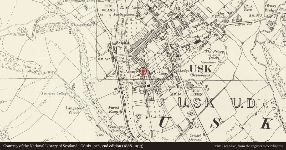
Slide toward Today to fade the historical sheet and see the modern map underneath.
David Rumsey Map Collection, Stanford LibrariesDavid Rumsey Map Collection, Stanford LibrariesDavid Rumsey Map Collection, Stanford LibrariesDavid Rumsey Map Collection, Stanford LibrariesDavid Rumsey Map Collection, Stanford Libraries
5 historical maps cover this location, the earliest the 1636 map "Cornubia : Devonia, Somersetus, Dorcestria, Wiltonia, Glocestria ..." (David Rumsey Map Collection, Stanford Libraries).
Historical maps covering this location
- 1636 · Cornubia : Devonia, Somersetus, Dorcestria, Wiltonia, Glocestria ... (David Rumsey Map Collection, Stanford Libraries)
- 1637 · The fourth table of England. Cornub. Devonia, Somerset etc. (David Rumsey Map Collection, Stanford Libraries)
- 1830 · V.3:11-15:XV.Britisches Reich. A. Kon: England. a. England ab sich: Shire:15-17, 33 (David Rumsey Map Collection, Stanford Libraries)
- 1895 · Sheet 11. Ordnance Survey of England and Wales. (David Rumsey Map Collection, Stanford Libraries)
- 1913 · Sheet 102. Newport. (David Rumsey Map Collection, Stanford Libraries)
Cadw's description
Location
Forming part of the road frontage of The Lawns property, integrated with the Garden Wall.
History
C19 altered later. It is likely that much of the masonry fronting the street pre-dates The Lawns, which was built on an area of garden plots.
Exterior
Outer wall of stable block incorporating former carriage entrance continuous with Garden Wall to The Lawns and adjoining No. 18. Of stone rubble, white painted, to street frontage; slate roof, hipped to left section. In three sections with 3 separate roofs. To right a lower unit with no openings to street but signs of alteration, double doors to rear. Centre deeper unit has a wide carriage entrance under timber lintel, brick to rear. End unit to left has small twin casements under timber lintels to street frontage: brick with C20 windows to rear.
Reason for designation
Included as an important part of the street frontage and for group value with other listed buildings in New Market Street, especially The Lawns and the Garden Wall.
Nearby in the register
- 18 New market StreetDomesticunder 1 mi
- No.23 New Market Street, and attached irailingsDomesticunder 1 mi
- 20 New Market StreetDomesticunder 1 mi
- No.21 New Market Street, and attached iron railingsDomesticunder 1 mi
Other entries of the same register within about three miles of this one, by straight line.