Cof Cymru: National Historic Assets of Wales · Wales
War Memorial
Pontllanfraith, Caerphilly, Wales
A Grade II listed building in Pontllanfraith, Caerphilly, designated on 31 March 1999.
The record
- Designation
- Listed building, Grade II
- Broad class
- Commemorative
- Date of designation
- 31 March 1999
- Locality
- Pontllanfraith
- Community
- Pontllanfraith
- Unitary authority
- Caerphilly
- Country
- Wales
- Coordinates
- 51.65700, -3.18994
- Cadw reference
- 21622
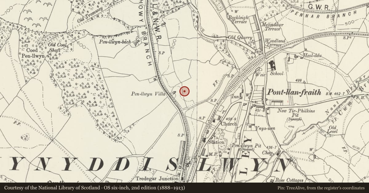
Slide toward Today to fade the historical sheet and see the modern map underneath.
David Rumsey Map Collection, Stanford LibrariesDavid Rumsey Map Collection, Stanford LibrariesDavid Rumsey Map Collection, Stanford LibrariesDavid Rumsey Map Collection, Stanford LibrariesDavid Rumsey Map Collection, Stanford Libraries
5 historical maps cover this location, the earliest the 1636 map "Cornubia : Devonia, Somersetus, Dorcestria, Wiltonia, Glocestria ..." (David Rumsey Map Collection, Stanford Libraries).
Historical maps covering this location
- 1636 · Cornubia : Devonia, Somersetus, Dorcestria, Wiltonia, Glocestria ... (David Rumsey Map Collection, Stanford Libraries)
- 1637 · The fourth table of England. Cornub. Devonia, Somerset etc. (David Rumsey Map Collection, Stanford Libraries)
- 1895 · Sheet 11. Ordnance Survey of England and Wales. (David Rumsey Map Collection, Stanford Libraries)
- 1906 · 249 Newport (Hills) (David Rumsey Map Collection, Stanford Libraries)
- 1913 · Sheet 102. Newport. (David Rumsey Map Collection, Stanford Libraries)
Cadw's description
Location
Sited in a small terraced enclosure in open ground in front of Caerphilly Borough Council Offices.
History
War Memorial to the Dead of two World Wars was formerly sited outside the former Mynyddislwyn District Council Offices.
Exterior
Monument of grey granite comprises 2 steps, a tiered battered plinth supporting a tapering rectangular pillar bearing the names in applied lettering of those fallen in the First World War on the front panel within a moulded surround; to sides are the names from the Second World War. Above a moulded cornice is a wreath, with further cornice surmounted by an acanthus leaf finial on a scroll.
Reason for designation
Included mainly for historic interest.
Nearby in the register
- Former Mynyddislwyn Urban District Council OfficesInstitutionalunder 1 mi
- Penllwyn, former manor house now Penllwyn Arms public houseCommercialunder 1 mi
- Garden Wall at PenllwynDomesticunder 1 mi
- Fort South of Pen-Llwyn-FawrFortunder 1 mi
Other entries of the same register within about three miles of this one, by straight line.