Cof Cymru: National Historic Assets of Wales · Wales
Garden Wall at Penllwyn
Pontllanfraith, Caerphilly, Wales
A Grade II listed building in Penllwyn, Pontllanfraith, Caerphilly, designated on 31 March 1999.
The record
- Designation
- Listed building, Grade II
- Broad class
- Domestic
- Date of designation
- 31 March 1999
- Locality
- Penllwyn
- Community
- Pontllanfraith
- Unitary authority
- Caerphilly
- Country
- Wales
- Coordinates
- 51.65285, -3.19578
- Cadw reference
- 21630
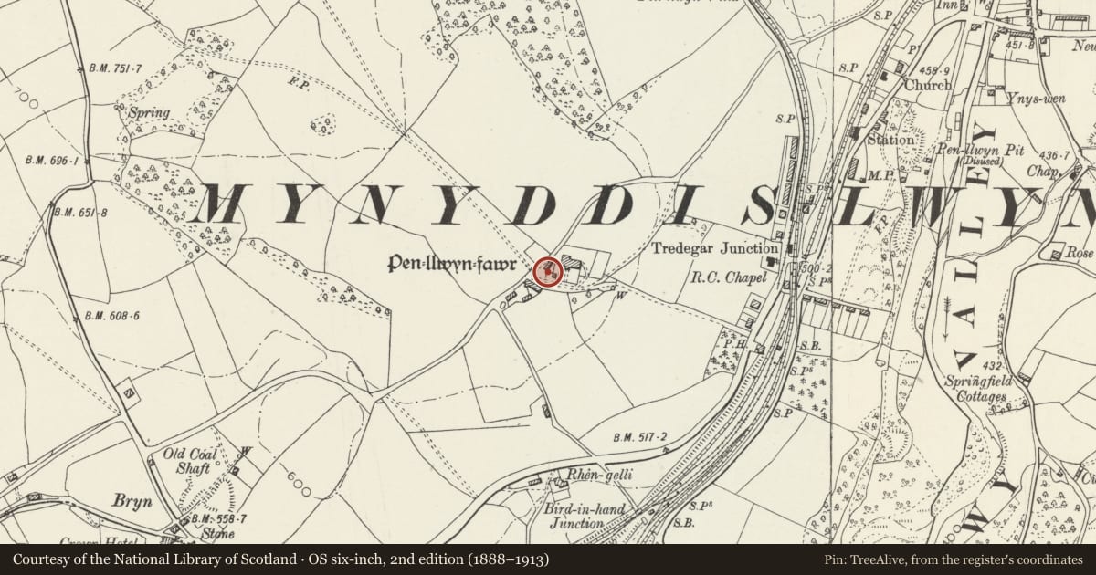
Slide toward Today to fade the historical sheet and see the modern map underneath.
David Rumsey Map Collection, Stanford LibrariesDavid Rumsey Map Collection, Stanford LibrariesDavid Rumsey Map Collection, Stanford LibrariesDavid Rumsey Map Collection, Stanford LibrariesDavid Rumsey Map Collection, Stanford Libraries
5 historical maps cover this location, the earliest the 1636 map "Cornubia : Devonia, Somersetus, Dorcestria, Wiltonia, Glocestria ..." (David Rumsey Map Collection, Stanford Libraries).
Historical maps covering this location
- 1636 · Cornubia : Devonia, Somersetus, Dorcestria, Wiltonia, Glocestria ... (David Rumsey Map Collection, Stanford Libraries)
- 1637 · The fourth table of England. Cornub. Devonia, Somerset etc. (David Rumsey Map Collection, Stanford Libraries)
- 1895 · Sheet 11. Ordnance Survey of England and Wales. (David Rumsey Map Collection, Stanford Libraries)
- 1906 · 249 Newport (Hills) (David Rumsey Map Collection, Stanford Libraries)
- 1913 · Sheet 102. Newport. (David Rumsey Map Collection, Stanford Libraries)
Cadw's description
Location
Surrounds the former Manor, the front section incorporating a gateway.
History
The garden enclosure is probably C16 and contemporary with the building. Shows as at present on Tithe Map 1846 but with two buildings adjacent at SW either side of current gap. On first edition OS map the wall surrounds a garden and orchard.
Exterior
Rubble wall with rough stone coping surrounding the former garden of the former manor house. Highest area is to front where the wall is stepped out to form an entrance bay roughly reflecting the frontage and raised to form piers to a segmental arched pegged boarded gate with heavy hinges. The wall continues down and across the hillside and to rear where it is interupted by a breeze block recess, and continues along uphill side to W where there is a wide entrance opening.
Reason for designation
Included for its historic interest as delineating the former garden enclosure and for group value with the the manor house.
Nearby in the register
- Penllwyn, former manor house now Penllwyn Arms public houseCommercialunder 1 mi
- Fort South of Pen-Llwyn-FawrFortunder 1 mi
- Former Mynyddislwyn Urban District Council OfficesInstitutionalunder 1 mi
- Shangri LaDomesticunder 1 mi
Other entries of the same register within about three miles of this one, by straight line.