Cof Cymru: National Historic Assets of Wales · Wales
Threshing Barn and two Sheds at Glan yr Afon
Llangernyw, Conwy, Wales
A Grade II listed building in Llangernyw, Abergele, Conwy, designated on 17 March 1999.
The record
- Designation
- Listed building, Grade II
- Broad class
- Agriculture and Subsistence
- Date of designation
- 17 March 1999
- Locality
- Llangernyw
- Town
- Abergele
- Community
- Llangernyw
- Unitary authority
- Conwy
- Country
- Wales
- Coordinates
- 53.20892, -3.67886
- Cadw reference
- 21485
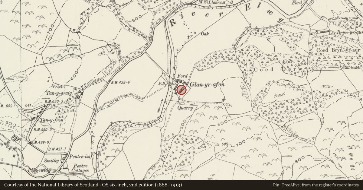
Slide toward Today to fade the historical sheet and see the modern map underneath.
David Rumsey Map Collection, Stanford LibrariesDavid Rumsey Map Collection, Stanford LibrariesLlyfrgell Genedlaethol Cymru – The National Library of WalesDavid Rumsey Map Collection, Stanford LibrariesDavid Rumsey Map Collection, Stanford Libraries
5 historical maps cover this location, the earliest the 1608 map "(13) Cambriae Typus." (David Rumsey Map Collection, Stanford Libraries).
Historical maps covering this location
- 1608 · (13) Cambriae Typus. (David Rumsey Map Collection, Stanford Libraries)
- 1795 · To Sir Watkin Williams-Wynn Bart ... the map of the six counties of North Wales is most… (Llyfrgell Genedlaethol Cymru – The National Library of Wales)
- 1830 · V.3:11-15:XV. Britisches Reich. A. Kon: England. b. Frstenthum Wales: Shire: 37-40 (David Rumsey Map Collection, Stanford Libraries)
- 1883 · Watershed map England, Wales 3. (David Rumsey Map Collection, Stanford Libraries)
- 1901 · Sheet 9 and 10. (David Rumsey Map Collection, Stanford Libraries)
Cadw's description
Location
The threshing barn and attached sheds stand in a range parallel and opposite to the stables and cart shed, on the SE side of the farmyard at Glan yr Afon, approximately 1.75km NNE of Llangernyw village centre.
History
Probably built in mid C19.
Exterior
Threshing barn and loft with single storey 2-bay shed attached to SW gable wall and 6-bay shed to NE, all aligned SW-NE. Built of local stone rubble; Welsh slate gabled roofs with clayware ridges; shed to NE has timber ridge ventilators. Corn barn has opposing double boarded doors with timber lintels. To left a stone stairway parallel with and attached to NW elevation, facing yard, gives access to boarded loft door in a gabled brick half-dormer. Ventilation slit next to stairway. SW shed has storey height opening to yard. Door and windows to NE shed have cambered brick arches and stone lintels and sills.
Interior
Threshing barn and sheds have open rafter roofs with king post trusses; remains of line shafting machinery in corn barn.
Reason for designation
Included as a good example of mid C19 improved farm buildings which form part of an intact farmstead group.
Nearby in the register
- Glan yr AfonAgriculture and Subsistenceunder 1 mi
- Stables and Cartshed at Glan yr AfonAgriculture and Subsistenceunder 1 mi
- Pigs Sties, Shelter Shed, Hay Loft, Shed and Stockyard Walls at Glan yr AfonAgriculture and Subsistenceunder 1 mi
- Hendre-Isaf Castle MoundMotteunder 1 mi
Other entries of the same register within about three miles of this one, by straight line.