Cof Cymru: National Historic Assets of Wales · Wales
Archway to drive, Dolwilym
Cilymaenllwyd, Carmarthenshire, Wales
A Grade II listed building in Llanglydwen, Whitland, Cilymaenllwyd, Carmarthenshire, designated on 12 March 1999.
The record
- Designation
- Listed building, Grade II
- Broad class
- Miscellaneous
- Date of designation
- 12 March 1999
- Locality
- Llanglydwen
- Town
- Whitland
- Community
- Cilymaenllwyd
- Unitary authority
- Carmarthenshire
- Country
- Wales
- Coordinates
- 51.90867, -4.65656
- Cadw reference
- 21455
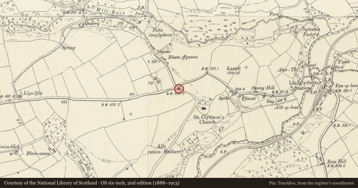
Slide toward Today to fade the historical sheet and see the modern map underneath.
David Rumsey Map Collection, Stanford LibrariesDavid Rumsey Map Collection, Stanford LibrariesDavid Rumsey Map Collection, Stanford LibrariesDavid Rumsey Map Collection, Stanford LibrariesDavid Rumsey Map Collection, Stanford Libraries
5 historical maps cover this location, the earliest the 1636 map "Cornubia : Devonia, Somersetus, Dorcestria, Wiltonia, Glocestria ..." (David Rumsey Map Collection, Stanford Libraries).
Historical maps covering this location
- 1636 · Cornubia : Devonia, Somersetus, Dorcestria, Wiltonia, Glocestria ... (David Rumsey Map Collection, Stanford Libraries)
- 1891 · Sheet 10. Ordnance Survey of England and Wales. . (David Rumsey Map Collection, Stanford Libraries)
- 1898 · 210 Cardigan (Hills) (David Rumsey Map Collection, Stanford Libraries)
- 1898 · 210 Cardigan (Outline) (David Rumsey Map Collection, Stanford Libraries)
- 1901 · Sheet 13. (David Rumsey Map Collection, Stanford Libraries)
Cadw's description
Location
About 500m W of Llanglydwen, at the entrance to the drive to Dolwilym and the parish church.
History
Dolwilym was a castellated country house built 1842-5 for the Protheroe family, but abandoned after 1908. It was demolished in 1984. The gateway is in similar style to the house, and therefore is probably also of the 1840s.
Exterior
A castellated gateway of rubble stone. Square turrets have narrow loops (arched to the rear elevation) and corbelled battlements of coursed rubble with copings. Between the turrets is a steeply pointed arch of narrow freestone voussoirs, and a stepped gable. Older gate piers are built into the jambs. Gates have been removed.
Reason for designation
Listed as a striking, picturesque mid C19 archway, and for group value with the parish church and lych gate.
Nearby in the register
- Lychgate at St Cledwyn's ChurchReligious, Ritual and Funeraryunder 1 mi
- Llanglydwen Churchyard CrossCrossunder 1 mi
- Church of St CledwynReligious, Ritual and Funeraryunder 1 mi
- Pont Llanglydwen (partly in Llanboidy Community)No class recordedunder 1 mi
Other entries of the same register within about three miles of this one, by straight line.