Cof Cymru: National Historic Assets of Wales · Wales
Monmouthshire House, including front iron railings
Usk, Monmouthshire, Wales
A Grade II listed building in Usk, Monmouthshire, designated on 3 July 1973.
The record
- Designation
- Listed building, Grade II
- Broad class
- Domestic
- Date of designation
- 3 July 1973
- Locality
- Usk
- Town
- Usk
- Community
- Usk
- Unitary authority
- Monmouthshire
- Country
- Wales
- Coordinates
- 51.70395, -2.89990
- Cadw reference
- 2141
Slide toward Today to fade the historical sheet and see the modern map underneath.
David Rumsey Map Collection, Stanford LibrariesDavid Rumsey Map Collection, Stanford LibrariesDavid Rumsey Map Collection, Stanford LibrariesDavid Rumsey Map Collection, Stanford LibrariesDavid Rumsey Map Collection, Stanford Libraries
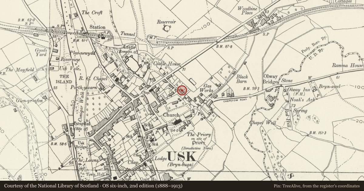
5 historical maps cover this location, the earliest the 1636 map "Cornubia : Devonia, Somersetus, Dorcestria, Wiltonia, Glocestria ..." (David Rumsey Map Collection, Stanford Libraries).
Historical maps covering this location
- 1636 · Cornubia : Devonia, Somersetus, Dorcestria, Wiltonia, Glocestria ... (David Rumsey Map Collection, Stanford Libraries)
- 1637 · The fourth table of England. Cornub. Devonia, Somerset etc. (David Rumsey Map Collection, Stanford Libraries)
- 1830 · V.3:11-15:XV.Britisches Reich. A. Kon: England. a. England ab sich: Shire:15-17, 33 (David Rumsey Map Collection, Stanford Libraries)
- 1895 · Sheet 11. Ordnance Survey of England and Wales. (David Rumsey Map Collection, Stanford Libraries)
- 1913 · Sheet 102. Newport. (David Rumsey Map Collection, Stanford Libraries)
Cadw's description
Location
The left house of a terrace of four, NE of the priory.
History
Formerly an Inn, The Monmouthshire House. Early C19 in outward appearance but an earlier interior, probably C17. Former list description refers to a blocked window, formerly making a 5-window range in all. The end left unit is a later addition or incorporation.
Exterior
House with Georgian frontage attached at one side. Rendered in roughcast with slate roof with swept overhanging bracketed eaves and corniced brick stacks, at end right and at former division on ridge. Two storeys. Three-window range to the main unit and one to end left: 12-pane sashes with exposed frames, shallow sills; 20-pane to ground floor. Wide segmental-arched latticed porch to part-glazed panelled door. Garden walls project on either side of frontage and join slender iron railings with centre rail and spear finials which extend across whole frontage, incorporating a gate at centre right.
Interior
Main interior is one room deep with open fireplace with timber lintel and stairs rising beside; boarded doors either side. Chamfered and stopped cross beams. Fine post and panel wooden screen adjacent to front entrance. Stone flags to rear and at lower level a former cellar.
Reason for designation
Part of a good range of town houses retaining their character in a historically important position. Group value with adjacent houses.
Nearby in the register
- 23 Four Ash StreetDomesticunder 1 mi
- 27 Four Ash StreetDomesticunder 1 mi
- 29 Four Ash StreetDomesticunder 1 mi
- 31 Four Ash StreetDomesticunder 1 mi
Other entries of the same register within about three miles of this one, by straight line.